Country:
 City:
City:


Park in the car spaces on Rue Clemenceau near the Auchan.
(S/E) From the square, head back towards the roundabout and take the left-hand exit. At the next roundabout, turn left onto Rue des Trois Épis. At the roundabout, turn left onto Avenue de Lattre de Tassigny and follow it to its end near a fountain and a green space.
(1) Head up Rue Clémenceau on the right, then, at the next fountain, turn right onto Rue du Lieutenant Capelle. At the car park, with its striking tree, take the street on the left to reach a well.
(2) Continue along the street until you rejoin Rue Clémenceau, which you should follow to the right. Then turn onto the first path on the right, followed by the cul-de-sac on the left, and take a passageway on the left leading to Saint-Laurent Church and a memorial stone.
(3) Turn left onto Rue du Logelbach to go round the square, then head back up Rue Clémenceau to the right, passing the town hall and another fountain. Continue until you reach the fifth street on the right (Rue du Lavoir). Take this street to reach the Jewish cemetery.
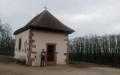
(4) Continue along the street and, at the junction, turn left onto Rue de la Chapelle. Carry on along the street, turn left at the bend as you leave the town and arrive near the Chapel of Notre-Dame-de-l’Assomption, passing by its grounds.
(5) Turn left onto Rue Clémenceau and, opposite the war memorial, take Rue du Maréchal Foch. At the end, turn right onto Rue du Chêne, then left to see Parc du Boden.
(6) Turn back and keep to the right four times. At the fifth junction, follow Rue du Maréchal Joffre to the right and pass a wayside cross. At the junction, keep left to follow the same street and you’ll come to another cross.
(7) Head straight ahead to reach the cemetery. Follow the road opposite the cemetery entrance and turn right onto Rue François Dietrick to reach the Square des Anciennes Écoles. Walk past this and head towards the synagogue.
(8) Carry on and turn right onto the street, then left again to rejoin Rue du Maréchal Joffre. Continue straight ahead along Rue des Trois Châteaux. At the end, turn right onto Rue Feldkirch before turning left onto Rue des Peupliers. Continue left onto Rue du Bouleau, then right onto Route de Colmar to reach the very modern Wintzenheim Chapel.
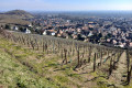
(9) Return to Route de Colmar, cross it and, opposite the chapel, take Rue des Bleuets. Keep left twice to reach the vineyard.
(10) Continue along the path on the left. Carry on along Rue René Schmitt and, at the roundabout, turn left to return to the car park via the same route you took on the way out (S/E).
 Visorando Member
 Moderate