Country:
 City:
City:


Park in the car park located right next to the town hall.
(S/E) With the town hall on your left, walk up Rue Deybach on your right, then turn straight on to Rue de la Promenade and continue to the Fork in the road near the playground.
(1) Keep left and walk down alongside the River Fecht, passing the sports grounds. Then join the cul-de-sac on the left and cross the bridge over the River Fecht. At the roundabout, carry straight on. At the next roundabout, you’ll see Villa Fleck on your left. Take the path to the right of the villa, which leads into Mauriac Park.
(2) Walk through the park, past numerous works of art, and exit at the other end. Then cross Rue Robert Schuman to join Rue du Président Kennedy. Turn right and then continue along the path on the left before taking the footbridge over the Fecht. On Quai de Fecht, keep right until you reach Rue de la Batteuse.
(3) Head straight ahead, go under the bridge and keep going straight on until you reach the Evangelical Mennonite Church.
(4) Walk back to Rue de la Batteuse.
(3) Carry on to the right along this street and, when you reach the stream, take the small path on the left running alongside it. Cross Rue du Général Pau and, at the junction, first turn right then left onto Rue du Quai until you reach Rue de la République.
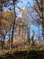
(5) Go up to the right, then, at the junction, turn right again to reach the roundabout with a statue of the Virgin Mary.
(6) Turn left onto Rue Clemenceau. Pass Rue du Florimont and take the next left, Rue des Juifs, to reach the Jardin du Presbytère. Cross the garden and exit via Rue Jeanne d’Arc, passing by a work of art. Turn right towards Saint-Barthélémy Church.
(7) Walk round the church on the left and pass a wayside cross. When you reach Rue du Cimetière, head up to the left to pass the cemetery, the Bavarian monument and the military plot. On Rue d’Ammerschwihr, turn left, then right onto Rue des Poilus (note the cross at the junction). Walk past a winegrower’s house and arrive at another junction. Cross Rue d’Ammerschwihr, then turn right to see a former winegrower-baker’s farm.
(8) Turn back and take a left to see the former girls’ school and the former textile mill. Then continue to the left of this building along Rue du Maréchal Foch, passing a winegrower’s farm and the former passenger railway station. At Rue des Trois Epis, turn left down the road, then turn left again onto Rue du Rempart. At Rue de la République, continue to the right, then turn right again onto Rue Deybach, passing close to the black pine, before reaching the car park (S/E).
 Visorando Member
 Moderate