Route de découverte de Mittelwihr

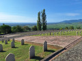
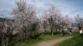
Mittelwihr is a small Alsatian village, right next to Bennwihr. This short route takes you through the streets of the village. The route is very short; it starts at Place Cancale, then heads down towards the village centre to see the churches of St Brigid and St Catherine, before returning to the starting point via the cemetery. As the route is short, it is recommended that you combine it with a visit to other villages such as Bennwihr and Beblenheim.

Details

n°110261030
Creation:
Last update:
Last review:
–
  • Walking
    Activity: Walking
  • ↔
    Distance: 1.48 mi
  • ◔
    Average duration: 0h 45 
  • ▲
    Difficulty: Easy

  • ⚐
    Back to start: Yes
  • ↗
    Ascent: + 118 ft
  • ↘
    Descent: - 115 ft

  • ▲
    Highest point: 850 ft
  • ▼
    Lowest point: 705 ft
  • ⚐ Country: France
  • ⚐ City: Mittelwihr (68630)
  • ⚑
    Start/End: N 48.15002° / E 7.31564°
  • ❏
    IGN map(s): Ref. 3718OT, 3718OTR
  • Hour-by-hour weather

Description of the walk

Park in the car park at Place Cancale.

(S/E) From the square, with your back to the car park, head down Rue du Bouxhof to the left, passing the “Solidarity without borders” sign and another sign introducing Bennwihr.

(1) At the junction, turn left onto Rue du Buhl and head towards the town hall, then onto the Route du Vin. Cross over to Rue de l’École, then keep left onto Rue du Château to reach the two churches.

(2) Turn right onto Rue des Églises. At the end, head almost straight ahead onto Rue du 25 Décembre to reach the cemetery.

(3) Turn left and then right onto Rue du Professeur Édouard Greiner. Walk down Rue de Riquewihr for a few metres until you reach a Fork in the road.

(4) Head up Rue du Vignoble to the right. Leave the village and reach a junction amongst the vineyards, near a cultural information board.

(5) Take the path on the left, then head down Rue du Bouxhof on the left, and keep to the right to return to the car park (S/E).

Waypoints

  1. S/E : mi 0 - alt. 791 ft - Place Cancale
  2. 1 : mi 0.13 - alt. 764 ft - Crossroads
  3. 2 : mi 0.45 - alt. 715 ft - Churches - Église Sainte-Catherine (Mittelwihr)
  4. 3 : mi 0.69 - alt. 764 ft - Cemetery - Chapelle Sainte-Brigitte (Mittelwihr)
  5. 4 : mi 0.85 - alt. 787 ft - T-junction
  6. 5 : mi 1.18 - alt. 850 ft - Crossroads and information board
  7. S/E : mi 1.48 - alt. 791 ft - Place Cancale

Worth a visit

Other walks in the area

For more walks, use our search engine .

The GPS track and description are the property of this route's author. Please do not copy them without permission.