Route de découverte de Bennwihr

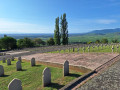
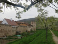
Bennwihr is a small wine-growing village situated on the Wine Route. Most people simply pass through this village, which was completely destroyed and then rebuilt after the Second World War. The walk starts near the Church of Saints Peter and Paul. It is an entirely urban walk that allows you to explore this village on the Wine Route, passing through the cemetery and past calvaries and other crosses. As the walk is short, it is advisable to combine it with the walks in Mittelwihr and Beblenheim.

Details

n°110257583
Creation:
Last update:
Last review:
–
  • Walking
    Activity: Walking
  • ↔
    Distance: 1.71 mi
  • ◔
    Average duration: 0h 50 
  • ▲
    Difficulty: Easy

  • ⚐
    Back to start: Yes
  • ↗
    Ascent: + 79 ft
  • ↘
    Descent: - 69 ft

  • ▲
    Highest point: 735 ft
  • ▼
    Lowest point: 646 ft
  • ⚐ Country: France
  • ⚐ City: Bennwihr (68630)
  • ⚑
    Start/End: N 48.14476° / E 7.32426°
  • ❏
    IGN map(s): Ref. 3718OT, 3718OTR
  • Hour-by-hour weather

Description of the walk

Park in the car spaces on Rue du Général de Gaulle, directly opposite the Church of Saint-Pierre-et-Paul.

(S/E) With the church on your left, pass it and the war memorial, then turn left into Rue de l’Église. Walk past a vineyard and then cut across two streets.

(1) At the end of Rue de l’Église, continue left onto Passage des Vignerons. Then leave Rue Hansi on your left and turn right at the next street. At the end of this street, keep right onto Rue de Jegun, which you should follow until you reach the wayside shrine.

(2) Turn left onto Rue du Général de Gaulle and head towards the cemetery, passing the sign for “Repartir de zéro”.

(3) Return to the wayside cross via the same route.

(2) Turn left onto Rue de la Cave. At the junction, keep left to pass a vineyard.

(4) Carry on and then keep to the right onto Rue des Vosges. Continue straight on, take Rue de l’École and head towards a cross.

(5) Keep right onto Rue du Général de Gaulle, then turn left onto Rue du Couvent. At the vineyard, you’ll see the village of Mittelwihr on your left. At the end of the street, turn right onto Rue du Commandant O’Connel. At the end of this street, turn left onto Rue du Maréchal de Lattre de Tassigny, then right onto Rue du 24 Décembre. At the end of this street, head up Rue de la Mairie on the right, then turn left through the passage between the town hall and the village hall to reach the church and the car park (S/E).

Waypoints

  1. S/E : mi 0 - alt. 679 ft - Rue du Général de Gaulle - Église Saints-Pierre-et-Paul (Bennwihr)
  2. 1 : mi 0.21 - alt. 653 ft - End of Rue de l’Eglise
  3. 2 : mi 0.45 - alt. 673 ft - Calvary
  4. 3 : mi 0.59 - alt. 676 ft - Cemetery
  5. 4 : mi 0.87 - alt. 725 ft - Vineyard
  6. 5 : mi 1.23 - alt. 722 ft - Cross
  7. S/E : mi 1.71 - alt. 679 ft - Rue du Général de Gaulle - Église Saints-Pierre-et-Paul (Bennwihr)

Worth a visit

Other walks in the area

For more walks, use our search engine .

The GPS track and description are the property of this route's author. Please do not copy them without permission.