Country:

 City:


Park in the small car park opposite the Champagney post office.
(S/E) Walk up the Grande Rue on the left until you reach the war memorial. Then turn left onto Rue des Vosges and go under the railway line. Immediately turn right onto Rue du 11 Novembre and continue until the next street on the right: Rue du Tram.
(1) Take this street and, at the next junction, turn right onto Chemin du Mont Serré à la Gare. Just before the end of this street, turn right onto the D4. Cross the railway line to reach the Champagney bus stop.
(2) Carry on straight ahead along Avenue de la Gare, then turn left onto Rue des Mésanges. At the end, turn right onto Rue Louis Pergaud. At the end, rejoin Avenue de la Gare, which you should follow to the left as far as the cemetery.
(3) Carry on along the road. At the roundabout, go straight ahead and turn left into Rue Anne Franck. At the Fork in the road with Rue du Rahin, keep left, then left again. Then keep left once more to walk past the nursery school and a picnic table. Head for the bridge over the Rahin.
(4) Turn right onto Grande Rue and continue to Saint-Laurent Church.
(5) Return to the bridge over the Rahin.
(4) Cross the river and head straight on along Grande Rue until you reach Rue Léopold Senghor.
(6) Go up this street on the left. At the junction, keep left and continue all the way to Avenue de France, which is at the end of the street.
(7) Cross carefully to take Rue du Beuveroux and continue to the right onto Rue Victor Hugo. Pass Chemin Chicherit on your right and continue to the end of the road. Turn right, cross Avenue de France at the pedestrian crossing and head towards the Sainte-Pauline Chapel.
(8) Take the path to the left of the chapel, Rue Sainte-Pauline, until you reach the D4.
(9) Walk along it on the right-hand side, taking great care, until you reach the Étang du Breuil car park.
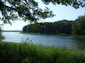
(10) Cross the car park to the left and walk alongside the lake to the campsite. Then turn right onto the embankment separating the two lakes and rejoin the D4. Take the path that runs alongside it to the roundabout.
(11) Turn left onto Rue du Titan. At the campsite entrance, turn right and cross the footbridge over the Rahin to reach Avenue du Général Brosset.
(12) Follow this avenue to the right. At the end, pass by a cultural information board highlighting the town’s various points of interest and turn left at the Fork in the road near the Maison de la Négritude. Return to the car park (S/E).
 Association / Club / Walk leader

 Visorando Member
 Easy