Country:
 City:
City:


Park in the car park on Rue du Stade.
(S/E) Head towards the roundabout and continue straight ahead. At the end of the road, turn left onto Rue de la Chapelle and continue to the fountain.
(1) Turn right onto Rue du Fossé. At the next fountain, continue right onto Rue de l’Église before reaching Rue des Écoles, located at the end. Turn left and carry on straight ahead along Rue de la Tuilerie until you reach Rue de la Lauch.
(2) Go up this street to the left until you reach a cross and Square Dominique Braun.
(3) Continue along Rue de la Lauch until you reach the next fountain. Turn right up Rue du Vignoble and walk past the statue of the Virgin Mary. You’ll find a wayside cross at the end of the street.
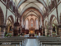
(4) Return to the fountain and turn right onto Rue de la Lauch. At Saint-Martin’s Church, go up the steps on the right, then walk round the church on the right, passing the war memorial. Enter the cemetery and exit via the first exit. Turn left onto a track, which quickly becomes a path. When you reach Rue du Schauenberg, head up it to the right until you reach the Oratoire Saint-Jean-Bosco and its Calvary.
(5) Walk back down the street to the town hall and the fountain. Then turn right onto the Grand’Rue. Pass another fountain and return to the junction you passed on the way out.
(1) Keep to the right onto Rue de Rouffach. Then take the second street on the left (Rue des Saules) to return to the roundabout. Turn right towards the car park (S/E).
 Visorando Member
 Moderate
 Very difficult
 Association / Club / Walk leader