Circular walk from Val du Pâtre via the Grossfels Rock

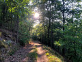
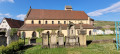
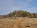
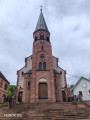
A short, easy family walk starting from Val du Pâtre. Most of the route is through woodland. Only a section of about one kilometre is exposed. The path is mainly flat. Only the section around the Rocher du Grossfels is uphill, but only for a very short distance. Highlights of the walk include the Romanian military cemetery, St Nicholas’ Chapel, St Mary’s Chapel and the Rocher du Grossfels.

Details

104961245
Creation:
Last update:
Last review:
  • Walking
    Activity: Walking
  • ↔
    Distance: 3.87 mi
  • ◔
    Average duration: 2h 00 
  • ▲
    Difficulty: Easy

  • ⚐
    Back to start: Yes
  • ↗
    Ascent: + 282 ft
  • ↘
    Descent: - 282 ft

  • ▲
    Highest point: 1,280 ft
  • ▼
    Lowest point: 994 ft

Description of the walk

Park at the Val du Pâtre car park.

(S/E) From the car park, leave the chapel on your left and walk up the road to the Romanian cemetery.

(1) Cross the main road to take the Chemin du Schafbuckel. Pass all the junctions on the left until you reach a crossroads.

(2) Keep right on the track for about 40 metres, then continue to the left. Leave the forest and enjoy the views over Wintzfelden and Osenbach. You’ll come to a lodge; continue along the road until you reach the cycle path. Turn right onto the cycle path and follow it to the picnic area.

(3) Turn right onto the road, cross the river and take the first track on the left. At the Y-junction, keep right onto the Chemin de l’Allée. Then ignore all the paths on the left and take the first path on the right, which leads to the Grossfels Rock and its viewpoint.

(4) Continue climbing. The path levels out very quickly and joins a wide track, then a junction.

(5) Keep left onto a path before taking the Chemin de Croix on the right. Carry on in this direction until you reach the car park (S/E).

Waypoints

  1. S/E : mi 0 - alt. 1,276 ft - Val du Pâtre car park - Chapelle Ste-Marie (Soultzmatt)
  2. 1 : mi 0.3 - alt. 1,266 ft - Cimetière militaire roumain (Soultzmatt)
  3. 2 : mi 0.87 - alt. 1,204 ft - Path
  4. 3 : mi 1.65 - alt. 997 ft - Picnic area - Ohmback (ruisseau) - Affluent de la Lauch
  5. 4 : mi 2.94 - alt. 1,214 ft - Rocher du Grossfels
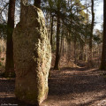
  6. 5 : mi 3.37 - alt. 1,270 ft - Trail - Menhir du Langenstein
  7. S/E : mi 3.87 - alt. 1,276 ft - Val du Pâtre car park - Chapelle Ste-Marie (Soultzmatt)

Notes

- Tables or benches available at Val du Pâtre (S/E), at (3) and at the Grossfels Rock (4).

Worth a visit

-St Mary’s Chapel and Val du Pâtre (S/E).

-Romanian military cemetery (1).

- Viewpoints between (2) and (3).

-St Nicholas’ Chapel between (3) and (4).

-Grossfels Rock (4).

-Continuing straight on at (5): Langenstein menhir.

-After (5): the Stations of the Cross to (S/E).

Other walks in the area

For more walks, use our search engine .

The GPS track and description are the property of this route's author. Please do not copy them without permission.