Country:

 City:
City:


Park on Place Stanislas in Bruyères.
(S/E) Opposite the war memorial, head towards the roundabout to see the Fontaine de la Dame de Bruyères and the Monument to Dr Villemin. Take the second exit onto Avenue du Cameroun. Continue to Rue du Général de Gaulle.
(1) Carry on straight ahead, with the village hall on your right and, directly opposite, a niche containing a sculpture of the Virgin Mary. Continue along Rue Léopold, then Rue Joffre, until you reach the police station. Go past it and continue until you reach Chemin de la Croix Sapin.
(2) Turn right onto this path, pass the cross, then keep left onto ‘Lotissement la Beheue’ Street. At the junction, turn right, then keep right onto Rue de Vielsam until you reach Rue de Bel Air.
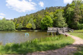
(3) Follow this street to the left. Just after the bend, continue to the left before taking the path on the right. Stay on the path on the left to reach the Étang de Pointhaie.
(4) Turn left, walk along the edge of the pond, then take the footbridge on the right. At the end, turn right and walk along the dyke. When you reach a track, keep right along the edge of the pond. Then continue straight on until you reach the next small pond.
(5) Turn back towards the Étang de Pointhaie. Turn left to rejoin the path you took on the way out.
(4) Return to the left, at the start of Rue de Bel Air, following the route in reverse to the one taken on the way there.
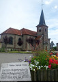
(3) Continue left onto Rue de Vielsalm and walk as far as the church. When you reach the church, look out for a fountain and continue along the road to the left. Walk past the town hall and continue to Avenue du Cameroun.
(1) Turn left and then immediately right onto Rue Jules Ferry. Before the school of the same name, take a side street on the left, head towards a car park and turn right to reach the entrance to a park.
(6) Cross the park and exit via the car park at the far end. Continue straight ahead down a narrow lane before turning right onto Avenue Gambetta. Walk to the railway station.
(7) Turn back and take the car park on the right. Cross the car park to reach Rue du Fraisne. Turn right onto this street, then continue left. When you reach the D423, turn left and take the first street on the right, Rue des Capucins.
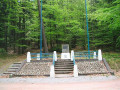
(8) Walk up this street, then, at the junction, turn right onto Rue de l’Hôpital before continuing to Rue de l’Avison. Turn left onto this street, then visit the cemetery and its military plot on the right.
(9) Return to Rue de l’Avison and walk up it. Then keep going straight ahead until you reach the artwork depicting the Ogre of Bruyères.
(10) Turn back and look out for some steps on the right: take these, then continue left along Rue du Lavoir. At the end of this street, head up Rue de Verdun on the left. At the first junction, turn right to reach Place Stanislas. Turn left twice to take Rue Simone et Jean Luçat. Walk past the museum and head towards another monument.
(11) Walk back to the car park (S/E).
 Tourist office

 Moderate