Country:
 City:
City:


Park in the car park in front of the agricultural college.
(S/E) Take the path at the foot of the Tour des Sorcières. At the end, you’ll see the former town hall on the right and the Cour Joseph Freyeisen and the Rouffach Town Museum on the left. Cross the Place de la République, walk past the Church of Notre-Dame-de-l’Assomption and head towards the town hall. Take the passageway on the left just before the town hall. At Rue de la Poterne, turn right and walk past the Maison de François-Joseph Lefebvre. Continue straight ahead to the square with the bust.
(1) Walk down Rue du Marché on the left and pass the former Saint-Esprit Hospital. At the well, continue straight ahead along Rue du Maréchal Joffre and turn right into Rue Rettig. Pass the Rettig Family House and continue to the second street on the right.
(2) Keep to the right onto Rue des Pères Oblats. Take the passageway to go through the fence and emerge onto Rue des Prêtres. Turn right onto this street. At the end, head up Rue du Maréchal Lefèbvre on the left to reach the Maison des Trois Dames.
(3) Keep straight ahead and turn left onto the footpath that runs alongside the old ramparts. At Rue aux Quatre Vents, first turn left then right to follow a pedestrian walkway. Cross Rue de l’Arsenal and continue to the end of Rue de Lucelle.
(4) Turn left onto Rue Raymont Poincaré and walk past the Institution Saint-Joseph. Pass Rue Bis and continue until you reach a fountain on your left. Turn right into Rue de la Demi-Lune. At the end, keep right onto Rue du Schauenberg and turn left into Rue Ris to reach a Fork in the road.
(5) Keep to the right, then at the roundabout, go straight ahead onto Rue de Pfaffenheim. At the junction, turn right to reach the entrance to Château d’Isembourg.
(6) Return to the junction on Rue Ris.
(5) Turn right onto Rue Louis Pasteur. At the first junction, keep left and do the same again to head down Rue Claude Ignace Callinet, passing a bas-relief depicting Saint Urbain. Then continue straight on until you reach the fountain.
(7) Turn back to the previous junction. Turn left onto Rue Raymond Poincaré to walk past the former Récollets Convent. Walk past the toilets, the bus stop and Square Pierre-Paul Faust, and continue to the park.
(8) Return to the bus stop and the toilets; opposite the toilets, take the path that runs alongside the ramparts. You’ll come back to the car park and the Tour des Sorcières.
(S/E) Head straight ahead, passing the agricultural college and the stork enclosure. Leave a small square on your right and continue along a street. When you reach Avenue de la Gare, follow it to the right as far as the cemetery.
(9) Enter the cemetery and walk straight through to the other side. On the other side, turn left onto Rue de l’Espérance, then left again onto Rue des Fossés. When you reach Avenue de la Gare again, keep to the right and continue straight on until you reach the Maison des Trois Dames.
(3) Turn left onto Rue Materne Becler and walk between the old dye works and the old abattoir. At the war memorial, keep right onto Rue des Oignons, then turn left and then right again onto Place de la République. Walk past the Church of Notre-Dame-de-l’Assomption to reach the car park (S/E).
 Visorando Member

 Moderate
  Association / Club / Walk leader
 Difficult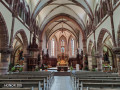
 Very difficult