Route de découverte de Sigolsheim

Sigolsheim is a small wine-growing village situated near Kaysersberg. This very short route allows you to stroll through the streets in search of the village’s heritage. There are numerous calvaries and crosses in this village. The route takes in the Sainte-Anne Chapel and the Church of Saint-Pierre and Saint-Paul. As the route is very short, it is recommended that you combine it with a visit to neighbouring villages such as Kienthzeim and Ammerschwihr.

Details

n°109187411
Creation:
Last update:
Last review:
–
  • Walking
    Activity: Walking
  • ↔
    Distance: 1.59 mi
  • ◔
    Average duration: 0h 50 
  • ▲
    Difficulty: Easy

  • ⚐
    Back to start: Yes
  • ↗
    Ascent: + 79 ft
  • ↘
    Descent: - 79 ft

  • ▲
    Highest point: 781 ft
  • ▼
    Lowest point: 692 ft
  • ⚐ Country: France
  • ⚐ City: Sigolsheim (68240)
  • ⚑
    Start/End: N 48.13419° / E 7.29991°
  • ❏
    IGN map(s): Ref. 3718OT, 3718OTR
  • Hour-by-hour weather

Description of the walk

Park in the car park near the Hirondelles school complex.

(S/E) Walk down Rue de la Première Armée to the right. At the end, you’ll find the Plague Cross.

(1) Take the Route des Vins on the right. At the first junction, stay on the path to the left to reach a playground on Rue de Cussac. Continue to the right before taking the first path on the right to reach another wayside cross.

(2) Head straight ahead onto Rue des Vosges. Pass two junctions, then, at Place du 19 Décembre, turn right onto Rue Saint-Jacques and follow it to the wayside cross.

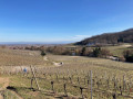
(3) Carry on along the street, then turn left onto Rue du Monastère, then right onto Rue du Mambourg. At Rue de l’Oberhof, head up this street to the wayside cross at the edge of the village, which offers a magnificent view of the Vosges and the Alsace plain.

(4) Walk down the street, carry on straight ahead at the junction and pass a fountain. At the next Fork in the road, turn left onto Rue de Bennwihr, which you should follow as far as the cemetery and the Sainte-Anne Chapel.

(5) Turn right onto Rue Sainte-Anne. Then take the first path on the right. At the end, first turn left then right onto Rue de l’Est. At the end of this street, carry on straight ahead, veering slightly to the right. Then cut across Rue des Vignes to reach the Church of Saint-Pierre and Saint-Paul, passing close to the war memorial and the Sainte-Richarde Fountain. Then continue to the left to return to the starting point (S/E).

Waypoints

  1. S/E : mi 0 - alt. 702 ft - School complex car park - Église Saint-Pierre et Saint-Paul (Sigolsheim)
  2. 1 : mi 0.08 - alt. 699 ft - Plague Cross
  3. 2 : mi 0.32 - alt. 712 ft - Calvary
  4. 3 : mi 0.62 - alt. 719 ft - Calvary
  5. 4 : mi 0.82 - alt. 781 ft - Calvary at the edge of the village
  6. 5 : mi 1.21 - alt. 696 ft - Cemetery and St Anne’s Chapel
  7. S/E : mi 1.59 - alt. 702 ft - School complex car park - Église Saint-Pierre et Saint-Paul (Sigolsheim)

Worth a visit

-Pest Cross (1)

-Calvary on the Wine Route (2)

-Calvary on Rue Saint-Jacques (3)

-Calvary on Rue de l’Oberhof (4) and its panoramic view

-Fountain on Rue de l’Oberhof

-Cemetery and Sainte-Anne Chapel (5). There is a cultural information board about the vineyard.

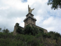
-Church of Saints Peter and Paul, war memorial and Sainte-Richarde Fountain.

Other walks in the area

For more walks, use our search engine .

The GPS track and description are the property of this route's author. Please do not copy them without permission.