Route de découverte de Husseren-les-Châteaux

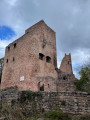
Husseren-les-Châteaux is situated at the foot of the Three Castles of Eguisheim. It is a peaceful village nestled in the heart of the Alsatian wine-growing countryside and on the edge of the Vosges. Along the route, there are numerous vantage points offering views over the plain, across to Germany and over the foothills of the Vosges. The walk is short and suitable for families. You can combine this visit with a trip to the neighbouring village of Voegtlinshoffen.

Details

106199102
Creation:
Last update:
Last review:
  • Walking
    Activity: Walking
  • ↔
    Distance: 1.78 mi
  • ◔
    Average duration: 1h 00 
  • ▲
    Difficulty: Easy

  • ⚐
    Back to start: Yes
  • ↗
    Ascent: + 187 ft
  • ↘
    Descent: - 207 ft

  • ▲
    Highest point: 1,306 ft
  • ▼
    Lowest point: 1,132 ft

Description of the walk

Park in the car park at the end of Rue de la Châtaigneraie.

(S/E) Note the statue of the Virgin Mary in a grotto to the right of the car park, then walk down the street to the fountain in front of the town hall.

(1) Continue to the right onto Rue Principale. Keep right again onto Rue du Weckmund. Pass one junction, then at the second, turn left down Rue de la Fontaine. When you rejoin Rue Principale, follow it to the right. Pass one junction and carry on to the next. Turn left onto Rue Principale to reach the town’s coat of arms.

(2) Turn left onto Rue du Vin and follow this street to the war memorial.

(3) Walk up Rue du Vin and turn left onto Rue des Chasseurs. Then turn left again onto Rue des Vergers. At the end, first turn right then left onto Rue du Rebgarten, then turn left onto Rue des Vignerons. At the junction, you’ll see a wayside cross. Continue right onto Rue du Hagueneck until you reach the cemetery.

(4) Return to the cross and continue straight ahead along Rue des Vignerons. Then turn right onto Rue de l’Église to reach the church.

(5) Carry on to the right along Rue des Trois Châteaux. Then take the first left, Rue de la Châtaigneraie. At the junction you passed on the way there, keep to the right and return to the car park (S/E).

Waypoints

  1. S/E : mi 0 - alt. 1,273 ft - Car park on Rue de la Châtaigneraie
  2. 1 : mi 0.1 - alt. 1,214 ft - Fountain
  3. 2 : mi 0.54 - alt. 1,247 ft - Coat of arms
  4. 3 : mi 0.77 - alt. 1,198 ft - War memorial
  5. 4 : mi 1.34 - alt. 1,175 ft - Cemetery
  6. 5 : mi 1.5 - alt. 1,220 ft - Saint-Pancrace Church
  7. S/E : mi 1.78 - alt. 1,273 ft - Car park on Rue de la Châtaigneraie

Notes

Worth a visit

-Cave of the Virgin (informative plaque on site) (S/E)

-Fountain (1)

-Coat of arms of Husseren-les-Châteaux (2)

-War memorial (3)

-Calvary on Rue des Vignerons

-Saint-Pancrace Church (5)

Other walks in the area

For more walks, use our search engine .

The GPS track and description are the property of this route's author. Please do not copy them without permission.