Route de découverte de Beblenheim

Beblenheim is a small wine-growing village, very close to Riquewihr. This route takes you round the village. Starting from the Protestant church, the route passes Saint-Martin’s Church before following the village’s outlying streets to circle round the village, passing by the cemetery. It is a very short walk and can also be combined with visits to other nearby villages such as Mittelwihr and Bennwihr.

Details

n°110265464
Creation:
Last update:
Last review:
–
  • Walking
    Activity: Walking
  • ↔
    Distance: 1.66 mi
  • ◔
    Average duration: 0h 50 
  • ▲
    Difficulty: Easy

  • ⚐
    Back to start: Yes
  • ↗
    Ascent: + 105 ft
  • ↘
    Descent: - 108 ft

  • ▲
    Highest point: 778 ft
  • ▼
    Lowest point: 653 ft
  • ⚐ Country: France
  • ⚐ City: Beblenheim (68980)
  • ⚑
    Start/End: N 48.1584° / E 7.32494°
  • ❏
    IGN map(s): Ref. 3718OT, 3718OTR
  • Hour-by-hour weather

Description of the walk

Park in the small car park opposite the Protestant church.

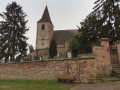
(S/E) With your back to the church, turn right onto Rue Chrétien Pfister. Walk past the cultural information panel ‘L’éducation buissonnière’. At the end of the street, turn right onto Rue de Zellenberg to reach Saint-Martin’s Church.

(1) Turn right onto the street of the same name. At the end, turn left onto Rue de Hoen and walk past the Gothic fountain, then past the Cave de Beblenheim and the historical and cultural information panel located there. Continue to the edge of the village and Rue du Gewurztraminer.

(2) Follow this street to the right until you reach its end.

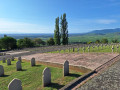
(3) Turn right onto Rue du Petit Château. At the bend, leave Rue de Bennwihr on your left and take the next street on that side, Rue des Vosges. At the end, turn right onto Chemin des Amandiers to reach the cemetery.

(4) Carry on until you reach Rue du 5 Décembre. Turn right onto this street, then left onto Rue des Tulipes. Then turn right onto Rue de Zellenberg and, at the Fork in the road, turn right onto the street to return to the car park (S/E).

Waypoints

  1. S/E : mi 0 - alt. 735 ft - Temple protestante Saint-Sébastien (Beblenheim)
  2. 1 : mi 0.13 - alt. 725 ft - Église Saint-Martin (Beblenheim)
  3. 2 : mi 0.45 - alt. 666 ft - Rue du Gewurztraminer
  4. 3 : mi 0.69 - alt. 682 ft - End of Rue du Gewurztraminer
  5. 4 : mi 1.2 - alt. 778 ft - Cemetery
  6. S/E : mi 1.66 - alt. 732 ft - Temple protestante Saint-Sébastien (Beblenheim)

Worth a visit

Other walks in the area

For more walks, use our search engine .

The GPS track and description are the property of this route's author. Please do not copy them without permission.