Country:

 City:
City:


Blue Diamond markings
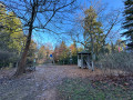
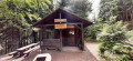
(S/E) From the Lipple car park, turn your back on the hut and take the track opposite. You’ll come to a large crossroads with a cross; continue along the track to the left of it. It climbs slightly. Ignore a track on the right and carry on to the ‘Bergle’ signpost.
Yellow Diamond markings
(1) Turn right onto a grassy path and, at the junction, head down to the left. At the Y-junction, turn right onto a path with tall grass. At the next Fork in the road, keep to the right until you reach the next signpost.
(2) Head all the way to the right towards Marzell. Pass a track that climbs up to the right, then carry on to the aerial.
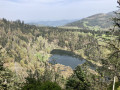
(3) Carry on straight ahead, leaving a path on your left, and take the next one coming from that direction. Shortly afterwards, as you emerge from the forest, enjoy a view taking in the mountainous area around Marzell, whilst also admiring the Blauen. You’ll arrive on Rue Auf dem Buck.
(4) Head down this street to the left, passing two benches where you can stop for a break to admire the scenery. You’ll reach Kanderstrabe at St Martin’s Protestant Church.
(5) Walk down the street before turning right at the next junction. Then keep left onto Auberdorf. At the Fork in the road, turn right and follow the road uphill to where it ends at a stream.
(6) Continue along the track before carrying on uphill to the right onto the Mattstallweg. Shortly afterwards, pass a path on the right, then another on the left around the bend, and a third, less obvious one on the right. You’ll reach a large crossroads of tracks.
(7) Head uphill straight ahead, passing close to a spring. Ignore an overgrown path branching off to the right, then two others, more clearly marked, heading in the same direction, and reach the pass known as ‘Hexenplatz’.
Westweg signposting (Red Diamond)
(8) Head right towards the shelter. At the shelter, take the path to its left before rejoining a track. Climb to the right until you reach the path on the right. Take this path, make a wide bend and cut across what looks like a track. Shortly afterwards, pass a track on the left and reach a junction at a signpost.
(9) Turn left, then, immediately afterwards, keep straight ahead. Pass a path on the left, then another on the right. Pass another path on the left and continue climbing until you reach a road.
(10) Continue on the other side along a very steep but very short climb. Leave the forest, pass a path on the left and walk past a paragliding take-off area. At the Fork in the road, turn left to reach the summit of the Blauen.
(11) Cross the car park to the right, passing by the picnic tables and a tower. At the paragliding take-off area, head down the path to the left. When you reach the road again, cross the car park and, on the other side, take the path before you reach a bend.
(12) As visibility is poor, cross the road very carefully. Immediately afterwards, keep to the right. After a descent, continue to the left to reach a pass.
(13) Carry on straight ahead, veering slightly to the right. Pass a junction of tracks to reach another pass.
(14) Follow the path to the right. When you reach a major track, turn left before taking the next track on the right. At the junction, head down the path on the right and, at the end, first turn right then left to reach the “Egerten” car park.
Blue Diamond markings
(15) Cross the road very carefully. Turn right twice onto the path leading to Lipple. Then ignore a disused path that descends to the road, followed by another that climbs to the left. Ignore a path that starts off to the far right and stay on the track until the next junction.
(16) Carry on straight ahead, passing close to a spring. Ignore a path on the right, then another on the left, and you’ll reach another Fork in the road.
(17) Keep to the right before taking the track on the left at the next junction. Ignore two overgrown paths coming from the left and follow the main track to Lipple and its car park (S/E).
 Visorando Member
 Easy
Easy 
 Difficult
  Association / Club / Walk leader