Route de découverte de Zellenberg

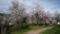
Zellenberg is a small wine-growing village, very close to Riquewihr and Ribeauvillé. This little village, with its strong Alsatian charm, is well worth a visit. The first part of the walk takes you round the village, offering views of the vineyards, with the Rhine plain on one side and the Vosges on the other. The views stretch as far as the Black Forest and Haut-Koenigsbourg, taking in the three castles of Ribeauvillé along the way. The village centre is just as charming, with colourful half-timbered houses, as in any Alsatian village. This route takes you past the village’s main landmarks.

Details

n°110451626
Creation:
Last update:
Last review:
–
  • Walking
    Activity: Walking
  • ↔
    Distance: 1.18 mi
  • ◔
    Average duration: 0h 35 
  • ▲
    Difficulty: Easy

  • ⚐
    Back to start: Yes
  • ↗
    Ascent: + 85 ft
  • ↘
    Descent: - 85 ft

  • ▲
    Highest point: 988 ft
  • ▼
    Lowest point: 902 ft
  • ⚐ Country: France
  • ⚐ City: Zellenberg (68340)
  • ⚑
    Start/End: N 48.16978° / E 7.32068°
  • Accessible from the train station Arrêt de Bus - Route du Vin à Zellenberg.
  • ❏
    IGN map(s): Ref. 3718OT, 3718OTR
  • Hour-by-hour weather

Description of the walk

Park in the car park on Rue du Vignoble, near a hand-operated fire pump.

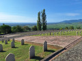
(S/E) With the fire pump on your right, head up Route d’Ostheim on your left and pass a cross. Immediately after the cross, you’ll come to the war memorial and a work of art, accompanied by cultural plaques on the duty to remember and the ‘malgré-nous’. Then turn right onto Rue du Schlossberg and head towards Place de l’Église.

(1) Cross the square and its car park, heading left, and walk past the sign describing the history of Zellenberg. Leave the village and head for the vineyard. Continue along the track until you reach a Y-junction.

(2) Stay on the path to the left. It is lined with benches, where you can stop and enjoy the view. You will then reach a tarmac road.

(3) Turn right to reach the cross, the artwork and the war memorial. Keep to the right, then turn right again to reach the Place de l’Église.

(1) Continue straight ahead along Rue du Schlossberg, passing the corner tower and then the guardhouse. Pass the former site of the entrance gate and turn right onto Rue de la Fontaine, which is on your right. Pass the communal stables – a house bearing the winegrower’s emblem – and reach a square with a sign for the Poche de Colmar.

(4) At the opposite corner of the square, take the street that continues from it and walk past the birthplace of the Resistance fighter René Roeckel, then past the site of the former castle and chapel. Walk down a little to enjoy a view of Haut-Koenigsbourg and the three castles of Ribeauvillé and Ricquewihr.

(5) Return to the square via the same route.

(4) Head straight ahead along Rue du Schlossberg and make your way to Place de l’Église, passing a house bearing the emblems of the merchant and the cooper, the village inn, the vicarage, the village bakery and the village council’s stove.

(1) Head straight ahead, then turn left to find the car park on the right (S/E).

Waypoints

  1. S/E : mi 0 - alt. 902 ft - Car park and hand pump
  2. 1 : mi 0.06 - alt. 925 ft - Church Square
  3. 2 : mi 0.25 - alt. 932 ft - Y-junction
  4. 3 : mi 0.54 - alt. 912 ft - Tarmac path
  5. 4 : mi 0.82 - alt. 974 ft - Square
  6. 5 : mi 0.9 - alt. 971 ft - Viewpoint
  7. S/E : mi 1.18 - alt. 902 ft - Car park and hand pump

Notes

-Picnic table at (S/E) and benches between (2) and (3)

Worth a visit

For all the locations listed below, all the cultural and historical information can be found on this website.

-Hand-operated fire pump (S/E).

-On the Route d’Ostheim: a crucifix, a work of art and a war memorial, as well as cultural plaques on the duty to remember, the war memorial and the ‘malgré-nous’.

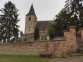
-St Ulrich’s Church and a notice board on the history of Zellenberg (1). Texts describing the church are displayed inside.

-Viewpoints over the vineyards, the Rhine plain and the Vosges mountains between (1) and (3).

-Corner tower.

-Guardhouse.

-Fountain on the street of the same name.

-Communal stables.

-On the houses: emblems of the winegrower, the merchant and the cooper.

-Cultural plaque on the Schirhoft (4)

-Birthplace of René Roeckel.

-Viewpoint overlooking Riquewihr and the Vosges (5).

-Village inn.

-Cultural information board by the vicarage.

-Village bakery.

-The village council’s stove.

Other walks in the area

For more walks, use our search engine .

The GPS track and description are the property of this route's author. Please do not copy them without permission.