Route de découverte de Katzenthal

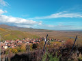
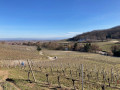
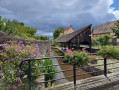
Katzenthal is a small Alsatian village situated between Ammerschwihr and Ingersheim. This walk can easily be completed in an hour. You can combine it with a visit to Ammerschwihr, a neighbouring village. This walk takes you past Saint-Nicolas Church and Wineck Castle, a medieval castle which is open to visitors. It is a wine-growing village with undeniable Alsatian charm.

Details

n°108271874
Creation:
Last update:
Last review:
–
  • Walking
    Activity: Walking
  • ↔
    Distance: 1.55 mi
  • ◔
    Average duration: 0h 55 
  • ▲
    Difficulty: Easy

  • ⚐
    Back to start: Yes
  • ↗
    Ascent: + 259 ft
  • ↘
    Descent: - 259 ft

  • ▲
    Highest point: 1,115 ft
  • ▼
    Lowest point: 850 ft

Description of the walk

Park in the cemetery car park, near the church.

(S/E) Enter the cemetery and head towards the church. Walk past a monument and, opposite the town hall, continue left onto Rue de l’Église. Then turn right onto Grand Rue. Walk up this street until you reach the fountain.

(1) Turn left onto Rue des Trois-Epis. Pass two streets on your right; walk past a wayside cross at the second one, then take the third street on the right, Rue du Bassin. At the bottom, turn left onto Rue du Galtz until you reach a junction.

(2) Turn right onto the Chemin du Château. Continue briefly through the woodland before continuing uphill to the path. Go straight ahead, then turn right to reach the Château du Wineck and its viewpoint.

(3) Return to Rue du Galtz via the same route.

(2) Head down to the left to reach a chapel.

(4) Walk down the Grand’Rue, then keep to the right, and then turn left twice. Continue to the right onto Rue du Vignoble, then leave the path on your left and, at the second bend, turn left towards the wayside cross and its junction.

(5) Keep to the right to reach another wayside cross, as well as the car park (S/E).

Waypoints

  1. S/E : mi 0 - alt. 856 ft - Cemetery car park - Église Saint-Nicolas (Katzenthal)
  2. 1 : mi 0.12 - alt. 892 ft - Fountain
  3. 2 : mi 0.45 - alt. 951 ft - Crossroads
  4. 3 : mi 0.73 - alt. 1,102 ft - Château du Wineck
  5. 4 : mi 1.12 - alt. 912 ft - Chapelle Notre-Dame des Douleurs (Katzenthal)
  6. 5 : mi 1.45 - alt. 850 ft - Crossroads
  7. S/E : mi 1.55 - alt. 856 ft - Cemetery car park - Église Saint-Nicolas (Katzenthal)

Worth a visit

Other walks in the area

For more walks, use our search engine .

The GPS track and description are the property of this route's author. Please do not copy them without permission.