


gérard bruet

 Visorando Member
 Premium user
 - Location: Tours-en-Savoie (73790)
- Gender: man
Sign up:
Published route(s)
 The Palatieux Balconies (Lè lôzè du Palatchu)
 2.51 mi
 +1,270 ft
 -1,260 ft
 2h 15
2h 15
 Moderate
 Departure from Tours-en-Savoie (Savoie)
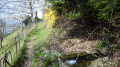
A lovely path running along a ridge overlooking the Tarentaise valley with stunning views of Tours-en-Savoie.
Route du Château de Chantemerle (Vèryâ du stâté dè Stantamerla)
 3.29 mi
+991 ft
-1,014 ft
2h 25
Moderate
Departure from La Bâthie (Savoie)
3.29 mi
+991 ft
-1,014 ft
2h 25
Moderate
Departure from La Bâthie (Savoie)
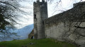
A trail that takes you to the 17th-century Château de Chantemerle with its breathtaking view of the village of La Bâthie. You will also pass through the village of Biorges and cross the stream, Ruisseau du Nant Varin.
Route de la Chapelle Saint-Clément (Viéryâ d’la stapèla Saint Clément)
 2.30 mi
+446 ft
-446 ft
1h 25
2.30 mi
+446 ft
-446 ft
1h 25
 Easy
Departure from Tours-en-Savoie (Savoie)
Easy
Departure from Tours-en-Savoie (Savoie)
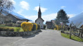
A family walk through the woodland. Pass by the 17th-century Saint-Clément Chapel, sheltered by the Brèche rock, and the Sainte-Apollonie Chapel in the centre of the village.
Former Cevins Slate Quarry
 4.63 mi
+1,542 ft
-1,542 ft
3h 30
Moderate
Departure from La Bâthie (Savoie)
4.63 mi
+1,542 ft
-1,542 ft
3h 30
Moderate
Departure from La Bâthie (Savoie)
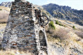
A walk that will take you past the remains of the slate quarries operated from the 16th century until the mid-20th century, offering lovely views from its balcony path over the Bellachat mountain pastures and the Col de La Bâthie. Best enjoyed from 10 June until the first snow
Circuit de Roche Étroite à Tours-en-Savoie
2.68 mi
+1,585 ft
-1,585 ft
2h 35
Moderate
Departure from Tours-en-Savoie (Savoie)
Une sortie sportive en forêt avec de magnifiques points de vue sur la vallée.
Soplat des Nants mountain hut via the Déberts circular loop
 7.25 mi
+4,094 ft
-4,081 ft
6h 55
7.25 mi
+4,094 ft
-4,081 ft
6h 55
 Difficult
Departure from Tours-en-Savoie (Savoie)
Difficult
Departure from Tours-en-Savoie (Savoie)
A circular route taking in the waterfalls of the Grand Ruisseau, Les Envers, the Soplat des Nants refuge, and returning via the Montagnettes des Déberts with magnificent views of the Pointe de la Grande Journée and the Tarentaise valley. Best undertaken from June to October, as the Soplat des Nants refuge remains snow-covered quite late into the season.
Lacha route via Le Raidier, starting from Tours-en-Savoie
 4.67 mi
+2,474 ft
-2,454 ft
4h 20
Moderate
Departure from Tours-en-Savoie (Savoie)
4.67 mi
+2,474 ft
-2,454 ft
4h 20
Moderate
Departure from Tours-en-Savoie (Savoie)
A somewhat challenging, woodland route with magnificent views over the valley.
Circular walk starting from Tours-en-Savoie, passing by Chantemerle Castle
 6.08 mi
+2,339 ft
-2,352 ft
4h 50
Moderate
Departure from Tours-en-Savoie (Savoie)
6.08 mi
+2,339 ft
-2,352 ft
4h 50
Moderate
Departure from Tours-en-Savoie (Savoie)
A pleasant route through woodland in the municipalities of Tours-en-Savoie and La Bathie, with a mix of ascents and descents. During this double circular route, you’ll discover Chantemerle Castle, the hamlet of Biorges and the waterfalls of the Grand Ruisseau. You’ll pass beneath Saint-Clément Chapel and above the EDF power station.
Circular route around the Refuge du Soplat des Nants
 2.51 mi
+919 ft
-942 ft
1h 55
Moderate
Departure from Tours-en-Savoie (Savoie)
2.51 mi
+919 ft
-942 ft
1h 55
Moderate
Departure from Tours-en-Savoie (Savoie)
A little-known route in the mid-mountains, ideal for enjoying the cool summer air with a stop at the Refuge du Soplat des Nants and its plateau, perfect for a family picnic.Route only accessible from May to October.
Refuge du Soplat des Nants par le chemin historique
5.68 mi
+3,691 ft
-3,691 ft
5h 50
Difficult
Departure from Tours-en-Savoie (Savoie)
Allez découvrir le Refuge du Soplat des Nants par le sentier historique peu fréquenté non représenté sur les cartes qui évite en grande partie la piste carrossable et vous permet de rejoindre le Chalet du Soplat des Nants en trois heures.À faire de mai à novembre pour éviter les risques d’avalanches.
The Pointe de la Grande Journée via the ridges, starting from the Belachat mountain pasture
 5.35 mi
+2,303 ft
-2,283 ft
4h 30
Difficult
Departure from La Bâthie (Savoie)
5.35 mi
+2,303 ft
-2,283 ft
4h 30
Difficult
Departure from La Bâthie (Savoie)
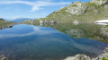
A beautiful circular hike that starts at the Bellachat mountain pastures with Beaufort cheese making, passing by the Croix de la Dormiaz and a path along the summit ridge with breathtaking views of the Albertville basin. Then head to the Pointe de la Grande Journée for stunning 360° views.
The Soplat of the Stream 7 circular loop
 4.87 mi
+1,640 ft
-1,640 ft
3h 40
Moderate
Departure from La Bâthie (Savoie)
4.87 mi
+1,640 ft
-1,640 ft
3h 40
Moderate
Departure from La Bâthie (Savoie)
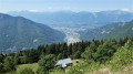
A little-used circular route that winds through the forest between Montagnette and the Refuge du Soplat des Nants, ideal for a long break. The return journey is on a track suitable for vehicles.This route is only accessible from May to October. Snow-covered in winter, this route is accessible with snowshoes.
Route du Logis des Fées
 7.25 mi
+3,543 ft
-3,543 ft
6h 25
Difficult
Departure from La Léchère (Savoie)
7.25 mi
+3,543 ft
-3,543 ft
6h 25
Difficult
Departure from La Léchère (Savoie)
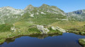
A hike in the Lauziere massif that will take you past the surrounding peaks, the Logis des Fées refuge, Lake L'Arpettaz and Lake Branlay along well-maintained paths.
The Balconies of Saint-Thomas (Lé lôzè dè Saint Thomas)
 4.47 mi
+1,562 ft
-1,535 ft
3h 25
Moderate
Departure from Esserts-Blay (Savoie)
4.47 mi
+1,562 ft
-1,535 ft
3h 25
Moderate
Departure from Esserts-Blay (Savoie)
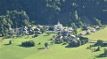
A route that will take you through the remote hamlets of the village of Saint-Thomas, overlooking the valley with magnificent views, a route alternating between footpaths, tracks and roads.
A sunny route early in the morning with very little traffic – enjoy it to your heart’s content.
Ridges of the Grande Journée starting from La Ravoire
 6.75 mi
+3,189 ft
-3,173 ft
5h 55
Difficult
Departure from La Bâthie (Savoie)
6.75 mi
+3,189 ft
-3,173 ft
5h 55
Difficult
Departure from La Bâthie (Savoie)
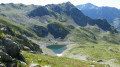
A beautiful circular walk that takes you through the Bellachat mountain pastures, where Beaufort cheese is made, past the Croix de la Dormiaz and along the summit ridge with breathtaking views over the Albertville basin, before reaching the summit of the Grande Journée and its stunning 360° panorama. Return via Lac Sans Fond and the Lavouet Lakes.
Chenal – Mario Bezzi Refuge
 8.01 mi
+3,907 ft
-2,037 ft
7h 05
Difficult
Departure from Sainte-Foy-Tarentaise (Savoie)
8.01 mi
+3,907 ft
-2,037 ft
7h 05
Difficult
Departure from Sainte-Foy-Tarentaise (Savoie)
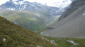
A steady climb taking you through La Combaz and the listed village of Le Monal with its small lakes, with a breathtaking view of Mont Pourri in the background; further up, you’ll cross the Vallon du Clou, which has been listed and protected since March 2013, to reach the Col du Rocher Blanc (2,830 m), and then descend to the Refuge de Mario Bezzi.
Bénévolo – Chivasso
 6.47 mi
+3,005 ft
-1,975 ft
5h 35
Difficult
Departure from Rhêmes-Notre-Dame (Aosta Valley)
6.47 mi
+3,005 ft
-1,975 ft
5h 35
Difficult
Departure from Rhêmes-Notre-Dame (Aosta Valley)
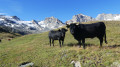
The ascent takes you through very wild, virtually off-trail terrain up to the Nivoletta Alpine Pass (3,152 m), followed by a descent via the gullies overlooking the magnificent Leitz and Rosset Lakes in the Valsavarenche. You then make your way towards the Chivasso Refuge through splendid flower-filled mountain pastures, renowned for their delicious fontina cheese.
Chivasso – Carro
 6.52 mi
+3,130 ft
-2,582 ft
5h 45
Difficult
Departure from Valsavarenche (Aosta Valley)
6.52 mi
+3,130 ft
-2,582 ft
5h 45
Difficult
Departure from Valsavarenche (Aosta Valley)
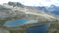
Cross the mountain pastures along a descending path, from where there is a magnificent view of Lake Agniel and Lake Serru (2,240 m). A path leads to Lago Delle Rocc Grandi and the high-altitude path over the Col du Carro (3,122 m). The pass marks the French-Italian border and the entrance to the Vanoise National Park. A steep descent leads to the Refuge du Carro (2,759 m) for a well-deserved rest.
Please note: Just before Lac du Caro, the glacier tongue has swept away the landmarks (markings, cairns), makingnavigation and progress very difficult(see notice dated 7 September 2026).
Carro – Fond des Fours
 10.53 mi
+2,474 ft
-3,212 ft
7h 00
Difficult
Departure from Bonneval-sur-Arc (Savoie)
10.53 mi
+2,474 ft
-3,212 ft
7h 00
Difficult
Departure from Bonneval-sur-Arc (Savoie)
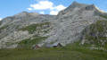
The magnificent balcony path takes you to the Col des Fours, under the curious gaze of chamois and marmots, as far as the Pont de la Neige (2,518 m), where you’ll find signs of civilisation as you cross the famous Col de l’Iseran road. As soon as you’ve crossed it, you’ll leave it behind as you head for the Col des Fours (2,976 m). Descend through the valley of the same name to reach the Col du Fond-des-Fours (2,537 m).
Fond des Fours – La Leisse
 10.52 mi
+3,061 ft
-3,215 ft
7h 30
Difficult
Departure from Val-d'Isère (Savoie)
10.52 mi
+3,061 ft
-3,215 ft
7h 30
Difficult
Departure from Val-d'Isère (Savoie)
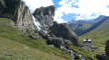
A little-used path leading to the Col de la Rocheure (2,911 m) runs alongside a myriad of small high-altitude lakes, before descending to the Refuge de la Femma. The ascent to the Col de Pierre-Blanche (2,842 m) is steady and not very well marked, even veering off the beaten track. The view is magnificent over the rocky Leisse valley, nestled between the giant peaks of the Grande Motte and the Grande Casse. Descend through these deserted landscapes towards the eagle’s nest that is the Refuge de la Leisse (2,487 m).
La Leisse – Tignes Val-Claret
 6.01 mi
+892 ft
-2,142 ft
3h 30
Moderate
Departure from Termignon (Savoie)
6.01 mi
+892 ft
-2,142 ft
3h 30
Moderate
Departure from Termignon (Savoie)
A steady climb takes you to the Col de la Leisse (2,761 m), offering breathtaking views of the Grande Motte glacier, before descending to Tignes Val-Claret with, in the background, the Dôme de la Sache (3,588 m), the Pointe de la Grande Sassière and, to the left, the Col du Palet and the Pointe du Chardonnet.
Tour of the Alpes Grées
 55.38 mi
+20,118 ft
-18,793 ft
7 days
Difficult
Departure from Sainte-Foy-Tarentaise (Savoie)
55.38 mi
+20,118 ft
-18,793 ft
7 days
Difficult
Departure from Sainte-Foy-Tarentaise (Savoie)
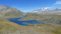
The Franco-Italian Alpes Grées mountain range lies in Savoie on the French side, and spans two valleys in Italy: the Aosta Valley and the Piedmont Valley.
Much of the Grées Alps is covered by two national parks: the Vanoise and the Gran Paradiso.
A truly alpine route where you’ll remain above 2,300 metres, with magnificent views of the glaciers, not to mention the sections through the Fontine and Beaufort mountain pastures.
Mario Bezzi – Benevolo
 7.31 mi
+3,648 ft
-3,629 ft
6h 30
Difficult
Departure from Valgrisenche (Aosta Valley)
7.31 mi
+3,648 ft
-3,629 ft
6h 30
Difficult
Departure from Valgrisenche (Aosta Valley)
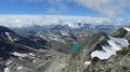
Hike up the magnificent glacial valley, which marks the end of the Val Grisenche, overlooking the imposing Glariettez Glacier. Access to the Val de Rhême via the Col de Bassac-Déré (3,082 m), then a descent through a high-mountain landscape to Lac de Golettaz, where the seracs are reflected in the water. The route then descends through the mountain pastures to the Refuge Benevolo (2,285 m).
Mont Bellacha via Les Foyères
 8.70 mi
+4,455 ft
-4,439 ft
6 hrs
8.70 mi
+4,455 ft
-4,439 ft
6 hrs
 Very difficult
Departure from La Léchère (Savoie)
Very difficult
Departure from La Léchère (Savoie)
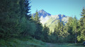
A hike in the Lauzière massif, a little-used route passing through the mountain pastures of Montagne d’en Haut and Montagne d’en Bas along a path marked in August 2020 to reach the Col de l’Arc. After a steady climb, you reach the summit of Mont Bellachat with a breathtaking 360° view of the surrounding valleys and peaks:
the Grand Arc, the Pic de la Lauzière, Mont Pourri, the Grande Casse, the Grand Bec, the Grande Motte, the Vanoise glaciers, not to mention Mont Blanc.
Vallon du Fruit, Lac des Fées, Refuge du Saut and Lac de Tuéda in Méribel
 8.63 mi
+1,578 ft
-1,558 ft
5h 20
Moderate
Departure from Les Allues (Savoie)
8.63 mi
+1,578 ft
-1,558 ft
5h 20
Moderate
Departure from Les Allues (Savoie)
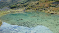
A family hike on trails in the Tuéda Nature Reserve on the edge of the Vanoise National Park. A route where you can see marmots running along the path, with a stop at Lac des Fées, ideal for a long break. Finally, pass by the Refuge du Saut and then Lac de Tuéda and its plateau.
Morel route starting from La Lèchère
 4.76 mi
+850 ft
-837 ft
2h 55
Moderate
Departure from La Léchère (Savoie)
4.76 mi
+850 ft
-837 ft
2h 55
Moderate
Departure from La Léchère (Savoie)
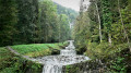
A route starting from the Thermes de la Léchère-les-Bains on a pretty path along the Isère river and up the banks of the Torrent du Morel with its waterfalls, once the scourge of the Aigueblanches valleys, now tamed by humans who have turned it into a peaceful mountain stream. After crossing the village of Saint-Oyen and returning with a view of the valley, you will reach the Thermes de la Léchère spa.
Pointe de Lavouet circular walk
 5.99 mi
+2,923 ft
-2,917 ft
5h 20
Difficult
Departure from La Bâthie (Savoie)
5.99 mi
+2,923 ft
-2,917 ft
5h 20
Difficult
Departure from La Bâthie (Savoie)
Ascent of Pointe de Lavouet, a less well-known peak than Pointe de la Grande Journée, offering views of Mont Blanc, Pierra Menta and the Col de la Bâthie. A beautiful, little-used circular route passing by the lovely Lac sans Fond and returning via the mountain pastures and the Col de la Bâthie. Best undertaken from June to October to avoid snow-covered sections that obscure the path and can be dangerous.
Le Fort du Mont au départ de Tours en Savoie
 7.28 mi
+2,913 ft
-2,913 ft
5h 55
Difficult
Departure from Tours-en-Savoie (Savoie)
7.28 mi
+2,913 ft
-2,913 ft
5h 55
Difficult
Departure from Tours-en-Savoie (Savoie)
Une belle randonnée, assez sportive, avec un cheminement en forêt avec tout le long de la randonnée de magnifiques points de vue sur la vallée, des traversées de petit hameaux, des chalets perdus au milieu des bois et arrivée au point culminant qui est le Fort du Mont .
Route de la Belle Étoile and La Négresse / Roc Rouge
 5.64 mi
+3,159 ft
-3,133 ft
5h 20
Difficult
Departure from Mercury (Savoie)
5.64 mi
+3,159 ft
-3,133 ft
5h 20
Difficult
Departure from Mercury (Savoie)
A very lovely hike on the border between Savoie and Haute-Savoie, on the iconic peaks of Albertville: the beautiful Étoile and the Négresse.
In the background, the Bauges massif, the Beaufortain, the Lauzière, Mont Blanc and Lake Annecy.
A hike best undertaken in dry weather, featuring exposed sections equipped with ladders and handrails.
Grand Roc Circular Trail
 9.86 mi
+4,439 ft
-4,429 ft
8h 25
Difficult
Departure from Cléry (Savoie) (Savoie)
9.86 mi
+4,439 ft
-4,429 ft
8h 25
Difficult
Departure from Cléry (Savoie) (Savoie)
The Grand Roc, situated in the Bauges Massif Nature Reserve, boasts a wealth of wildflowers that are particularly striking in May: daffodils and narcissi in abundance all along the path. A steady path leads to the Col de la Fougère after a long climb.
You reach the Col du Haut du Four via a narrow path, then follow the ridge path with its breathtaking views over the Albertville valley, before finally reaching the Grand Roc with its splendid views of the surrounding peaks.
Couteray - Refuge du Vieux Emosson
 7.45 mi
+3,753 ft
-1,053 ft
6h 40
Difficult
Departure from Vallorcine (Haute-Savoie)
7.45 mi
+3,753 ft
-1,053 ft
6h 40
Difficult
Departure from Vallorcine (Haute-Savoie)
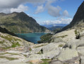
A pretty route, with views of the Tour and Argentière glaciers, which passes through the Refuge de Loriaz to reach the Barrage d'Emosson via a balcony path and finishes at the Refuge du Vieux Emosson.
Vieux Emosson Refuge - Refuge de la Pierre à Bérard
 7.85 mi
+3,921 ft
-4,715 ft
7 hrs
Very difficult
Departure from Finhaut (Valais)
7.85 mi
+3,921 ft
-4,715 ft
7 hrs
Very difficult
Departure from Finhaut (Valais)
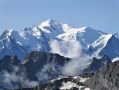
Pass through the listed site of dinosaur footprints, then climb up to Cheval Blanc and reach the summit of Buet via the ridges. A difficult alpine route classified as T4 with breathtaking views of the Aiguilles Rouges.
Refuge de la Pierre à Bérard - Refuge des Fonts
 11.24 mi
+3,527 ft
-5,331 ft
8 hrs
Very difficult
Departure from Vallorcine (Haute-Savoie)
11.24 mi
+3,527 ft
-5,331 ft
8 hrs
Very difficult
Departure from Vallorcine (Haute-Savoie)
A lovely hike passing through the Col de Salenton, descend to take the balcony path through the mountain pastures of the Vallée de la Diosaz. Continue on to the Refuge de Moede-Anterne, then the Col d'Anterne and descend to the magnificent Lac d'Anterne. Then reach the Refuge des Fonts via a pretty path passing through the Petit Col d'Anterne.
⚠️ This route crosses the Aiguilles Rouges nature reserve. Please respect the regulations in force. See practical information.
Refuge des Fonts - Refuge de la Vogealle
 14.69 mi
+4,423 ft
-2,664 ft
7 hrs
Very difficult
Departure from Sixt-Fer-à-Cheval (Haute-Savoie)
14.69 mi
+4,423 ft
-2,664 ft
7 hrs
Very difficult
Departure from Sixt-Fer-à-Cheval (Haute-Savoie)
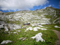
A lovely hike in the Cirque du Fer à Cheval with its remarkable waterfalls, a stop at the Bout du Monde, with a balcony path through the forest to reach the Chalet du Boret, and a steady climb to reach the Refuge de la Vogealle perched on a pretty plateau.
Important note: this route requires a taxi shuttle from the Cascade du Rouget to the Cirque du Fer à Cheval (14 km) to reduce the walking distance.
Vogealle Refuge - Bonavau Inn
 7.48 mi
+3,412 ft
-4,570 ft
6h 25
Difficult
Departure from Sixt-Fer-à-Cheval (Haute-Savoie)
7.48 mi
+3,412 ft
-4,570 ft
6h 25
Difficult
Departure from Sixt-Fer-à-Cheval (Haute-Savoie)
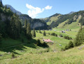
Straddling the French-Swiss border, between Sixt-Fer-à-Cheval and Champéry, this marked trail takes you between alpine pastures and high mountains. The Dents Blanche pass is remarkable for its geology, with its tightly folded limestone layers. A steep descent down a rocky chimney (with cables) takes you to the Col de Bostan, on the French-Swiss border. The Pas de la Bide, a tricky passage with its famous letterbox, leads to the Brame mountain pastures and the Auberge de Bonavau.
Auberge de Bonavau - Auberge de Salanfe
 9.16 mi
+6,831 ft
-6,001 ft
7 hrs
Very difficult
Departure from Champéry (Valais)
9.16 mi
+6,831 ft
-6,001 ft
7 hrs
Very difficult
Departure from Champéry (Valais)
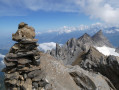
A big day with spectacular scenery. The Pas d'Encel pass is a little tricky to navigate to reach the foot of Mont Ruan. Reach Haute Cime, the highest point of the Dents du Midi at 3,257 metres, via the Col de Susanfe, then descend to the Auberge de Salanfe on the edge of the lake.
Auberge de Salanfe - Cabane du Vieux Emosson
 10.52 mi
+6,050 ft
-4,813 ft
7 hrs
Very difficult
Departure from Evionnaz (Valais)
10.52 mi
+6,050 ft
-4,813 ft
7 hrs
Very difficult
Departure from Evionnaz (Valais)
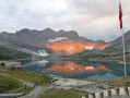
A long day leading to Lac d'Emosson via the Col d'Emaney and Col de Barberine. Descent to Lac d'Emosson, then Col de la Gueulaz and the final climb to the Cabane du Vieux Emosson.
Cabane du Vieux Emosson - Couteray
 7.16 mi
+2,067 ft
-4,728 ft
5h 05
Difficult
Departure from Finhaut (Valais)
7.16 mi
+2,067 ft
-4,728 ft
5h 05
Difficult
Departure from Finhaut (Valais)
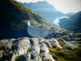
This route begins with a detour off the beaten track, suggested to us by the refuge warden, to reach the Col de la Terrasse. An alpine route with the Emosson dam in the background and a chance to discover the lakes at the Col du Corbeaux. After a long descent at the foot of Mont Buet in the Tré les Eaux valley, cross a long ledge equipped with cables and ladders to finally reach the Chalets des Granges and arrive at the Couteray car park.
Tour of the Dents Blanches massif, Ruan, Tenneverge
75.55 mi
+33,983 ft
-33,875 ft
8 days
Very difficult
Departure from Vallorcine (Haute-Savoie)
Straddling the Franco-Swiss border, the Dents Blanches, Dents du Midi, Tenneverge, Mont Ruan and Aiguilles Rouges. An area strongly shaped by the folding of the Alps, with surprising landscapes ranging from lunar deserts to high-altitude lakes, waterfalls and forgotten mountain pastures. A wild and unspoilt nature that only hikers can discover. Alpine valleys, often isolated by "pas", technical and cabled paths opening the doors to this universe of raw and grandiose nature...
Brèche Portetta and Col de Grande Pierre
 7.90 mi
+5,276 ft
-5,272 ft
6 hrs
7.90 mi
+5,276 ft
-5,272 ft
6 hrs
 Extremely difficult
Departure from Pralognan-la-Vanoise (Savoie)
Extremely difficult
Departure from Pralognan-la-Vanoise (Savoie)
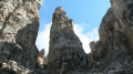
A route passing through the Brèche Portetta, a cluster of small peaks including the Bec, the Dent du Biot and the Dent Portetta (2,629 m), …
We shall therefore confine ourselves to the Brèche Portetta and the various narrow passages between these jagged pillars of limestone and dolomite. The views are superb, taking in the Vanoise glaciers, the Grande Casse, the Aiguille du Fruit, the Chavière valley and Mont Blanc.
Col de Jean above Les Allues
 7.01 mi
+2,395 ft
-2,405 ft
5h 20
Moderate
Departure from Les Allues (Savoie)
7.01 mi
+2,395 ft
-2,405 ft
5h 20
Moderate
Departure from Les Allues (Savoie)
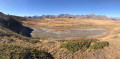
A lovely hike in the Allues Valley, best undertaken from June to October on well-maintained paths away from the ski lifts.
 Col de la Lézette and Chard du Beurre
 4.71 mi
+1,017 ft
-1,007 ft
4 hrs
Moderate
Departure from Hauteluce (Savoie)
4.71 mi
+1,017 ft
-1,007 ft
4 hrs
Moderate
Departure from Hauteluce (Savoie)
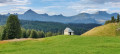
A lovely hike with magnificent views of Mont Blanc
Circular Crève Tête via the Col de la Coche
 7.94 mi
+3,009 ft
-3,028 ft
6h 15
Difficult
Departure from Fontaine-le-Puits (Savoie)
7.94 mi
+3,009 ft
-3,028 ft
6h 15
Difficult
Departure from Fontaine-le-Puits (Savoie)
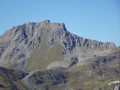
A walk above the resort of Valmorel, following the ridge from the Col de la Coche to Crève Tête, the highest point of the route with its 360° view. Return via the Pierre Larron refuge and the Coche basin.
Circuit of Mont Coua and its lakes
 14.40 mi
+3,875 ft
-3,875 ft
7 hrs
Very difficult
Departure from Les Allues (Savoie)
14.40 mi
+3,875 ft
-3,875 ft
7 hrs
Very difficult
Departure from Les Allues (Savoie)
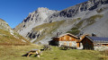
A long but scenic route passes through the Vallon du Fruit in the Plan de Tuéda Nature Reserve (Vanoise massif) between Méribel-Mottaret and the Refuge du Saut. Panoramic views of the Aiguille du Fruit ridge, a jagged massif. Below, a view of the confluence of the Doron des Allues and the Ruisseau de Chanrouge. The Mont Coua lakes are well worth the effort, and you may spot some ibex along the way as you reach the fourth lake.
Lac des Cornaches circular route via the Col de la Tourche Vernay
 6.18 mi
+3,097 ft
-3,097 ft
5h 30
Difficult
Departure from Cevins (Savoie)
6.18 mi
+3,097 ft
-3,097 ft
5h 30
Difficult
Departure from Cevins (Savoie)
Looking for space and solitude? This walk is for you.
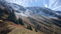
A path that’s shaded in the morning – ideal in hot weather – will take you to Lac des Cornaches via the Col de la Tourche Vernay, with a balcony-style walkway offering views of the Bellachat mountain pastures, the Albertville valley and the Grand Mont.
Combe de Lioux, Château Saint-Lambert and Falaise de la Madeleine
 11.48 mi
+2,060 ft
-2,044 ft
7h 05
Difficult
Departure from Lioux (Vaucluse)
11.48 mi
+2,060 ft
-2,044 ft
7h 05
Difficult
Departure from Lioux (Vaucluse)
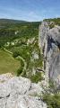
Discover the Combe de Lioux, which is narrow in places, with its natural caves, as you walk in the cool shade. Leave the valley to cross the cedar forest and reach the Château de Saint-Lambert, a former sanatorium that has been abandoned and vandalised. After a descent, you will reach the Falaise de la Madeleine, a remarkable site with an impressive view of the village of Lioux and a 360° panorama.
From Albertville station to the Refuge du Soplat des Streams
 7.03 mi
+4,177 ft
-604 ft
6h 50
Difficult
Departure from Albertville (Savoie)
7.03 mi
+4,177 ft
-604 ft
6h 50
Difficult
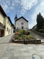
Departure from Albertville (Savoie)
A lovely climb starting from Albertville, passing through the medieval town of Conflans and pretty mountain hamlets with views of the Tarentaise Valley, before reaching the Refuge du Soplat des Stream. The refuge is ideally located near the Tour du Beaufortain with a beautiful view of Albertville and the Olympic Park. Hike to be done from May to November: avalanche risk in winter above 1,100 metres.