Pointe de Lavouet circular walk

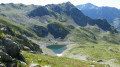
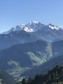
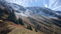
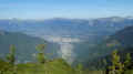
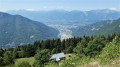
Ascent of Pointe de Lavouet, a less well-known peak than Pointe de la Grande Journée, offering views of Mont Blanc, Pierra Menta and the Col de la Bâthie. A beautiful, little-used circular route passing by the lovely Lac sans Fond and returning via the mountain pastures and the Col de la Bâthie. Best undertaken from June to October to avoid snow-covered sections that obscure the path and can be dangerous.

Details

4228366
Creation:
Last update:
Last review:
  • Walking
    Activity: Walking
  • ↔
    Distance: 5.99 mi
  • ◔
    Average duration: 5h 20 
  • ▲
    Difficulty: Difficult

  • ⚐
    Back to start: Yes
  • ↗
    Ascent: + 2,923 ft
  • ↘
    Descent: - 2,917 ft

  • ▲
    Highest point: 7,907 ft
  • ▼
    Lowest point: 5,020 ft

Photos

Description of the walk

To reach the start, drive through the village of La Bâthie on the D990, near the N90 junction, south of the village of Tours-en-Savoie. Take the D65 and drive up to the hamlet of Le Daru, passing through the hamlets of Le Fugier, Montesseaux, Lachat and Le Mondon. At ‘Le Daru’, continue towards La Ravoire and Bellachat. At the end of the tarmac road, carry on straight ahead along the track towards La Ravoire and park at the bridge crossing the stream.

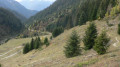
(S/E) Walk back a few metres and take the path leading uphill to the right. After about thirty minutes, you’ll reach a plateau. Continue along the path until you join a track leading to the Col de la Bâthie.

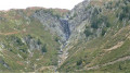
(1) Cross the track and follow the path marked with a few yellow markings. You’ll pass close to the Lavouet waterfall. After a fairly steep climb, the path levels out, reaching a plateau and joining the junction with the GRP®.

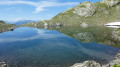
(2) Follow theGRP® uphill for about fifty metres, then leave it by keeping to the right to reach Lac de Lavouet.

(3) Head off to the right and follow the dry stream bed.

(4) Follow the stream bed on the left bank (cairns) to reach Lac sans Fond.

(5) Continue along the faint path, following the cairns. After a steep climb, the slope levels out and you can see the small pass, which you will reach.

(6) Turn right into the small valley below the summit ridge and follow it to reach the summit of Pointe de Lavouet.

(7) Retrace your steps.

(6) Set off to the right onto a small path marked by cairns. Descend a fairly steep slope to reach a small flat area amongst the boulders, with the Catexes cistern about a hundred metres to the left. Follow the cairns and the few red paint marks through the boulders to rejoin a more clearly marked path and reach a small pass from where you can see the Col de la Bâthie.

(8) Continue along the path until you reach the Col de la Bâthie.

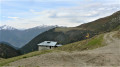
(9) Turn right onto the descending track and reach the Chalet du Soufflet.

(10) Leave the track and take a small path towards La Ravoire, as indicated on the sign, and reach the EDF water intake building. Ignore the track and take the path on the right to return directly to the starting point (S/E).


Waypoints

  1. S/E : mi 0 - alt. 5,020 ft - Car park at the Ravoire bridge
  2. 1 : mi 0.98 - alt. 5,942 ft - Junction with the Col de la Bâthie track
  3. 2 : mi 1.95 - alt. 6,936 ft - GRP junction°°®°°
  4. 3 : mi 2.04 - alt. 6,969 ft - Lac de Lavouet
  5. 4 : mi 2.11 - alt. 7,014 ft - Stream
  6. 5 : mi 2.37 - alt. 7,313 ft - Lac Sans Fond
  7. 6 : mi 2.73 - alt. 7,743 ft - Unnamed pass
  8. 7 : mi 3.12 - alt. 7,907 ft - Pointe de Lavouet
  9. 8 : mi 3.87 - alt. 7,201 ft - Small pass
  10. 9 : mi 4.68 - alt. 6,204 ft - Col de la Bäthie (1889m)
  11. 10 : mi 5.07 - alt. 5,935 ft - Challet du Soufflet (1819m)
  12. S/E : mi 5.99 - alt. 5,030 ft - Car park at the Ravoire bridge

Notes

Best undertaken from June to October.

Worth a visit

Pointe de la Grande Journée.

Reviews and comments

4.4 / 5
Based on 3 reviews

Reliability of the description
4.3 / 5
Ease of following the route
4 / 5
Route interest
5 / 5
User 8504803

Overall rating : 4 / 5

Date of your route : Aug 01, 2025
Reliability of the description : ★★★★☆ Good
Ease of following the route : ★★★☆☆ Average
Route interest : ★★★★★ Very good
Very busy route : No

A beautiful hike offering magnificent views and the chance to spot marmots!
Be careful though, as the route is not marked and it can sometimes be difficult to follow the trail.
It can be difficult to find the path to the Lavouet peak, and it is easy to lose your way on the descent.

Machine-translated

gérard bruet
gérard bruet

Overall rating : 4.7 / 5

Date of your route : Aug 15, 2023
Reliability of the description : ★★★★★ Very good
Ease of following the route : ★★★★☆ Good
Route interest : ★★★★★ Very good
Very busy route : No

A lovely walk, despite the rain, to the summit of Pointe des l’Avouer

Machine-translated

opale
opale

Overall rating : 4.7 / 5

Date of your route : Aug 24, 2022
Reliability of the description : ★★★★☆ Good
Ease of following the route : ★★★★★ Very good
Route interest : ★★★★★ Very good
Very busy route : No

A lovely walk, but we didn’t make it to the Pointe de Lavouet.
At the pass, we followed the cairns heading left to the Pointe de la Grand Journée.
A 360° view from the summit… splendid.
A very steep descent after the pass.

Machine-translated

EVERUN
EVERUN

During the winter months, I plan my summer hikes whilst the weather allows… so I’ve downloaded, amongst many others…
- Roc de Viuz - Cevins Slate Quarries - Grande Journée and Pointe de Lavouet, etc...
When the time comes, I’ll be happy to share my thoughts on them
Looking forward to it, best regards

Machine-translated

Other walks in the area

For more walks, use our search engine .

The GPS track and description are the property of this route's author. Please do not copy them without permission.