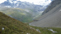
Chenal – Mario Bezzi Refuge

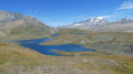
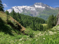
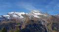
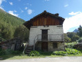
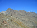
A steady climb taking you through La Combaz and the listed village of Le Monal with its small lakes, with a breathtaking view of Mont Pourri in the background; further up, you’ll cross the Vallon du Clou, which has been listed and protected since March 2013, to reach the Col du Rocher Blanc (2,830 m), and then descend to the Refuge de Mario Bezzi.

This walk is part of a multi-day hike: Tour of the Alpes Grées

Details

n°3873377
Creation:
Last update:
Last review:
  • Walking
    Activity: Walking
  • ↔
    Distance: 8.01 mi
  • ◔
    Average duration: 7h 05 
  • ▲
    Difficulty: Difficult

  • ⚐
    Back to start: No
  • ↗
    Ascent: + 3,907 ft
  • ↘
    Descent: - 2,037 ft

  • ▲
    Highest point: 9,288 ft
  • ▼
    Lowest point: 5,571 ft

Photos

Description of the walk

From Bourg-Saint-Maurice, follow the RN 90 then the D902 to Sainte-Foy. Drive through the village towards Val d’Isère. Continue for 8 km to Les Pigettes, then turn left just before the avalanche barrier. Drive up to Chenal – the end of the road accessible by car and the starting point.

(S) From the Chenal car park, walk up the road to thesecond hairpin bend.

(1) Leave the road and continue straight on to the hamlet of La Combaz. A path climbs to the right, heading due east. Pass by the base of the climbing rocks and arrive at Le Monal, which you cross. Continue out of the village past the cheese dairy and reach the start of the path on the left-hand side heading towards Le Clou.

(2) Follow the path which climbs through the larch forest; ignore the path branching off to the right, join the track and, after a short climb, reach the hilltop offering a remarkable view of Le Monal and Mont Pourri.

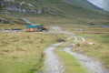
(3) Carry on, join the pastoral track, follow it and pass the Saint Jaques memorial; stay on the track above the Clou dam to reach the Chalets des Balmes, which you pass through, and reach the crossroads at the end of the track.

(4) Follow the path on the right-hand side to reach the Col du Rocher Blanc.

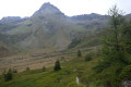
(5) Continue along the path leading down into the valley to reach the Mario Bezzi Refuge (E).

Waypoints

  1. S : mi 0 - alt. 5,571 ft - Le Chenal car park
  2. 1 : mi 0.44 - alt. 5,856 ft - Junction
  3. 2 : mi 1.38 - alt. 6,204 ft - Le Monal
  4. 3 : mi 1.88 - alt. 6,811 ft - Viewpoint
  5. 4 : mi 3.55 - alt. 7,539 ft - Les Balmes junction
  6. 5 : mi 5.41 - alt. 9,288 ft - Col du Rocher Blanc ou col de Vaudet (2835m)
  7. E : mi 8.01 - alt. 7,470 ft - Mario Bezzi Mountain Hut

Reviews and comments

5 / 5
Based on 1 review

Reliability of the description
5 / 5
Ease of following the route
5 / 5
Route interest
5 / 5
Andeor
Andeor

Overall rating : 5 / 5

Date of your route : Aug 30, 2026
Reliability of the description : ★★★★★ Very good
Ease of following the route : ★★★★★ Very good
Route interest : ★★★★★ Very good
Very busy route : No

A lovely stretch of the journey.
We only came across herds of cows – no mountain dogs.

Machine-translated

Other walks in the area

For more walks, use our search engine .

The GPS track and description are the property of this route's author. Please do not copy them without permission.