Chivasso - Carro

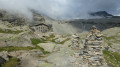
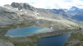
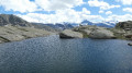
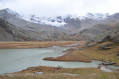
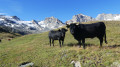
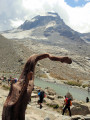
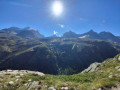
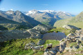
Traversée des alpages sur un chemin descendant, d’où la vue est magnifique sur le Lac Agniel et le Lac Serru (2240 m). Un sentier menant au Lago Delle Rocc Grandi et au sentier aérien du col du Carro (3122 m). Le passage du col marque la frontière franco-italienne et l’entrée dans le Parc National de la Vanoise. Une descente raide conduit au Refuge du Carro (2 759 m) pour un repos bien mérité.

This walk is part of a multi-day hike: Tour des Alpes Grées

Details

3873975
Creation:
Last update:
Last review:
  • Walking
    Activity: Walking
  • ↔
    Distance: 6.52 mi
  • ◔
    Average duration: 5h 45 
  • ▲
    Difficulty: Difficult

  • ⚐
    Back to start: No
  • ↗
    Ascent: + 3,130 ft
  • ↘
    Descent: - 2,582 ft

  • ▲
    Highest point: 10,315 ft
  • ▼
    Lowest point: 7,313 ft
  • ⚐ Country: Italy
  • ⚐
    Area: Alps
  • ⚐ City: Valsavarenche 
  • ⚑
    Start: N 45.479802° / E 7.142816°
  • ⚑
    End: N 45.419878° / E 7.122872°
  • ❏
    IGN map(s): Ref. 3633ET, 3633ETR
  • Hour-by-hour weather

Description of the walk

(S) Du Refuge Chivasso partir par le chemin descendant sous le refuge. Traverser la route au niveau de l'épingle pour se diriger ver le petit lac.

(1) Suivre à gauche le sentier balisé Rouge et Blanc, peu marqué au départ, arriver sur un plateau, pourssuivre rive gauche du ruisseau . Rejoindre plus loin par un cheminement quasiment horizontal le pont sur le ruisseau alimentant maintenant le Lac Agnel.

(2) Traverser le ruisseau et entamer une très légère montée avec un magnifique point de vue sur le lac Agnel, descendre la vire ensuite en s'aidant du câble. Poursuivre sur le sentier balcon avec la vue sur le Lac Serru jusqu’à rejoindre un croisement.

(3) Rester sur le chemin en balcon en ignorant le chemin descendant à gauche. Passer à proximité des chalets de Serru.

(4) Traverser le ruisseau et parvenir une centaine de mètres plus loin à un petit plateau en contrebas du chemin. Poursuivre hors sentier sur le plateau pour rejoindre un chemin quelques centaines de mètres plus bas.

(5) Obliquer à gauche dans ce chemin, couper 3 fois la route, et parvenir au parking en dessous du barrage.

(6) Suivre la direction Col du Carro indiquée sur un panneau et balisée Rouge et Blanc. Laisser à droite le sentier qui fait le tour du Lac de Serru. Passer à côté d'un petit fortin. Le chemin est assez régulier dans les alpages pour arriver au Lac Rocce Grandi.

(7) Poursuivre en laissant peu à peu les alpages pour arriver dans un univers haute montagne et parvenir au dessus du col avec une vue magnifique sur les lacs Serru et Agnel.

(8) Revenir sur ses pas d'une centaine de mètres et retrouver le chemin balisé Rouge et Blanc. Suivre les cairns et le balisage dans un univers très haute montagne pour arriver au 2e passage délicat. C'est une vire équipée d'une main courante.

(9) Sortir de la vire et poursuivre sur une pente bien raide pour rejoindre la 3e vire. La passer en utilisant les équipements en place, accéder rapidement ensuite au Col Carro marqué par de multiple cairns sur son plateau.

(10) Partir droit devant pour voir la vue sur le refuge et ses lacs. Suivre les cairns dans les blocs et par une descente raide arriver au lac puis au Refuge du Carro (E) étape du jour.

Waypoints

  1. S : mi 0 - alt. 8,540 ft - Refuge Citta di Chivasso
  2. 1 : mi 0.18 - alt. 8,396 ft - Petit lac
  3. 2 : mi 0.96 - alt. 8,176 ft - Pont
  4. 3 : mi 1.2 - alt. 7,927 ft - Intersection
  5. 4 : mi 1.5 - alt. 7,887 ft - Chalets de Serru
  6. 5 : mi 1.78 - alt. 7,802 ft - Chemin balisé RB
  7. 6 : mi 2.19 - alt. 7,369 ft - Parking sous le barrage
  8. 7 : mi 3.53 - alt. 8,002 ft - Lac Rocce Grand
  9. 8 : mi 4.28 - alt. 8,839 ft - Point de vue au col
  10. 9 : mi 5.32 - alt. 9,455 ft - Deuxième vire
  11. 10 : mi 5.62 - alt. 10,308 ft - Col du Carro (3149m)
  12. E : mi 6.52 - alt. 9,062 ft - Refuge du Carro

Notes

Attention 3 parties câblées : ne pas avoir le vertige.

Reviews and comments

3.5 / 5
Based on 2 reviews

Reliability of the description
4 / 5
Ease of following the route
2 / 5
Route interest
4.5 / 5
Andeor
Andeor

Overall rating : 3.7 / 5

Date of your route : Sep 02, 2026
Reliability of the description : ★★★★☆ Good
Ease of following the route : ★★☆☆☆ Disappointing
Route interest : ★★★★★ Very good
Very busy route : No

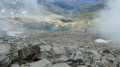
A magnificent stretch, but WARNING: just before reaching the Col du Carro (after about 5 hours’ walk), the path crosses a glacier tongue (which is often snow-covered, but this wasn’t the case when we passed through in early September). This glacier tongue regularly collapses, sweeping away all the red and white markings and the cairns with it...
The written description is no longer accurate: the second ledge from point no. 9 has clearly been swept away in the rockfall.

We found ourselves completely lost at the foot of the rocky ridge and spent over an hour exploring the surrounding area (unstable scree slopes) to find the rest of the path. The GPX track seemed reliable, but we couldn’t pick up the signal properly (bloody Italian mobile data), so there was no way we could follow it. Our paper map from the IGC (the Italian “equivalent” of the IGN, though far inferior) didn’t help us work out where we were or where to go either (long live those contour lines that just stop for no apparent reason).
From the glacier, it was impossible to see the pass, so we had absolutely no idea what to aim for (there were no visible markers or cairns either). Using a compass to find our bearings, the vertical face in front of us looked more like a climb requiring climbing gear than a hike.

We decided to turn back (having set off from the Savoia refuge, we’d already been walking for nearly 6 hours, and the sun was already starting to dip below the mountain’s peak). Fortunately, ten minutes later, we came across another Italian hiker who was able to pick up the GPX track and showed us how to cross the glacier tongue (no easy feat – you have to walk across a very unstable scree slope, as the boulders are resting on ice that’s melting and cracking...). Once on the other side, we were finally able to find the red and white markings again and begin the ascent of the rock face, which turned out to be a little less steep than it appears when you’re on the other side of the glacier.

The final 100 metres of elevation gain (roughly between points 9 and 10) are more like climbing than hiking, with ropes and pitons fixed into the face. It can be done without equipment, even though the section is rated EEA by the Italians (Escursionista Esperto Attrezzato – Experienced hiker with equipment: highly technical routes equipped with cables, ladders or handrails similar to a via ferrata, requiring suitable kit (helmet, straps and harness)), but ABSOLUTELY NOT RECOMMENDED FOR THOSE SUFFERING FROM HEIGHT PHOBIA.
The pass remains out of sight almost until the very end: you have to approach it with a ‘leap of faith’ and tackle the technical sections one by one until the summit comes into view…

Crampons and ice axes are compulsory if there is still snow on the glacier: remember to ask the warden beforehand (and to ask him specifically about the state of the markings on the glacier: he didn’t tell us anything about this, even though we’d asked him whether the route was passable… If we’d had that information earlier, we wouldn’t have had to second-guess ourselves so much as we made our way towards the pass).

Machine-translated

Other walks in the area

For more walks, use our search engine .

The GPS track and description are the property of this route's author. Please do not copy them without permission.