Country:

 City:


From Albertville, pass through Conflans, follow signs for Fort du Mont via the D105 and park in the fort’s car park, the starting point of the walk.
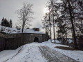
(S/E) Set off to the left along the access road, pass in front of the Fort du Mont gate, continue to the corner of the rampart and follow the path to the left, running alongside the fort’s rampart, to its end. Continue straight ahead along the descending path marked in yellow, which leads away from the ramparts, and join the track next to the bridge. Follow it to the left to reach Le Mont.
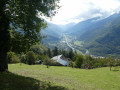
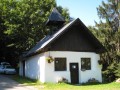
(1) On leaving the hamlet, follow the yellow-marked route towards Les Deberts along a path descending for 50 metres to a junction. Continue to the left along an easy path to reach the Champ Blaire chalet, which offers a lovely view over the Tarentaise Valley.
(2) Carry on along the path until you reach a junction; keep left to reach another junction (signposted ‘Roche Étroite’). Follow the signs for Les Deberts whilst continuing to follow the yellow markings; ignore the path on the right, pass by the cross and come out onto a track.
(3) Follow the track to the left, pass thefirst hairpin bend and carry on straight ahead through thesecond hairpin bend towards Le Gros Fayard. Pass a yellow barrier (cow pasture across the path) and reach the track junction at Les Déberts du Haut.
(4) Follow the track to the right towards Le Gros Fayard and reach a junction (signposted); from here, there are no further yellow markings. Ignore the track leading uphill to the left, carry on and reach another track junction. Keep left onto the less-used track and reach the turning area at its end.
(5) Then take the newly resurfaced track (signposted ‘Soplat des Nants’), cross the streams, ignoring the paths to the right and left. Reach the Grand Ruisseau.
(6) Cross it, climb up the embankment on the right-hand side and continue along a descending track for about a hundred metres until you reach the start of a path on the left-hand side: (signpost ‘Soplat des Nants’ above the track). Take this ascending path and, via a fairly steep climb, reach the Soplat des Nants refuge.
(7) After a break, retrace your steps along the path until you reach the Déberts du Haut junction.
(4) Continue along the gently ascending track towards the Col des Cyclotouristes (yellow markings). After a long walk, you’ll reach the start of a path on the right marked by the “Le Grébau” signpost.
(8) Follow the direction of the Col des Cyclotouristes along this path, which climbs for 200 m and is then relatively easy going. You’ll reach the track: signpost “Sur le Grébau”. Continue along this track to the left and reach the Col des Cyclotouristes and the tarmac road.
(9) Take the path leading down to the left, at the picnic area, towards Fort du Mont. Pass below a chalet and reach a junction of tracks: signpost “Lacay”.
(10) Follow the track leading uphill to the left and you’ll reach the Fort du Mont car park (S/E).




 Visorando Member
 Easy

 Difficult