Soplat des Nants mountain hut via the Déberts circular loop

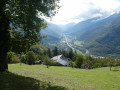
A circular route taking in the waterfalls of the Grand Ruisseau, Les Envers, the Soplat des Nants refuge, and returning via the Montagnettes des Déberts with magnificent views of the Pointe de la Grande Journée and the Tarentaise valley. Best undertaken from June to October, as the Soplat des Nants refuge remains snow-covered quite late into the season.

Details

3136694
Creation:
Last update:
Last review:
  • Walking
    Activity: Walking
  • ↔
    Distance: 7.25 mi
  • ◔
    Average duration: 6h 55 
  • ▲
    Difficulty: Difficult

  • ⚐
    Back to start: Yes
  • ↗
    Ascent: + 4,094 ft
  • ↘
    Descent: - 4,081 ft

  • ▲
    Highest point: 4,685 ft
  • ▼
    Lowest point: 1,398 ft

Photos

Description of the walk

Park in the car park at the Tours-en-Savoie power station.

(S/E) Follow the track and cross the Grand Ruisseau. Continue along the path, following the stream on its left bank. Ignore the track on the right and continue along the stream (path not shown on the IGN map). When you reach the second junction, ignore the path on your left. Continue along the descending path which leads away from the Grand Ruisseau. Pass through Le Villaret and continue to the left along the path marked by white stones numbered 17 to 24. This path crosses the track and leads to the chalets at La Thuile.

(2) Take the track to reach the ruined chalets of Les Cornettes.

(3) Stay on the track suitable for vehicles; ignore the track on the right, continue straight on and you’ll reach a crossroads of tracks.

(4) Leave the track on the left and continue along the one on the right. After a few hairpin bends, you’ll reach the Chalets des Enverts.

(5) Turn left, join a recently upgraded track – rebuilt in 2019 to accommodate the power station’s penstock – and follow it to reach the junction with the Chemin du Soplat des Nants.

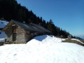
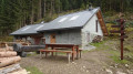
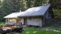
(6) Continue to the right to reach the Refuge de Soplat des Nants chalet.

(7) Return via the same route to the previous junction.

(6) Turn right to climb up onto the embankment and cross the Grand Ruisseau on the right-hand side at the wall, then follow a lovely path that crosses five streams to reach the track beneath the ruins of the small pass.

(8) Take this track to the right, slightly uphill, passing beneath the Gros Fayard chalets. Begin the descent here to reach the Déberts crossroads (signpost).

(9) Follow the track on the left downhill, pass a yellow gate and arrive at the entrance to the hamlet of Les Déberts.

(10) Take the path on the right and follow the sign for ‘Le Mont and Tours’. Pass the junction with the Lardyre and you’ll soon come to another crossroads with a sign.

(11) Continue along the path on the left, signposted ‘Tours’. Stay on this main path, ignoring all side paths to the right and left. Continue until you reach the Cairn Croisement.

(12) Follow the path leading uphill to the left towards the Chapelle Saint-Clément, cross the canal, reach the embankment, and walk down it to reach the power station car park (S/E).

Waypoints

  1. S/E : mi 0 - alt. 1,490 ft - Car park at the Tours power station
  2. 1 : mi 0.46 - alt. 2,060 ft - 2nd junction
  3. 2 : mi 0.76 - alt. 2,405 ft - Return via the track suitable for vehicles
  4. 3 : mi 1.32 - alt. 2,890 ft - Les Cornettes.
  5. 4 : mi 1.72 - alt. 3,140 ft - Crossroads of tracks at the power station
  6. 5 : mi 1.97 - alt. 3,455 ft - Les Enverts
  7. 6 : mi 2.38 - alt. 3,868 ft - Start of the path leading to Soplat des Nants, a stream
  8. 7 : mi 2.91 - alt. 4,685 ft - Mountain hut - Cabane du Soplat des Nants
  9. 8 : mi 4.36 - alt. 4,075 ft - Crossroads after the small pass
  10. 9 : mi 4.88 - alt. 4,147 ft - Intersection at the top of Les Déberts
  11. 10 : mi 5.46 - alt. 3,825 ft - Junction. Les Déberts
  12. 11 : mi 5.74 - alt. 3,520 ft - Croisement le Mont, Champ Blaire, Tours
  13. 12 : mi 6.94 - alt. 1,401 ft - Chapelle Saint-Clément (Tours-en-Savoie)
  14. S/E : mi 7.25 - alt. 1,490 ft - Car park at the Tours power station

Worth a visit

(7) Soplat des Nants: refuge where you can spend the night with your own equipment; water available.
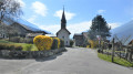
(12) Saint-Clément Chapel.

Reviews and comments

4.7 / 5
Based on 2 reviews

Reliability of the description
4.5 / 5
Ease of following the route
5 / 5
Route interest
4.5 / 5
dedelanguille
dedelanguille

Overall rating : 5 / 5

Date of your route : Aug 19, 2024
Reliability of the description : ★★★★★ Very good
Ease of following the route : ★★★★★ Very good
Route interest : ★★★★★ Very good
Very busy route : No

A superb walk, done in windy, cold weather – the last few kilometres of the climb in the fog weren’t easy!
At the summit, luckily, there was a superb view above the clouds!
On the way down, we came across some families of ibex

Machine-translated

Visophi
Visophi

Overall rating : 4.3 / 5

Date of your route : Jun 26, 2020
Reliability of the description : ★★★★☆ Good
Ease of following the route : ★★★★★ Very good
Route interest : ★★★★☆ Good
Very busy route : No

Hello,
Hike taken on 14 June 2020. The first day it reached 40°
We started by parking opposite the EDF micro power station. Huge construction vehicles were at work, obscuring the entrance slightly.
Well done on the route description, especially for the ascent: it’s true that many of the paths aren’t marked on the IGN map. We only missed one junction, but it didn’t matter. All the paths seem to converge at some point or another!
On the way down from the refuge, we ignored a sign prohibiting access to the construction site (WP 5 in the route description). There, we ended up a bit too high up within the site. As we turned back, we spotted a cairn marking the path. If you don’t know where it is, it’s very hard to see: as you’re climbing, it’s on the left, towards the gorge where the torrent plunges.
It hadn’t rained for at least three or four days, but we were glad to be wearing our high-top walking boots. It was a bit of a close call for the first three torrents!
After that, we made good progress. From WP 9 to the yellow barrier, the path is blocked by numerous electric fences, criss-crossing in all directions. We had to play leapfrog (which is quite ironic in the Beaufort region)
Disappointment at the Saint Clément chapel – it’s closed!
A lovely walk: the forest sheltered us from the heat. It’s a bit tricky, which is part of its charm!
We didn’t come across a single other hiker!

Machine-translated

Other walks in the area

For more walks, use our search engine .

The GPS track and description are the property of this route's author. Please do not copy them without permission.