Country:

 City:


From Moutiers, head towards Val Thorens Saint-Martin de Belleville via the D117.
When you reach the roundabout at the entrance to Les Menuires, follow signs for Val Thorens, pass under three ski lifts, continue for about 150 metres and take the road to the lake on the right. Park at the Parking des Bruyères 200 metres further on.
(S/E) Head towards the lake, cross the bridge over the Doron des Bellevilles and reach the start of the Chemin du Lac du Lou at the foot of the clearly visible statue.
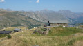
(1) Follow the Chemin du Lac du Lou, which is relatively easy. Pass by the adventure park and the ruined chalets. The path climbs along the left bank of the Torrent du Lou to reach the Refuge and Lac du Lou and a crossroads.
(2) Keep left towards the Col de Pierre Blanche to go round the lake.
(3) Continue along the path, which becomes steeper, on the left bank of the Ruisseau du Rever. You’ll reach a plateau with thefirst of the Lacs de Pierre Blanche (altitude 2,304 m).
(4) Still following the path, go round this lake on the left and reach another plateau with a small stream on your right-hand side, where there is a junction (altitude 2,380 m).
(5) Ignore the path on the left heading towards the Col de la Vallée Étroite and the Lacs de Pierre Blanche, and continue to the right towards the Col de Pierre Blanche. Pass over a plateau and, after a bit of a climb, reach the start of another plateau at an altitude of 2,590 m.
(6) Leave the main path here and head left for 100 metres to see the magnificent unnamed lake. An ideal spot for a break to catch your breath. Set off again, skirting the lake to the left: there is no marked path, but the going is easy.
Rejoin the main path leading up to the Col de Pierre Blanche, with more lakes nearby.
From there, you’ll see the Col de Pierre Blanche with its cross: head towards it.
(7) At the pass, at an altitude of 2,636 metres, head off to the right towards the Col de la Grande Combe.
(8) Continue towards the Col de Montfiot and its small lake (signpost).
Follow this magnificent ridge path, marked in yellow and with cairns. After a series of ascents and descents, you’ll reach the Col du Montfiot at an altitude of 2,656 metres.
(9) Head down to the right, towards the clearly visible Petit Lac de Montfiot. Walk past it and you’ll reach a junction at its northern end.
(10) There are two options at this point:
- Shorten the route by 1 hour 15 minutes by descending directly to the Grand Lac de Montfiot via the path on the right.
- continue along the ascending path and reach the small pass of Collet Blanc at elevation 2679, following this route description.
(11) At the Collet, enjoy the view of the Grand Perron des Encombres and Lac de la Montagnette. Then, turn right and head due north along the ridge path towards the Pointe de la Masse. Pass the Pointe du Collet Blanc at an elevation of 2,706 metres, and reach the summit of the Pointe de la Masse below the new cable car currently under construction.
(12) Take the path – which is poorly marked due to the construction work – below the new cable car building, and this will lead you to the clearly visible Lac de la Masse.
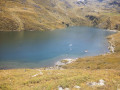
(13) From the lake, continue downwards along the Torrent du Lou. You’ll reach the Grand Lac de Montfiot at an elevation of 2,480 metres. Walk round it on the left-hand side. Second break, with the option to go for a swim.
(14) Continue southwards, descending towards the Refuge du Lou, whilst making sure to admire, much further on to your left, the miniature lake with its crystal-clear water.
(15) From the miniature lake, head towards the lake and the Refuge du Lou at the crossroads you passed on the way out.
(2) Follow the path in the opposite direction to the one you took on the way there to return to the starting point (S/E).

 Visorando Member
 Moderate

 Tourism professional
 Very difficult
 Easy