Mont des Acrays via the Passage de la Charmette

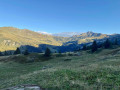
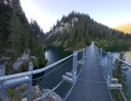
A lovely circular walk above the Saint-Guérin and Roselend dams. A ridge walk suitable for all.

Details

n°65279936
Creation:
Last update:
Last review:
  • Walking
    Activity: Walking
  • ↔
    Distance: 5.86 mi
  • ◔
    Average duration: 4h 30 
  • ▲
    Difficulty: Moderate

  • ⚐
    Back to start: Yes
  • ↗
    Ascent: + 2,080 ft
  • ↘
    Descent: - 2,057 ft

  • ▲
    Highest point: 7,198 ft
  • ▼
    Lowest point: 5,210 ft

Photos

Description of the walk

Head to Beaufort via the RD925 and follow signs for Arêches via the D218A. In Arêches, follow signs for the Saint-Guérin dam via the D218d and park in the car park above it.

(S/E) With your back to the car park, turn left onto the tarmac road leading up to the Cormet d’Arêches and continue until you reach a junction.

(1) With the return route straight ahead, turn left towards Les Acrays. Continue first along an ascending tarmac road until it ends, then follow the track due north, continuing in the same direction, to reach the Les Acrays chalets (signposted).

(2) Turn right onto the Passage de la Charmette path, which climbs steeply and leads directly onto the ridge.

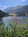
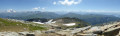
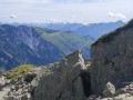
(3) Turn right to follow the ridge, passing by the hay cable hut. After several ascents and descents, you’ll reach the Passage du Miraillet, “a small pass with a superb view; veer off to the left for about a hundred metres to enjoy the view of Lake Roselend and Mont Blanc”.

(4) Retrace your steps and follow the path to the left, heading down towards Arceni and Saint-Guérin. You’ll come to a track.

(5) Keep to the right and follow this track, pass the first hairpin bend and continue to the next one.

(6) Leave the track and take the path leading down (signposted) towards Lac de Saint-Guérin. You’ll reach the Route du Cormet d’Arêches.

(7) Follow the road, turning right, pass by the superb waterfall and carry on straight ahead to reach the car park (S/E).

Waypoints

  1. S/E : mi 0 - alt. 5,210 ft - Car park - Barrage de Saint Guérin
  2. 1 : mi 0.12 - alt. 5,272 ft - Junction of the circular loop
  3. 2 : mi 1.1 - alt. 5,594 ft - Les Acrays
  4. 3 : mi 2.19 - alt. 6,752 ft - La Charmette section
  5. 4 : mi 3.3 - alt. 7,149 ft - Miraillet Pass. View of the - Lac de Roselend
  6. 5 : mi 3.94 - alt. 6,745 ft - Arceni
  7. 6 : mi 4.17 - alt. 6,591 ft - Junction, leave the track
  8. 7 : mi 5.08 - alt. 5,472 ft - Junction with the Route du Cormet d’Arêches
  9. S/E : mi 5.86 - alt. 5,213 ft - Car park

Notes

No water along the route.

Reviews and comments

4.8 / 5
Based on 2 reviews

Reliability of the description
5 / 5
Ease of following the route
5 / 5
Route interest
4.5 / 5
FTT
FTT

Overall rating : 4.7 / 5

Date of your route : Sep 18, 2026
Reliability of the description : ★★★★★ Very good
Ease of following the route : ★★★★★ Very good
Route interest : ★★★★☆ Good
Very busy route : No

A really lovely walk, very easy to follow (once you’ve downloaded the route). Mid-September is a brilliant time of year for this walk.

Machine-translated

ChristianNo
ChristianNo

Overall rating : 5 / 5

Date of your route : Aug 04, 2025
Reliability of the description : ★★★★★ Very good
Ease of following the route : ★★★★★ Very good
Route interest : ★★★★★ Very good
Very busy route : Yes

Very beautiful ridge hike.
The paths are badly damaged by cattle, unless it's the trails.

Machine-translated

Other walks in the area

For more walks, use our search engine .

The GPS track and description are the property of this route's author. Please do not copy them without permission.