Bénévolo – Chivasso

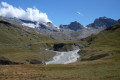
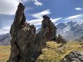
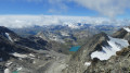
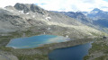
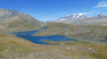
The ascent takes you through very wild, virtually off-trail terrain up to the Nivoletta Alpine Pass (3,152 m), followed by a descent via the gullies overlooking the magnificent Leitz and Rosset Lakes in the Valsavarenche. You then make your way towards the Chivasso Refuge through splendid flower-filled mountain pastures, renowned for their delicious fontina cheese.

This walk is part of a multi-day hike: Tour of the Alpes Grées

Details

n°3873379
Creation:
Last update:
Last review:
  • Walking
    Activity: Walking
  • ↔
    Distance: 6.47 mi
  • ◔
    Average duration: 5h 35 
  • ▲
    Difficulty: Difficult

  • ⚐
    Back to start: No
  • ↗
    Ascent: + 3,005 ft
  • ↘
    Descent: - 1,975 ft

  • ▲
    Highest point: 10,371 ft
  • ▼
    Lowest point: 7,480 ft

Photos

Description of the walk

(S) Leave the Benevolo Refuge.

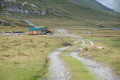
(1) Follow route 13B towards Col Basey and the Chivasso Refuge, signposted in yellow. Climb very gradually through splendid flower-filled mountain pastures – renowned for their delicious Fontina cheese – on the right bank of the Rhêmes torrent until you reach almost the bottom of the valley and an unmarked crossroads.

(2) Follow the path rising to the left, where the grass thins out to give way to scree. Head in the direction of the few cairns along a fairly steep slope. You’ll reach the junction with the Col Nivolet to Benovolo path.

(3) Take this path to the left and, after a final climb, reach the pass marked by a cairn.

(4) Head left onto the descending path marked in red and white. You’ll come to a tricky section where a cable is fixed in place.

(5) Take care when crossing the ledge, using the cable for support. Follow the path to the lakes to reach Lac Leità. Continue on to quickly reach the junction with path 3C at Col Rosset.

(6) Turn right onto the fairly flat path and head towards a junction next to the Alpe Riva sheepfold.

(7) Keep to the right on the path towards the Chivasso Refuge. Pass by the small lake, go round it and join the red and white-marked path, which climbs gently. Cross the road to reach the Chivasso Refuge (E).

Waypoints

  1. S : mi 0 - alt. 7,490 ft - Refuge Benevolo
  2. 1 : mi 0.09 - alt. 7,487 ft - Right bank of the - Dora Di Rhêmes (cours d'eau) - Italie - Affluent du Savara
  3. 2 : mi 1.8 - alt. 8,494 ft - Junction
  4. 3 : mi 2.97 - alt. 9,862 ft - Below the pass: final climb
  5. 4 : mi 3.38 - alt. 10,308 ft - Cairn at the start of the path
  6. 5 : mi 4.74 - alt. 9,078 ft - Passage along the ledge
  7. 6 : mi 5.17 - alt. 8,835 ft - Crossroads
  8. 7 : mi 5.77 - alt. 8,573 ft - Crossroads – Alpe Riva sheepfold
  9. E : mi 6.47 - alt. 8,540 ft - Refuge Citta di Chivasso

Notes

Between (7) and (E) You can swim in the small lake just before the refuge.

Reviews and comments

3.7 / 5
Based on 1 review

Reliability of the description
5 / 5
Ease of following the route
2 / 5
Route interest
4 / 5
Andeor
Andeor

Overall rating : 3.7 / 5

Date of your route : Sep 01, 2026
Reliability of the description : ★★★★★ Very good
Ease of following the route : ★★☆☆☆ Disappointing
Route interest : ★★★★☆ Good
Very busy route : No

Please note that the climb up to the Col du Nivolet is difficult.
As clearly stated in the written description, there are no signposts, only cairns: these are difficult to spot and clearly collapse quite often. Even whilst following the GPX track, we found ourselves on extremely slippery gravel, with a steep gradient (nearly 40° in places) over long stretches, which makes the climb gruelling and somewhat dangerous.

The Chivasso refuge is permanently closed . An inn has opened a little further north, a few hundred metres along the road (it is possible to follow the current track and route description all the way to the end; you can see it from Chivasso): it calls itself Rifugio Savoia, but in reality bears no resemblance to a refuge. It is a roadside restaurant, with a few relatively comfortable but under-equipped dormitories (a single room serving as a shower, toilet and washbasin for two dormitories of six each…). There is no common room, and the welcome is rather cold. If you have the option, it’s better to camp…

Machine-translated

Other walks in the area

For more walks, use our search engine .

The GPS track and description are the property of this route's author. Please do not copy them without permission.