La Leisse – Tignes Val-Claret

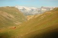
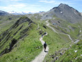
A steady climb takes you to the Col de la Leisse (2,761 m), offering breathtaking views of the Grande Motte glacier, before descending to Tignes Val-Claret with, in the background, the Dôme de la Sache (3,588 m), the Pointe de la Grande Sassière and, to the left, the Col du Palet and the Pointe du Chardonnet.

This walk is part of a multi-day hike: Tour of the Alpes Grées

Details

n°3894416
Creation:
Last update:
Last review:
–
  • Walking
    Activity: Walking
  • ↔
    Distance: 6.01 mi
  • ◔
    Average duration: 3h 30 
  • ▲
    Difficulty: Moderate

  • ⚐
    Back to start: No
  • ↗
    Ascent: + 892 ft
  • ↘
    Descent: - 2,142 ft

  • ▲
    Highest point: 9,052 ft
  • ▼
    Lowest point: 6,909 ft
  • ⚐ Country: France
  • ⚐
    Areas: Alps, Vanoise
  • ⚐ City: Termignon (73500)
  • ⚑
    Start: N 45.396985° / E 6.882462°
  • ⚑
    End: N 45.453765° / E 6.898073°
  • ❏
    IGN map(s): Ref. 3532ET, 3532ETR, 3633ET, 3633ETR
  • Hour-by-hour weather

Photos

Description of the walk

(S) From the Refuge de la Leisse, head uphill on theGR®55, following the red and white markings. Pass to the left of the Plan des Nettes plateau and reach the Lac des Nettes.

(1) Continue along this well-maintained path, passing close to the Lacs de la Leisse on the right-hand side of the path.

(2) Cross the Leisse torrent and reach the Col de la Leisse.

(3) Cross the pass and begin the descent towards Tignes Val-Claret. Reach the junction at the Col de Fresse.

(4) Ignore the path on the right leading to this pass and continue straight ahead on theGR®55. You will then reach the
Tignes Val-Claret resort and its ski lifts. Pass under the Fresse chairlift and reach a junction at the base of the chairlift near the Chalet de la Leisse.

(5) Leave theGR® and turn left onto the path to reach the large car park at Tignes Val-Claret (E).

Waypoints

  1. S : mi 0 - alt. 8,163 ft - Refuge de la Leisse
  2. 1 : mi 1.63 - alt. 8,658 ft - Lac des Nettes
  3. 2 : mi 1.92 - alt. 8,711 ft - Torrent de la - Leisse (cours d'eau)
  4. 3 : mi 2.8 - alt. 9,029 ft - Col de la Leisse
  5. 4 : mi 4.05 - alt. 8,343 ft - Fresse Pass junction
  6. 5 : mi 5.45 - alt. 7,241 ft - Chalet de la Leisse
  7. E : mi 6.01 - alt. 6,909 ft - Tignes Val-Claret Car Park

Notes

(E) For the return journey by car to Le Chenal, allow 30 minutes for 15 km.

Always be cautious and plan ahead when you're outdoors. Visorando and the author of this route cannot be held responsible for any accidents occurring on this route.

The GR® and PR® markings are the intellectual property of the Fédération Française de Randonnée Pédestre.

Other walks in the area

For more walks, use our search engine .

The GPS track and description are the property of this route's author. Please do not copy them without permission.