Carro - Fond des Fours

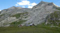
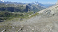
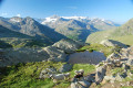
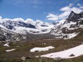
Le magnifique chemin en balcon vous mène au Col des Fours, sous les regards curieux des chamois et marmottes, jusqu’au Pont de la Neige (2518 m), où vous retrouvez des traces de la civilisation en traversant la célèbre route du Col de l’Iseran. Aussitôt franchie, vous vous en éloignez en accédant au Col des Fours (2976 m). Descente par le vallon du même nom pour atteindre le Col du Fond-des-Fours (2537 m).

This walk is part of a multi-day hike: Tour des Alpes Grées

Details

3882065
Creation:
Last update:
Last review:
  • Walking
    Activity: Walking
  • ↔
    Distance: 10.53 mi
  • ◔
    Average duration: 7h 00 
  • ▲
    Difficulty: Difficult

  • ⚐
    Back to start: No
  • ↗
    Ascent: + 2,474 ft
  • ↘
    Descent: - 3,212 ft

  • ▲
    Highest point: 9,760 ft
  • ▼
    Lowest point: 8,104 ft

Description of the walk

(S) Du refuge du Carro prendre la direction du Pont de l'Oulietta en empruntant le GRP® du Tour de la Haute Maurienne balisé Rouge et Jaune jusqu'au croisement de chemin.

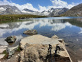
(1) Partir main droite sur le long chemin en balcon. Traverser plusieurs ruisseaux avant de rejoindre le Lac du Pys.

(2) Poursuivre toujours sur le sentier balcon pour atteindre Plan des Eaux.

(3) Conserver le même chemin, après une descente arriver au Pont de L'Oullietta sur la route du Col de L'Iseran.

(4) Suivre à droite en montée la route en direction du Col de L'Iseran. Passer le tunnel (attention), traverser le Pont de la Neige, pour rejoindre 30 mètres plus loin le carrefour de la variante du GR®5.

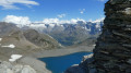
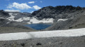
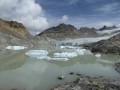
(5) L'emprunter à gauche, un panneau indique le Col des Fours. Rester sur le balisage Rouge et Blanc, surplomber le lac glaciaire en dessous du col. Déboucher ensuite au Col des Fours.

(6) Entamer plein Ouest la descente du col, traverser le Vallon des Fours. atteindre un carrefour de sentiers, rester sur le GR® à droite pour accéder au Refuge du Fond des Fours (E) étape du jour.

Waypoints

  1. S : mi 0 - alt. 9,055 ft - Refuge du Carro
  2. 1 : mi 0.56 - alt. 8,848 ft - Carrefour GRP
  3. 2 : mi 2.6 - alt. 8,737 ft - Lac du Pys
  4. 3 : mi 4.7 - alt. 8,802 ft - Plan des Eaux
  5. 4 : mi 6.78 - alt. 8,107 ft - Pont de l'Oulietta
  6. 5 : mi 7.82 - alt. 8,314 ft - Carrefour variante du GR5
  7. 6 : mi 9.39 - alt. 9,760 ft - Col des Fours (2976m)
  8. E : mi 10.53 - alt. 8,323 ft - Refuge du Fond des Fours

Notes

(3) Plan des Eaux : endroit idéal pour faire une pause et admirer la montagne de la Ouille du Midi.

Always be cautious and plan ahead when you're outdoors. Visorando and the author of this route cannot be held responsible for any accidents occurring on this route.

The GR® and PR® markings are the intellectual property of the Fédération Française de Randonnée Pédestre.

Reviews and comments

4.3 / 5
Based on 1 review

Reliability of the description
5 / 5
Ease of following the route
5 / 5
Route interest
3 / 5
Andeor
Andeor

Overall rating : 4.3 / 5

Date of your route : Sep 03, 2026
Reliability of the description : ★★★★★ Very good
Ease of following the route : ★★★★★ Very good
Route interest : ★★★☆☆ Average
Very busy route : Yes

An easy route to follow, with no difficulties other than the length of the stage. The start along the balcony trail is very pleasant, but then the return to civilisation (noisy roads below + lots and lots and LOTS of people, no doubt because the route is easily accessible by car) is a bit of a slog.

The stretch along the tarmac road between the Oulietta Bridge and the Neige Bridge is a nightmare, a real leg-burner (not to mention the cars, motorbikes and bikes that overtake you, nearly cutting you off). I regret not having tried to head down onto the GR5 from the Oulietta Bridge, despite the fact that it adds a bit of elevation gain.

No Patou dogs, just herds of unguarded cows (and hordes of trail runners who nearly trample you and shout at you because you’re slowing them down on their descent).

Machine-translated

Other walks in the area

For more walks, use our search engine .

The GPS track and description are the property of this route's author. Please do not copy them without permission.