Dormiaz Ridge Route

A lovely, unspoilt route that climbs via the Trimpaz Forest track to join an old path where you make your way through rhododendrons and blueberries to reach the Dormiaz ridge.
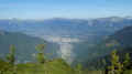
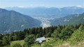
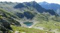
Breathtaking views over the Albertville basin, the Roche Pourrie, the Aulp de Tours, the Grande Journée and the Bellachat mountain pastures.

Details

n°61407137
Creation:
Last update:
Last review:
  • Walking
    Activity: Walking
  • ↔
    Distance: 5.19 mi
  • ◔
    Average duration: 4h 20 
  • ▲
    Difficulty: Moderate

  • ⚐
    Back to start: Yes
  • ↗
    Ascent: + 2,224 ft
  • ↘
    Descent: - 2,224 ft

  • ▲
    Highest point: 7,126 ft
  • ▼
    Lowest point: 4,875 ft

Photos

Description of the walk

Access: to reach the start, drive through the village of La Bâthie via the D990, near the N90 junction, south of the village of Tours-en-Savoie. Take the D65 and drive up to the hamlet of Le Daru, passing through the hamlets of La Coutaz, Le Fugier, Montesseaux, Lachat and Le Mondon. At the hamlet of Le Daru, turn sharply left and continue along a mountain road. Pass by the ruined chalets of La Montagne des Prés. At the next hairpin bend (elevation 1,496), follow the start of the track leading to Le Soplat des Nants and park at the side of the road.

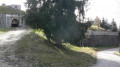
(S/E) Set off north-east along the Soplat des Nants track, cross the Nant Varin stream and reach the start of the track on your right.

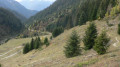
(1) Follow the ascending track, staying on the main track and ignoring the tracks to the right and left; pass seven hairpin bends and reach the end of the track.

(2) From here, the path is not very well marked. Follow the path for about twenty metres and turn left. The start of the path is not very well marked. Follow the red and white tape and rejoin the path 40 metres further on.

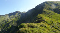
(3) Follow the path as it emerges from the forest and head for the summit ridge.

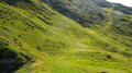
(4) From there, follow the path hidden by rhododendrons and blueberries, keeping close to the summit ridge and, following the tape markers to help you find your way, reach a small pass at elevation 2095, where a couloir joins the path on your left.

(5) Follow the faint but clearly visible path on your right to reach the ridge.

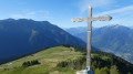
(6) Follow the ridge to the right along a well-marked path to reach the Croix de la Dormiaz.

(7) Continue along the descending path marked in yellow and reach the junction with the Toutafond mountain bike trail (signpost).

(8) Keep to the right along the terraced path marked in yellow.

(9) Continue to the left along the path which enters the forest and crosses the track three times to reach the tarmac road on the Montagne des Prés.

(10) Leave the path, follow the road to the right and return to the starting point (S/E).

Waypoints

  1. S/E : mi 0 - alt. 4,911 ft - Car park on Route de la Montagne des Prés
  2. 1 : mi 0.38 - alt. 4,898 ft - Start: the Trimpaz uphill track
  3. 2 : mi 1.45 - alt. 5,925 ft - End of the Trimpaz track
  4. 3 : mi 1.5 - alt. 6,007 ft - Old path
  5. 4 : mi 1.61 - alt. 6,027 ft - Start of the Crête path
  6. 5 : mi 2.24 - alt. 6,870 ft - Small pass at the end of the couloir
  7. 6 : mi 2.59 - alt. 7,113 ft - Crête de la Dormiaz summit
  8. 7 : mi 3.29 - alt. 6,594 ft - Dormiaz Cross
  9. 8 : mi 3.58 - alt. 6,198 ft - Junction with the Toutafon path
  10. 9 : mi 4.03 - alt. 6,014 ft - Entry into the forest
  11. 10 : mi 4.84 - alt. 5,105 ft - Junction. Route de la Montagne des Prés
  12. S/E : mi 5.19 - alt. 4,911 ft - Car park on Route de la Montagne des Prés

Notes

No water along the route.

Worth a visit

Bellachat mountain pasture – Beaufort cheese production
Col des Lacs
Summit of the Grande Journée

Reviews and comments

3.8 / 5
Based on 2 reviews

Reliability of the description
4 / 5
Ease of following the route
3.5 / 5
Route interest
4 / 5
User 26519927
• Edited:

Overall rating : 3.5 / 5

Date of your route : Aug 23, 2025
Reliability of the description : ★★★★☆ Good
Ease of following the route : ★★★☆☆ Average
Route interest : Not used / Not applicable
Very busy route : No

Very disappointed with this hike for several reasons:
- the entire climb is on an unmarked trail; the second part is well marked with tape, but there are still several points where it is unclear which way to go because the path is rarely used and therefore poorly marked, which wastes time
- after the forest track, the climb takes place among blueberry bushes and other low coniferous vegetation: wear long trousers or your legs will be scratched
- this section, in the middle of blueberry bushes and other low vegetation, is uninteresting and tiring, with no end in sight, and it is also quite steep
The time seems to have been underestimated because after a fairly tiring 2½-hour climb, we were only at an altitude of 2,095 metres. The remaining distance seemed very long, and we turned back because of the rising fog.
Frustrated at not having reached the cross.
Perhaps plan the route in the other direction as it is partially marked?
We didn't encounter any other hikers. Is that a sign?

Machine-translated

JFC73
JFC73

Overall rating : 4 / 5

Date of your route : Oct 30, 2024
Reliability of the description : ★★★★☆ Good
Ease of following the route : ★★★★☆ Good
Route interest : ★★★★☆ Good
Very busy route : No

This is a walk best undertaken in fine weather, as the view from the summit stretches for miles (La Meige, the Barre des Ecrins, etc.). Be sure to follow the route description carefully on the ascent, as the path is often poorly marked and it’s easy to lose your way. The rhododendrons you have to step over make progress a bit laborious in places. The descent route is much clearer. If you stick to this track, you should, in principle, avoid the hunters...

Machine-translated

Other walks in the area

For more walks, use our search engine .

The GPS track and description are the property of this route's author. Please do not copy them without permission.