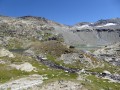
Fond des Fours – La Leisse

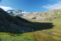
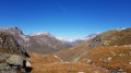
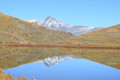
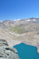
A little-used path leading to the Col de la Rocheure (2,911 m) runs alongside a myriad of small high-altitude lakes, before descending to the Refuge de la Femma. The ascent to the Col de Pierre-Blanche (2,842 m) is steady and not very well marked, even veering off the beaten track. The view is magnificent over the rocky Leisse valley, nestled between the giant peaks of the Grande Motte and the Grande Casse. Descend through these deserted landscapes towards the eagle’s nest that is the Refuge de la Leisse (2,487 m).

This walk is part of a multi-day hike: Tour of the Alpes Grées

Details

n°3893362
Creation:
Last update:
Last review:
  • Walking
    Activity: Walking
  • ↔
    Distance: 10.52 mi
  • ◔
    Average duration: 7h 30 
  • ▲
    Difficulty: Difficult

  • ⚐
    Back to start: No
  • ↗
    Ascent: + 3,061 ft
  • ↘
    Descent: - 3,215 ft

  • ▲
    Highest point: 9,662 ft
  • ▼
    Lowest point: 7,700 ft

Photos

Description of the walk

(S) From the Refuge du Fond des Fours, follow the same path as the previous day to the crossroads. Here, leave theGR®5, turn right and head up the valley along this little-used path, which leads to the Col de la Rocheure. Follow the Ruisseau des Fours on the right bank, pass a first set of steps to reach the plateau.

(1) Continue along the path marked by cairns across this long plateau. You’ll reach a steeper section after crossing the Ruisseau des Fours. Carry on, heading westwards, to reach the Col de la Rocheure via plateaus dotted with numerous lakes.

(2) Ignore the path on the right-hand side, walk alongside Lac de la Rocheure and, via a long descent through the mountain pastures, reach the Refuge de la Femma.

(3) Walk past it to reach the stream (see note on this stream in the ‘During’ section).
At the crossroads, turn right onto the faintly marked ascending path. Pass by the waterfall and continue through the mountain pasture. Cross several streams, keeping a westerly direction, then veer right to rejoin a path at the Ruisseau du Genevrey.

(4) Turn left onto this path and pass beneath the Pointe des Chartreux. Continue the climb to reach the Col de Pierre Blanche.

(5) Here, follow the cairns – be careful as there is no marked path – heading north then north-east. Pass above the Lac de la Leisse. Continue until you reach a break in the slope, where you will see the Refuge de la Leisse opposite.

(6) Descend as the terrain dictates, cross the Ruisseau du Charbonnier, and begin a final ascent to reach the Refuge de la Leisse (E), today’s destination.

Waypoints

  1. S : mi 0 - alt. 8,317 ft - Refuge du Fond des Fours
  2. 1 : mi 0.55 - alt. 8,658 ft - A short climb to reach the plateau
  3. 2 : mi 2.82 - alt. 9,551 ft - Col de la Rocheure
  4. 3 : mi 5.46 - alt. 7,720 ft - Refuge de la Femma
  5. 4 : mi 6.89 - alt. 8,419 ft - Crossroads
  6. 5 : mi 8.6 - alt. 9,321 ft - Col de Pierre Blanche (2842m)
  7. 6 : mi 10.03 - alt. 8,474 ft - Change in gradient, view of the - Leisse (cours d'eau)
  8. E : mi 10.52 - alt. 8,163 ft - Refuge de la Leisse

Worth a visit

(2) Col de la Rocheure: Note that this pass is also known by the more romantic name of Guécées de Tignes.
(3) Refuge de la Femma: the nearby stream feeds the micro power station, supplying it with electricity.

Always be cautious and plan ahead when you're outdoors. Visorando and the author of this route cannot be held responsible for any accidents occurring on this route.

The GR® and PR® markings are the intellectual property of the Fédération Française de Randonnée Pédestre.

Reviews and comments

4.3 / 5
Based on 1 review

Reliability of the description
5 / 5
Ease of following the route
4 / 5
Route interest
4 / 5
Andeor
Andeor

Overall rating : 4.3 / 5

Date of your route : Sep 04, 2026
Reliability of the description : ★★★★★ Very good
Ease of following the route : ★★★★☆ Good
Route interest : ★★★★☆ Good
Very busy route : No

A rather lovely stage.

There’s a lot of off-trail walking, but if you follow the GPX track (thank goodness for the French network), it’s very straightforward. The grassy terrain makes it easy to find your way: even when the path ends or disappears, or there are no cairns, it’s fairly easy to head in the right direction, whether you’re climbing up to the Col de Pierre Blanche or heading down to the La Leisse refuge. One slight downside: it would no doubt have been more difficult in poor visibility.

If you’re wary of going off-trail or if visibility is poor, one option is to stay in the valley floor to reach the Entre-deux-eaux refuge: this makes for a stage of about 6 hours, and then the same again the next day to return to Tignes.

Machine-translated

Other walks in the area

For more walks, use our search engine .

The GPS track and description are the property of this route's author. Please do not copy them without permission.