Country:

 City:


Drive up towards Pralognan-la-Vanoise via the D915. 1 km from Pralognan-la-Vanoise, turn right onto the road to the village of La Croix, continue for 500 m and park at the entrance to the village, in the car park.
(S/E) Set off from the village of La Croix and turn left. After the reservoir, follow the signposted direction for Rocher de Villeneuve (3 hrs). After walking through the village, you’ll reach a crossroads.
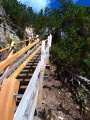
(1) At the signpost, turn right towards Crête du Mont Charvet via the Sentier des Envers. The path is quite steep to begin with but then becomes a series of hairpin bends.
Ignore all paths branching off to the left until you reach a crossroads by two chalets, where there is a sign for Les Rossechets.
(2) Continue to the right along the path, which descends slightly before levelling out, to reach the Chalets de Laitet. Continue along the path through the mountain pasture to reach the Col du Golet.
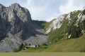
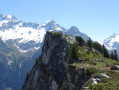
(3) Turn right to reach the Rocher de Villeneuve and its plateau, with views of the Grand Bec overlooking the cliff where you can see the village of Chamberanger.
(4) From the Rocher de Villeneuve, retrace your steps back to the Col du Golet.
(3) At the pass, follow the signposted route straight ahead towards the Col de la Grande Pierres. Continue along the Crête du Charvet and ignore a path on the right (elevation 2079). The path turns southwards to reach a junction.
(5) Ignore the path branching off to the right towards Lac de la Rosière and continue along the long path on the Crête du Mont Charvet to reach the Col de Grande Pierre (elevation 2393).
(6) Turn left, north-east, via the Couloir de la Grande Pierre at the signpost indicating ‘La Montagne’. Follow this path. Before July, the path may be covered with snowfields in places. Reach the next junction.
(7) Turn right to reach the junction with the track and follow this track to the right, following the signpost indicating the direction of La Croix, to reach the start of a path on the left. Please note: there are no signposts.
(8) Turn left onto the footpath to reach a junction; then continue left along the descending path to join the track, which is suitable for vehicles, and follow it for about a hundred metres.
(9) Follow the signs for La Croix. Pass the Rocher des Fattes headland and its viewpoint.
(10) Retrace your steps to the previous fork and turn left onto the shaded path, continuing until you reach a crossroads.
(11) Turn left and stay on the descending path to reach the car park (S/E).

 Visorando Member
 Moderate

 Very difficult
 Extremely difficult