Mario Bezzi – Benevolo

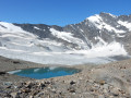
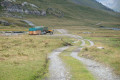
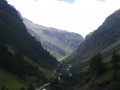
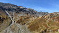
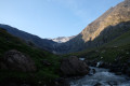
Hike up the magnificent glacial valley, which marks the end of the Val Grisenche, overlooking the imposing Glariettez Glacier. Access to the Val de Rhême via the Col de Bassac-Déré (3,082 m), then a descent through a high-mountain landscape to Lac de Golettaz, where the seracs are reflected in the water. The route then descends through the mountain pastures to the Refuge Benevolo (2,285 m).

This walk is part of a multi-day hike: Tour des Alpes Grées

Details

3934969
Creation:
Last update:
Last review:
  • Walking
    Activity: Walking
  • ↔
    Distance: 7.31 mi
  • ◔
    Average duration: 6h 30 
  • ▲
    Difficulty: Difficult

  • ⚐
    Back to start: No
  • ↗
    Ascent: + 3,648 ft
  • ↘
    Descent: - 3,629 ft

  • ▲
    Highest point: 10,948 ft
  • ▼
    Lowest point: 7,441 ft
  • ⚐ Country: Italy
  • ⚐
    Area: Alps
  • ⚐ City: Valgrisenche 
  • ⚑
    Start: N 45.540943° / E 7.017958°
  • ⚑
    End: N 45.515633° / E 7.08446°
  • ❏
    IGN map(s): Ref. 3532ET, 3532ETR
  • Hour-by-hour weather

Photos

Description of the walk

(S) From the Mario Bezzi Refuge, take path 12C towards Col Bassac-Déré and the Benevolo Refuge. The ascent follows a path through the mountain pasture, which very quickly gives way to high mountain terrain. The path becomes more challenging as it passes over the pass and reaches a plateau with the Glariettez Glacier below.

(1) Continue along the path marked by large cairns. Pass by the Lower and Upper Basacc Lakes. Follow the few yellow paint markings and, after a steep section, reach Col Bassa-Déré.

(2) Turn right onto the well-marked path and head for the summit of Becca la Traversière (3,337 m).

(3) Retrace your steps to return to the Col de Bassa-Déré.

(2) Turn right onto the descending path 13D, heading towards Lac de la Golettaz, via a fairly steep descent. Reach Lac de la Golettaz.

(4) Cross the stone bridge and continue along the relatively flat path until you reach a junction.

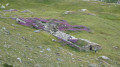
(5) Carry on to the right along the descending path and reach the clearly visible Sauche crossroads with the ruined sheepfold.

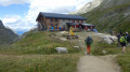
(6) Turn right towards the clearly visible Refuge Benevolo.

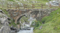
(7) Cross the Fond stream and the Rhêmes stream, with its remarkable stone bridge, to reach the Refuge Benevolo (E), today’s destination.

Waypoints

  1. S : mi 0 - alt. 7,474 ft - Mario Bezzi Mountain Hut
  2. 1 : mi 1.88 - alt. 9,344 ft - Plateau above the Vérrou
  3. 2 : mi 3.35 - alt. 10,125 ft - Col Bassac Deré (3083m)
  4. 3 : mi 3.86 - alt. 10,948 ft - Becca de la Traversière summit - Pointe de la Traversière (3337m)
  5. 4 : mi 5.58 - alt. 8,865 ft - Lago Goletta
  6. 5 : mi 6.33 - alt. 8,553 ft - Junction
  7. 6 : mi 6.93 - alt. 7,595 ft - Crossroads at Sauches (ruined sheepfold)
  8. 7 : mi 7.2 - alt. 7,448 ft - Stone bridge - Dora Di Rhêmes (cours d'eau) - Italie - Affluent du Savara
  9. E : mi 7.31 - alt. 7,490 ft - Refuge Benevolo

Worth a visit

(2) Summit of Becca de la Traversière: enjoy a magnificent view here of Lac de la Sassière, Tignes, Mont Pourri and the Dôme de la Sache, the La Golettaz Glacier and the Granta Parey.

Reviews and comments

4.8 / 5
Based on 3 reviews

Reliability of the description
4.7 / 5
Ease of following the route
4.7 / 5
Route interest
5 / 5
Andeor
Andeor

Overall rating : 5 / 5

Date of your route : Aug 31, 2026
Reliability of the description : ★★★★★ Very good
Ease of following the route : ★★★★★ Very good
Route interest : ★★★★★ Very good
Very busy route : No

A magnificent stage – perhaps the most beautiful of the entire route for me.
The climb up to Becca Della Traversière is definitely worth doing if visibility allows (but be careful not to lose your footing). Personally, I wouldn’t have left my rucksack at the foot of the climb...

Machine-translated

User 23763347

Overall rating : 5 / 5

Date of your route : Jul 19, 2026
Reliability of the description : ★★★★★ Very good
Ease of following the route : ★★★★★ Very good
Route interest : ★★★★★ Very good
Very busy route : Yes

This hike is a classic route linking the two mountain huts. The scenery is magnificent. The route runs from Bezzi to Benevolo. The walk is not difficult. We suggest leaving your rucksack at the Bassac Déré Pass and then making a round trip to the summit of Becca della Traversière. You come across more people on the descent towards Benevolo. There are even dogs of all sizes running loose; it’s no wonder you don’t see any wild animals on that side. The melting of the glaciers is depressing; in 10 years’ time, it’ll all be over.

Machine-translated

110015596
110015596

Overall rating : 4.3 / 5

Date of your route : Aug 12, 2021
Reliability of the description : ★★★★☆ Good
Ease of following the route : ★★★★☆ Good
Route interest : ★★★★★ Very good
Very busy route : Yes

A really lovely route through high-mountain terrain. Take care on the descent from the Bassac Déré Pass to Lake Goletaz – it’s a steep descent!

Machine-translated

Other walks in the area

For more walks, use our search engine .

The GPS track and description are the property of this route's author. Please do not copy them without permission.