Country:

 City:
City:


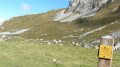
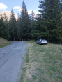
Head to Pralognan-la-Vanoise, pass the avalanche barrier and take the first road on the right; continue for 300 m and park at Le Plan.
(S/E) Set off along the track (next to the wooden reservoir) leading to La Montagne; follow it, pass under an old ski lift and reach a path starting on the left-hand side.
(1) Head up the path on your left, following the signs for the Col de Napremont, until you reach the crossroads (signposted ‘Combe de Napremont’ (altitude 1,850 m)).
(2) Turn left onto the Col de Napremont path. Follow this steady path with numerous bends until you reach the 2,086-metre mark at a bend marked by a small cairn and the start of a track.
(3) Take the little-used track to the right at the bend, leading to the scree slope.
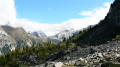
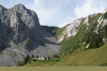
(4) Continue across the scree slope, following the cairns and the track, which is not always easy to see. Climb up to the right of the scree slope, facing the Aiguille d’Août and the Col du Biol, and reach the foot of the cliff. The entrance to the gap is then clearly visible on the left.
(5) Enter the breach, keeping to the right at the foot of the cliff. The climb is steep over unstable scree. Whenever the gully splits in two, take the right-hand branch. Pass the steep section where you’ll need to use your hands and, after a steep climb over the boulders, reach the Brèche Portetta pass.
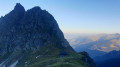
(6) Cross the Brèche Portetta with the imposing Aiguille du Bec in front of you and, to your right in the distance, the Aiguille du Fruit.
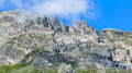
(7) Descend a few metres and join the path coming from the Vallée des Avalles. Continue through the rock spires to the left, climbing along the trail to reach the summit of the Tour Penchée ridge.
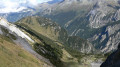
The view is spectacular: below lies the Col de Napremont, and opposite is the Grande Casse.
(8) Then turn back and descend, following the cairns and the path; pass between the rock spires, continue the descent with the Vallée des Avalles below you, and reach a first plateau, then a second with a junction marked by a signpost.
(9) Turn right towards the Col de la Grande Pierre (marked with old pink paint) and reach the crossroads.
(10) Continue to the right along the fairly steep ascending path and, after 20 minutes, reach the Col de la Grande Pierre at an altitude of 2,393 metres.
(11) Cross over to the other side towards La Montagne via the steep path of the Couloir de la Grande Pierre and join the clearly visible track suitable for vehicles.
(12) Continue to the right, following the track down towards La Montagne, until you reach the hairpin bend.
(13) Leave the track, follow the path – which climbs slightly at first – and reach the junction you passed on the way there.
(2) Turn left onto the descending path you took on the way there and head for the Plan car park (S/E).

 Visorando Member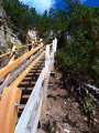
 Difficult
 Moderate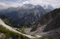
 Tourism professional