Tour des Alpes Grées

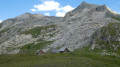
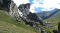
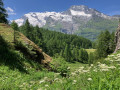
Le massif montagneux des Alpes Grées Franco-Italiennes est situé en Savoie pour la France, et situé sur deux vallées en Italie, la vallée d’Aoste et la vallée du Piémont.
Une grande partie du massif des Alpes Grées est recouverte par 2 parcs nationaux : celui de la Vanoise et celui du Grand Paradis.
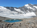
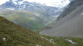
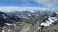
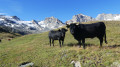
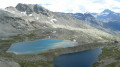
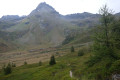
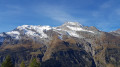
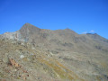
Un parcours très alpin où vous resterez au dessus de 2300 m avec de magnifiques points de vues sur les glaciers sans oublier le passage dans les alpages de la Fontine et du Beaufort.

Details

3904873
Creation:
Last update:
Last review:
  • Walking
    Activity: Walking
  • ↔
    Distance: 55.43 mi
  • ◔
    Average duration: 7 days 
  • ▲
    Difficulty: Difficult

  • ⚐
    Back to start: No
  • ↗
    Ascent: + 20,148 ft
  • ↘
    Descent: - 18,806 ft

  • ▲
    Highest point: 10,948 ft
  • ▼
    Lowest point: 5,571 ft

Photos

Stages of the route

This route needs several days, find the details below:

  1. S
  2. 2
  3. 3
  4. 4
  5. 5
  6. 6
  7. E

Notes

Prévoir une voiture à Tignes Val-Claret pour le dernier jour pour faire la navette avec le départ de la randonnée situé au Chenal.

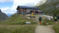
Refuges sur le parcours :
- Mario Bezzi alti 2279 m Contact : 39016597129 portable 393482641927
- Benevolo alti 2285 m Contact : 390165936143 ou 393454238692
- Refuge Chivasso alti 2532 m Contact : 016594141
- Le Carro alti 2759 m Contact : 0479059579
- le Fond -des- Fours alti 2537 m Contact : 0479061690
- La Femma alti 2352 m Contact : 0479054540
- La Leisse alti 2487 m Contact : 0479054533 portable 0615443368

Always be cautious and plan ahead when you're outdoors. Visorando and the author of this route cannot be held responsible for any accidents occurring on this route.

Reviews and comments

4.5 / 5
Based on 2 reviews

Reliability of the description
4 / 5
Ease of following the route
4.5 / 5
Route interest
5 / 5
Andeor
Andeor

Overall rating : 4.3 / 5

Date of your route : Aug 30, 2026
Reliability of the description : ★★★★☆ Good
Ease of following the route : ★★★★☆ Good
Route interest : ★★★★★ Very good
Very busy route : No

A magnificent route, which will probably be one of my favourites. Thank you – I’d never have thought of going for a walk in this area!

It does, however, require you to be in (very) good physical shape (some of the slopes are steep…), especially as not all the terrain is easy: see, in particular, my comments on the Benevolo–Chivasso/Savoia and Chivasso/Savoia–Carro stages.

Strictly not recommended for walkers who are prone to vertigo! (see the Chivasso/Savoia–Carro stage).

Despite Visorando’s warnings, we didn’t come across any snowfields or herds guarded by dogs (but plenty of marmots, and even some chamois!). We hiked in late August/early September.
Do remember, however, to ring the mountain huts in advance to ask them about this.

Tip: if you’re in pain somewhere and think you might struggle to climb into a bunk bed in a mountain hut, give them a ring before you arrive, and the warden might be able to sort you out by giving you a bottom bunk ;-)

Machine-translated

gérard bruet
gérard bruet

Hello
No need for crampons – the roped-up sections are well maintained
Have a nice day

Machine-translated

Andeor
Andeor

For your information: as of 15 August 2026, contrary to what Visorando states, there are no snowfields on the route or the mountain passes, and this has been the case for several weeks (confirmed by all the mountain huts along the route).

Machine-translated

User 8081455

Overall rating : 4.7 / 5

Date of your route : Jul 28, 2025
Reliability of the description : ★★★★☆ Good
Ease of following the route : ★★★★★ Very good
Route interest : ★★★★★ Very good
Very busy route : No

We completed this route in late July/early August 2025, camping in bivouacs.

The entire route is generally very well marked, and the GPX track proved to be very accurate. On the third day, we opted to go via the Col du Rosset, which is slightly lower than the Col de la Nivoletta and shortens the stage, although the climb is still steep. Finally, we decided to return to Val d'Isère from the bottom of the fours and thus finish the tour on day 5.

We encountered very little snow: only two short, gently sloping snowfields during the climb to the Col du Carro on the Italian side. This climb takes place in a very wild and unfrequented area, but the trail is well marked and the GPX track is reliable. Be careful, though: the end of the climb is very technical, with three sections equipped with ropes that are more like climbing or via ferrata than classic hiking.

Finally, regarding refuges, please note that the Chivasso is permanently closed, but you can stay at the Savoia, which is a few metres lower down (less typical). Please note that the Fond des Fours refuge has very limited capacity. Booking is compulsory, including for bivouacking nearby, and you need to book in advance as only 10 people can bivouac there.

Machine-translated

User 4089289

Hello Cindy, did you do the tour? I'm interested in the answers to the questions you asked . Thank you

Machine-translated

Cindy hike
Cindy hike

Hello, I'm planning to do this route in a few days. Do you think I should take crampons or is there likely to be a lot of snow at this time of year?
Also, the route was mapped out a few years ago. Do you know if the cable sections are well maintained?
Thanks

Machine-translated

Other walks in the area

For more walks, use our search engine .

The GPS track and description are the property of this route's author. Please do not copy them without permission.