Country:

 City:
City:


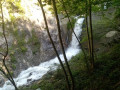

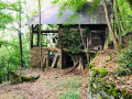
Park in the car park along the Route du Grand Village, near its junction with the D990.
(S/E) Return to the D990 and follow it to the left. After crossing the Grand Ruisseau, turn left onto Impasse des Contamines. After about fifty metres, turn left onto a track suitable for vehicles. You’ll come to a T-junction.
(1) Turn right, continue to the end of the field, turn left onto Chemin du Nuéray (signposted Biorges) and continue along the uphill track until you reach a junction by the reservoir.
(2) Ignore the path on the right and take the one on the left. Pass over the reservoir and, after several hairpin bends , the path emerges into the fields. Continue to the track , avoiding walking through the middle of the fields; stay on the right-hand edge of the path. Reach the junction with Rue de la Résistance at the entrance to the village of Biorges.
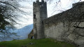
(3) Follow this road to the reservoir. Take the path leading down to the right after the reservoir for a few metres to reach another junction. Follow the signs for Chantemerle. Pass the castle of the same name and arrive at the entrance to the village of Chantemerle (picnic area).
(4) Walk back up alongside the Vigniettes stream, cross it to reach the start of a well-marked path. Continue along the ascending path, which includes sections running along a ledge above the EDF power station (caution: tricky section – not for those with a fear of heights), to reach the junction near the reservoir you passed earlier.
(2) Turn right onto the same path you took on the way out to reach the track junction at the entrance to Biorges.
(3) This time, turn left. Follow the track, which climbs gently for 300 m, then turn right at the edge of the forest onto the ascending path, following the red markings. When you reach the small road, follow it to the left for a few dozen metres and then turn left off it, following the sign for Tours-en-Savoie. Follow the path; further on, cross the stream called the Nant Varin to reach a junction by a ruin.
(5) Ignore the path leading down to the left and continue along the ascending path. Pass the Chalet du Touvet and join the track. Follow it uphill; at the bend, turn left, pass beneath the inhabited chalet at Le Villaret and continue along the yellow-marked path. Follow this to reach a junction; turn left (signposted ‘Chemin des Cascades’) and follow the track until you are near the Grand Ruisseau. Stay on the path leading down alongside the Grand Ruisseau (yellow markings) to reach the hydroelectric power station.
(6) Take the path on the right, towards the Chapelle Saint-Clément, for about a hundred metres, then turn left. Cross the stream via the footbridge, pass beneath the Chapelle Saint-Clément, follow the path to join the Route de la Perrière and continue along it until you reach the junction with the Montée Saint-Clément.
(7) Continue straight ahead along the Chemin de la Cour to reach the junction with the Montée du Nant Varin.
(8) Carry on straight ahead along the track and pass under the storage area. Cross the Grand Ruisseau, follow it along its left bank to reach thefirst junction you passed on the way out.
(1) Turn right and follow the route back in the opposite direction to the outward journey to return to the car park along the Route du Grand Village (S/E).



 Visorando Member
 Easy
Easy 
 Difficult