Lacha route via Le Raidier, starting from Tours-en-Savoie

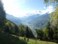
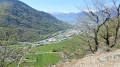
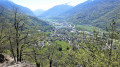
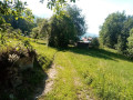
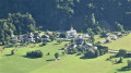
A somewhat challenging, woodland route with magnificent views over the valley.

Details

3142549
Creation:
Last update:
Last review:
  • Walking
    Activity: Walking
  • ↔
    Distance: 4.67 mi
  • ◔
    Average duration: 4h 20 
  • ▲
    Difficulty: Moderate

  • ⚐
    Back to start: Yes
  • ↗
    Ascent: + 2,474 ft
  • ↘
    Descent: - 2,454 ft

  • ▲
    Highest point: 3,527 ft
  • ▼
    Lowest point: 1,355 ft

Photos

Description of the walk

Allée de la Pierrière, end of the tarmac road in Tours-en-Savoie.

(S/E) Set off along the ascending track to reach the junction at the end of the track.

(1) Ignore the path on the right towards the Chapelle Saint-Clément and continue along the ascending footpath. After several hairpin bends, you’ll reach the junction leading to Le Palatieux.

(2) Turn right and head towards Les Déberts. Pass La Grangette, reach afirst junction (not shown on the IGN map) and continue to the right to reach a second junction at an altitude of 1,070 m.

(3) Turn left, heading north-west towards Champ Blaire, Le Mont and Le Reidier. When you reach a junction, ignore the path on the right leading to Champ Blaire. Continue along the descending path towards Le Reidier, passing the Vauthier chalet, until you reach the junction with the track at Le Reidier.

(4) Turn left onto the track, pass the Lacha sawmill and continue along the track, ignoring the track leading uphill on the left, to reach the start of a path not shown on the map.

(5) Leave the track and turn left onto the path. Continue to the crossroads.

(6) Take the hairpin bend to the right and follow the path down from Le Palatieux to reach the Muradoran chalet.

::7: Turn left towards Saforin and follow the balcony path to the junction leading to Les Déberts

(2) Continue along the ascent route to return to the starting point, Allée de la Pierrière (S/E).

Waypoints

  1. S/E : mi 0 - alt. 1,355 ft - Allée de la Pierrière: end of the tarmac road.
  2. 1 : mi 0.07 - alt. 1,404 ft - Crossroads - Chapelle Saint-Clément (Tours-en-Savoie)
  3. 2 : mi 0.47 - alt. 1,975 ft - Crossroads at the end of the circular loop
  4. 3 : mi 1.46 - alt. 3,517 ft - Crossroads at 1070
  5. 4 : mi 2.49 - alt. 2,543 ft - Le Reidier.
  6. 5 : mi 2.97 - alt. 2,582 ft - Start of the path (not shown on the map)
  7. 6 : mi 3.31 - alt. 2,707 ft - Crossroads
  8. 7 : mi 3.65 - alt. 2,310 ft - Muradoran
  9. S/E : mi 4.67 - alt. 1,355 ft - Allée de la Pierrière

Worth a visit

Detour to Champ Blaire, a magnificent chalet offering a stunning view of the valley.

Reviews and comments

4.4 / 5
Based on 3 reviews

Reliability of the description
4.7 / 5
Ease of following the route
4.3 / 5
Route interest
4.3 / 5
eveveni
eveveni

Overall rating : 3.7 / 5

Date of your route : Nov 09, 2025
Reliability of the description : ★★★★☆ Good
Ease of following the route : ★★★☆☆ Average
Route interest : ★★★★☆ Good
Very busy route : No

A lovely forest hike, fairly technical, pleasant thanks to its regular shade, and accessible for our two dogs. The climb is intense with 600 m of elevation gain over almost 2 km, with a few dizzying but accessible passages and some nice views of the Alberville valley. The noise of the ring road during the climb remains in the background, but you get used to it.

Watch out for obstacles after point 4 (trees and rocks), the passage was difficult because there was no detour possible. At point 5, the trail is not very visible, so be sure to turn left at the stone marker.

Cross a farm with cows on the path; keep your dogs on a leash.

Machine-translated

canardo
canardo

Overall rating : 5 / 5

Date of your route : Aug 12, 2022
Reliability of the description : ★★★★★ Very good
Ease of following the route : ★★★★★ Very good
Route interest : ★★★★★ Very good
Very busy route : No

A lovely walk on a very hot day, but as it’s in the shade of the forest, it was no problem tackling the challenging morning climb (a steep, continuous gradient over more than 600 metres).
Despite the forest, there are plenty of opportunities to take in the scenery.
It’s worth noting that people prone to vertigo might find certain sections challenging, as despite the trees, the terrain is very steep.
As for finding your way, there’s no problem at all – at every junction there are signs indicating where the path leads; if you have a map or a GPS, it’s very straightforward.
Please note: to return to the starting point using the Maps app, enter ‘Allée de la Perrière’ and do not rely on Maps, which directs you along a forest track back to the starting point.

Machine-translated

VivienESF
VivienESF

Overall rating : 4.7 / 5

Date of your route : Sep 13, 2021
Reliability of the description : ★★★★★ Very good
Ease of following the route : ★★★★★ Very good
Route interest : ★★★★☆ Good
Very busy route : No

A walk on a sunny Monday morning, sheltered from the sun in the forest with two or three panoramic views of the valley
At point 5, there’s a path on the left leading uphill – don’t miss it, otherwise you’ll end up going straight on into a dead end.
It’s a challenging route with a steady climb to the summit right from the start.
Thanks for the directions!

Machine-translated

Other walks in the area

For more walks, use our search engine .

The GPS track and description are the property of this route's author. Please do not copy them without permission.