Country:

 City:
City:


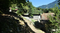
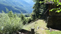
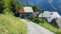
From the A90, take exit 32 and follow signs for Saint-Thomas at the end of the straight stretch of road. Park at the start of the Route des Espagnols next to the bus shelter.
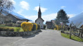
(S/E) Set off along the path leading uphill behind the bus shelter and reach the junction with the Chapel of Saint-Thomas (signpost). Turn right onto the path leading uphill towards Le Fay and reach a crossroads.
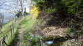
(1) Ignore the path on the left-hand side leading to Le Fay; continue straight on along the fairly easy path until you reach a crossroads after a wide-open stretch passing under the high-voltage power line.
(2) Continue along the path on the left and, after 70 m, you’ll reach a junction. Follow the path uphill, pass by the electricity pylon and reach the track near the hamlet of Le Fay.
(3) Follow the track to the right for 1.6 km; it begins with a wide-open stretch offering a lovely view of the valley. Ignore the path at the hairpin bend heading towards Albertville and continue along the track for about 1.3 km, which runs through the shade of the forest. You’ll reach a track junction. Ignore the track on your right and carry on straight ahead for 50 metres until you reach the end of the track.
(4) Follow the slightly uphill path until you reach a junction (not shown on the map).
At the junction, turn left, passing by the ruins and ignoring the path that climbs to the right (not shown on the map). Continue along the track, passing through the hamlet of La Roche next to a barn and the ‘hunters’ chalet’, recognisable by its deer antlers.
Cross the village of Charanget, following the track suitable for vehicles, which offers some lovely views; ignore the path on the left, and reach the Replain junction (signpost).
(5) Follow the tarmac road, pass through the village of Replain and continue for about 500 m along the road until you reach a crossroads.
(6) Turn left onto the Chemin de la Ville; after 50 m, leave the track and turn left onto the path that crosses it. Walk through the centre of the village of La Ville, ignore the paths branching off to the left and follow the signs for Chariondet, staying on the descending track. Walk past the water reservoir and rejoin the tarmac road. Continue to the right along this road until you reach the village of Chariondet.
(7) Leave the road and turn left towards Tours-en-Savoie. The route passes between the houses in Chariondet. Carry on, cross the D11 road and follow Impasse des Vergers. Pass two bends and reach the start of the path on the right.
(8) Follow the path on the right which winds between the houses; ignore the path branching off to the right at the hairpin bend (not shown on the map) and carry on past a green gate. At the edge of the house, join the D122 Rue Ferlay. Turn left and follow the road back to the starting point (S/E).


 Visorando Member

 Easy
Easy 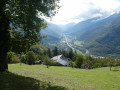
 Difficult