Lac des Cornaches circular route via the Col de la Tourche Vernay

Looking for space and solitude? This walk is for you.
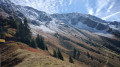
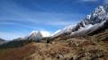
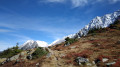
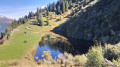
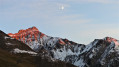
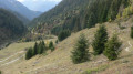
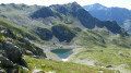
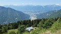
A path that’s shaded in the morning – ideal in hot weather – will take you to Lac des Cornaches via the Col de la Tourche Vernay, with a balcony-style walkway offering views of the Bellachat mountain pastures, the Albertville valley and the Grand Mont.

Details

58845344
Creation:
Last update:
Last review:
  • Walking
    Activity: Walking
  • ↔
    Distance: 6.18 mi
  • ◔
    Average duration: 5h 30 
  • ▲
    Difficulty: Difficult

  • ⚐
    Back to start: Yes
  • ↗
    Ascent: + 3,097 ft
  • ↘
    Descent: - 3,097 ft

  • ▲
    Highest point: 6,837 ft
  • ▼
    Lowest point: 4,062 ft

Photos

Description of the walk

Head to Cevins and take the road near the church that climbs up to Bénétant. Near Bénétant, take the track on the right, following signs for Lacs des Tempêtes, and park about 100 m further up, at the first track branching off to the right.

(S/E) Follow the track, which very quickly turns south, then south-west, climbing steadily whilst ignoring the tracks on the left. Cross the Torrent du Grand Nant and the Merderet stream, then continue for about a hundred metres to reach the start of a path on the left.

(1) Follow this path, which crosses two tracks and, after a steep climb, reaches a crossroads.

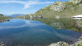
(2) Turn left onto the ascending path. Wind your way up through numerous bends to reach the Lac des Cornaches.

(3) Carry on straight ahead (north-east) towards the Cabane des Cornaches.

(4) Return to the previous junction.

(3) Carry on to the left, heading south-west along the ascending path.

(5) Shortly afterwards, turn left and head east towards the Col de la Tourche Vernay. The climb is steep.

(6) Turn left and continue north-east along a path running along the ridge. This will take you to the Col de la Tourche Vernay (signpost).

(7) Turn right and, after a short descent, you’ll reach a Fork in the road (signpost: ‘Sous le Col’).

(8) Follow the path on the right, heading north-east and uphill. You’ll reach the highest vantage point (unnamed peak; panoramic view).

(9) Return to the previous junction.

(8) Follow the path down to the right to reach the Priolet crossroads.

(10) Turn left onto the path leading down towards Bènètant. After a long descent and numerous hairpin bends, you’ll reach a track at a signpost.

(11) Follow it to the left for a few hundred metres to reach the car park (S/E).

Waypoints

  1. S/E : mi 0 - alt. 4,062 ft - Start of the track - Nant du Dard (cours d'eau) - Affluent de l'Arrondine
  2. 1 : mi 0.99 - alt. 4,701 ft - Start of the trail
  3. 2 : mi 1.23 - alt. 5,016 ft - Junction
  4. 3 : mi 1.86 - alt. 5,846 ft - Junction - Lac des Cornaches
  5. 4 : mi 2 - alt. 5,876 ft - Cornaches Hut
  6. 5 : mi 2.19 - alt. 5,938 ft - Junction
  7. 6 : mi 2.42 - alt. 6,283 ft - Start of the balcony trail
  8. 7 : mi 3.2 - alt. 6,427 ft - Col de Tourche Vernay (1928m)
  9. 8 : mi 3.36 - alt. 6,355 ft - Below the Col de la Tourche Vernay
  10. 9 : mi 3.99 - alt. 6,801 ft - Highest vantage point
  11. 10 : mi 4.79 - alt. 6,207 ft - Priolet junction
  12. 11 : mi 5.99 - alt. 4,157 ft - Slate Quarry Track
  13. S/E : mi 6.18 - alt. 4,062 ft - Start of the track

Notes

Lac des Cornaches hut.
No drinking water along the route.
Please note: steep gradient for such a short walk.

Reviews and comments

4.5 / 5
Based on 2 reviews

Reliability of the description
4.5 / 5
Ease of following the route
4.5 / 5
Route interest
4.5 / 5
Guett
Guett

Overall rating : 4.7 / 5

Date of your route : Jun 17, 2026
Reliability of the description : ★★★★★ Very good
Ease of following the route : ★★★★☆ Good
Route interest : ★★★★★ Very good
Very busy route : No

A very beautiful route, but there must have been some severe windstorms – perhaps accompanied by heavy snowfall – as many trees have been snapped or uprooted, making the route rather tricky at times, particularly on the way back, where a huge fir tree blocks the path and you can’t get past it either by going round the sides or over the top. The only way is to take off your rucksack and crawl under the branches, crouching very low.

Machine-translated

muse_88_
muse_88_

Overall rating : 4.3 / 5

Date of your route : Sep 29, 2024
Reliability of the description : ★★★★☆ Good
Ease of following the route : ★★★★★ Very good
Route interest : ★★★★☆ Good
Very busy route : No

Hello,
A lovely walk with beautiful autumn colours, the beauty of the lake and the magnificent high-altitude trails. Just above us, at 2,000 metres, lay the first snow – absolutely stunning.
The descent is very steep; I’d recommend taking walking poles, as it’s a long and tedious climb down. It took us 6 hours to complete the whole hike.

Machine-translated

Other walks in the area

For more walks, use our search engine .

The GPS track and description are the property of this route's author. Please do not copy them without permission.