Refine your search for walks in Virignin
Virignin walks


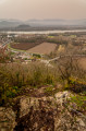
 Around the Rhône diversion canal between Virignin and Belley
 Visorando Member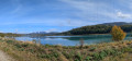
 6.60 mi
 +66 ft
 -69 ft
 3h 05
3h 05
 Moderate
 Departure from Virignin (Ain)
A circular walk suitable for families, following the Rhône diversion canal, mostly along the embankments. No difficulties; there is a striking contrast between the hills on the Brens and Belley side and the steep cliffs on the Virignin side. The canal is notable for the wide variety of birds that can be spotted there.
Notre-Dame de la Montagne and the Chevru Cross on the heights of Yenne.
 4.30 mi
+909 ft
-909 ft
2h 45
4.30 mi
+909 ft
-909 ft
2h 45
 Easy
Departure from Yenne (Savoie)
Easy
Departure from Yenne (Savoie)
A hike in partial shade and partial sun on the heights of Yenne, offering beautiful panoramic views of Mont du Chat and the Rhône plain. Beautiful views of the Gorges de la Balme, the Château de Pierre Châtel and Fort les Bancs.
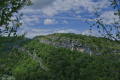
Circuit of viewpoints and balconies in Yenne
 5.26 mi
+1,040 ft
-1,040 ft
3h 20
Moderate
Departure from Yenne (Savoie)
5.26 mi
+1,040 ft
-1,040 ft
3h 20
Moderate
Departure from Yenne (Savoie)
This is a half-day outing and the route is dotted with points of interest with information panels.
Until the Pré Cevin intersection, shortly after the Croix de Chevru, the route follows theGR® trail, which is part of the Way of St. James. Then follow the yellow markings until you reach your destination.
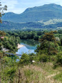
Circular route in the Montagne de Parves from the Pont de Nattages
 9.71 mi
+1,696 ft
-1,670 ft
5h 55
Moderate
Departure from Yenne (Savoie)
9.71 mi
+1,696 ft
-1,670 ft
5h 55
Moderate
Departure from Yenne (Savoie)
The Montagne de Parves is a promontory of the Bugey region, wedged between the Rhône diversion feeding the Belley waterfall and the route of the bypassed section of the Rhône passing through the Pierre-Châtel gorge. Its modest altitude makes it accessible all year round; the suggested route starting from Yenne offers a wide variety of landscapes and views, ranging from the banks of the Rhône, the site of Fort les Bans, the limestone plateau of Mont Chevreaux and the rural landscape of the commune of Parves-et-Nattages.
Rothonne Forest and Chevreuil Trail in Belley
 5.56 mi
+574 ft
-548 ft
3h 05
Easy
Departure from Belley (Ain)
5.56 mi
+574 ft
-548 ft
3h 05
Easy
Departure from Belley (Ain)
Near Belley, the Rothonne Forest offers pleasant, well-maintained and marked trails. The Chevreuil trail presented here is 9 kilometres long. It is a lovely, peaceful walk with a view of the Dent du Chat at the top. The elevation gain of approximately 200 metres is not significant, allowing everyone to enjoy themselves. The trail is entirely shaded.
The Mountain of Parves
 6.97 mi
+1,329 ft
-1,302 ft
4h 20
Moderate
Departure from Parves (Ain)
6.97 mi
+1,329 ft
-1,302 ft
4h 20
Moderate
Departure from Parves (Ain)
Parves and a few other villages are nestled between the old Rhône and the canal (actually the canalised Rhône): you could say that this area forms an island. The suggested walk takes place at low altitude through woods, forests, agricultural landscapes, villages and hamlets that have preserved or enhanced the typical buildings of the Bugey region. There is also a beautiful view of the Savoyard foothills.
The Croix de Chevru as seen from Les Malods
7.51 mi
+1,188 ft
-1,207 ft
4h 30
Moderate
Departure from Traize (Savoie)
Set off to discover the sights on this walk, which takes place mainly through woodland on the hills above Yenne. It follows part of the GR®65 route, offering panoramic views of the meandering Rhône, the villages in the plain and the mountains overlooking them, as well as Pierre Châtel’s fortress. Despite a few minor roads, it is a very pleasant walk.
Circular route via Corne Bœuf and Lac d'Armaille from Thoys
 6.05 mi
+692 ft
-692 ft
3h 25
Easy
Departure from Arbignieu (Ain)
6.05 mi
+692 ft
-692 ft
3h 25
Easy
Departure from Arbignieu (Ain)
This circular route goes up the Ruisseau d'Armaille, passes La Roche Percée de Corne Bœuf and runs alongside the marshes and Lacs d'Armaille, before descending through the forest. Remaining at low altitude, it can be done in any season, with only the water levels of the lakes and streams potentially complicating certain passages.
Circular walk between Le Grangeon (Thoys) and Essieux
 9.12 mi
+1,178 ft
-1,178 ft
5h 15
Moderate
Departure from Arbignieu (Ain)
9.12 mi
+1,178 ft
-1,178 ft
5h 15
Moderate
Departure from Arbignieu (Ain)
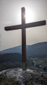
A pleasant and refreshing route thanks to the many lakes and streams along the way. It is situated to the west of the village of Thoys, in an area of forests and marshes to the south of the Bugey. You’ll be walking through peaceful, relaxing surroundings, taking in the typical landscapes and villages of the Bugey.
From Veyrin to Conzieu through woods and lakes
 6.38 mi
+525 ft
-531 ft
3h 25
Easy
Departure from Saint-Bois (Ain)
6.38 mi
+525 ft
-531 ft
3h 25
Easy
Departure from Saint-Bois (Ain)
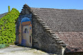
A peaceful hike that starts from the picturesque little hamlet of Veyrin in Saint-Bois in the Ain department and takes us to Conzieu. Peace and quiet guaranteed, with paths that are generally good and easy to walk on.
Lucey and Jongieux circuit
7.64 mi
+1,129 ft
-1,129 ft
4h 30
Moderate
Departure from Lucey (Savoie) (Savoie)
This circuit runs along a sunny hillside. It takes you to the heritage sites of the commune of Lucey and offers a beautiful view of the Jongieux vineyards dominated by the Saint-Romain Chapel.
On the heights of Jongieux
 7.78 mi
+2,274 ft
-2,260 ft
5h 35
Moderate
Departure from Jongieux (Savoie)
7.78 mi
+2,274 ft
-2,260 ft
5h 35
Moderate
Departure from Jongieux (Savoie)
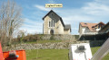
A pleasant, varied walk, with sections through vineyards, others through forest and some beautiful panoramic views.
Loop around Jongieux
 6.60 mi
+1,106 ft
-1,119 ft
4h 00
Moderate
Departure from Jongieux (Savoie)
6.60 mi
+1,106 ft
-1,119 ft
4h 00
Moderate
Departure from Jongieux (Savoie)
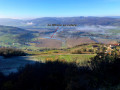
Tour of the vineyards of the Savoyard hinterland.
Circuit around Mont Landard from Jongieux
 10.63 mi
+1,804 ft
-1,821 ft
6h 30
10.63 mi
+1,804 ft
-1,821 ft
6h 30
 Difficult
Departure from Jongieux (Savoie)
Difficult
Departure from Jongieux (Savoie)
A pleasant route starting from Jongieux, alternating between sections through the vineyards of the Savoyan foothills and through woodland, culminating in a route around Mont Landard and its viewpoint overlooking Saint-Pierre-de-Curtille.
La Charvaz - Ontex route
 10.70 mi
+3,035 ft
-3,015 ft
7h 35
Difficult
Departure from Billième (Savoie)
10.70 mi
+3,035 ft
-3,015 ft
7h 35
Difficult
Departure from Billième (Savoie)
A medium-altitude hike in the Avant Pays Savoyard. Ideal for spring or autumn when there is still or already snow elsewhere.
The yellow markers and directional signs at the main intersections leave very little room for doubt.
Circular walk starting from Billième via Saint-Romain
 5.66 mi
+846 ft
-820 ft
3h 20
Easy
Departure from Billième (Savoie)
5.66 mi
+846 ft
-820 ft
3h 20
Easy
Departure from Billième (Savoie)
This circular walk starting from the village of Billième in the Savoyard foothills allows you to explore the region’s vineyards and take in some panoramic views.In autumn, along the path there’s a chestnut tree here, a walnut tree there – your pockets won’t be big enough for all the fruit you’ll gather. In the vineyards, the grape-pickers will surely have left a few grapes behind. If a hiker tries to slip off the path discreetly, follow them – it means they know a spot for mushrooms.
Saint-Julien viewpoint from Arboy-en-Bugey
 2.21 mi
+899 ft
-899 ft
1h 50
Easy
Departure from Saint-Bois (Ain)
2.21 mi
+899 ft
-899 ft
1h 50
Easy
Departure from Saint-Bois (Ain)
A short hike suitable for all seasons, leading to a viewpoint with unobstructed views of the Bugey and the Alps.
Lake Barterand
 5.10 mi
+1,145 ft
-1,119 ft
3h 20
Moderate
Departure from Cressin-Rochefort (Ain)
5.10 mi
+1,145 ft
-1,119 ft
3h 20
Moderate
Departure from Cressin-Rochefort (Ain)
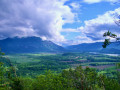
A peaceful hike on the border between Ain and Savoie. From the start, there is a beautiful view of the Rhône riverbed. Further on, you will see Lac de Barterand, bordered by unexpected sculptures in the rock. A short climb towards the flag reveals a beautiful view of the lake.
Bois de Glaize: Saint-Martin Chapel, Recorba and Mont Tournier
 5.12 mi
+988 ft
-984 ft
3h 15
Moderate
Departure from Loisieux (Savoie)
5.12 mi
+988 ft
-984 ft
3h 15
Moderate
Departure from Loisieux (Savoie)
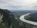
This circular route takes place mainly in the forest and can be completed in any season in half a day, allowing you to visit the characteristic sites and viewpoints of this area crossed by pilgrims on the Way of St James.
 Route of the wine-growing villages of Bugey, starting from Lac du Lit au Roi.
 26.06 mi
+1,745 ft
-1,762 ft
4 hrs
Easy
Departure from Cressin-Rochefort (Ain)
26.06 mi
+1,745 ft
-1,762 ft
4 hrs
Easy
Departure from Cressin-Rochefort (Ain)
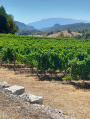
Starting from Lac du Lit au Roi, passing by Lac de Barterand and then through the wine-growing villages of Bugey, Flaxieu, Pollieu, Vongnes, Ceyzerieu and its hamlets, and Saint-Martin de Bavel.Views of the Grand Colombier and the Lavours marshes.Circular with return to Lac du Lit du Roi for a quick dip.
Mont de la Charvaz, loop from Billième
 5.21 mi
+2,103 ft
-2,103 ft
4h 15
Moderate
Departure from Billième (Savoie)
5.21 mi
+2,103 ft
-2,103 ft
4h 15
Moderate
Departure from Billième (Savoie)
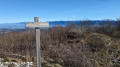
Among the many access routes to Mont de la Charvaz, this loop takes the most direct route to the summit, via its steep western face, and descends via gentler forest paths. The view from the summit over the Avant Pays Savoyard and the surrounding mountains is extensive.
The Conzieu lake tour
 7.06 mi
+1,096 ft
-1,096 ft
4h 10
Moderate
Departure from Conzieu (Ain)
7.06 mi
+1,096 ft
-1,096 ft
4h 10
Moderate
Departure from Conzieu (Ain)
Hike around the Conzieu Lakes, visible from the heights, and Lac de Crotel, which cannot be seen. The hike takes place on good paths and a few steep trails. Spring or autumn in dry weather is preferable, as the few difficult passages can become slippery.
The Montagne de Tentanet circular loop, via the Roman staircase
 6.59 mi
+2,244 ft
-2,215 ft
5h 00
Moderate
Departure from Conzieu (Ain)
6.59 mi
+2,244 ft
-2,215 ft
5h 00
Moderate
Departure from Conzieu (Ain)
This circular route can be completed in almost any season, starting from Conzieu, which allows you to climb up to the ridge via the Escalier Romain. The ascent is along the north-west ridge, and the return route takes a detour to the west to return to Lac de Crotel. The route is wooded, but there are several viewpoints overlooking the Alps or the Rhône Valley.
Maisons Fortes viewpoint: a circular walk from Le Chevelu
 7.65 mi
+1,719 ft
-1,699 ft
5h 00
Moderate
Departure from Saint-Jean-de-Chevelu (Savoie)
7.65 mi
+1,719 ft
-1,699 ft
5h 00
Moderate
Departure from Saint-Jean-de-Chevelu (Savoie)
From Saint-Jean-de-Chevelu, a circular route to the Maison Forte viewpoint above Vernatel offers a superb view towards the Chevelu Lakes. It is possible to climb to the Dent du Chat via the Col de la Vacherie.
The Grand Thur circular loop from Izieu
 3.41 mi
+1,030 ft
-1,030 ft
2h 30
Moderate
Departure from Izieu (Ain)
3.41 mi
+1,030 ft
-1,030 ft
2h 30
Moderate
Departure from Izieu (Ain)
Circular route above Izieu, suitable for all seasons. The route is mainly through forest but offers some views of the Rhône valley and the surrounding mountains.
The main viewpoints in the Bois de Glaize
 5.13 mi
+732 ft
-751 ft
3h 00
Difficult
Departure from Loisieux (Savoie)
5.13 mi
+732 ft
-751 ft
3h 00
Difficult
Departure from Loisieux (Savoie)
The Bois de Glaize offers a variety of route combinations suitable for all seasons: this circular route takes in the main viewpoints in the area, alternating between marked paths and off-trail sections – some of which are quite wild – where your sense of direction will be put to the test.
Moderator’s note A GPS device is recommended for this walk. Please read the reviews carefully.
Montagne d’Izieu and Grand Thur from Murs
 5.89 mi
+1,821 ft
-1,798 ft
4h 20
Moderate
Departure from Murs-et-Gélignieux (Ain)
5.89 mi
+1,821 ft
-1,798 ft
4h 20
Moderate
Departure from Murs-et-Gélignieux (Ain)
The Montagne d’Izieu and the Grand Thur are accessible all year round via numerous paths criss-crossing the area. The circular route described here takes you along these paths from the Route de Fay via pleasant wooded trails.
Mont Gela and Château de Tavollet circular
 6.06 mi
+1,266 ft
-1,263 ft
3h 55
Moderate
Departure from Murs-et-Gélignieux (Ain)
6.06 mi
+1,266 ft
-1,263 ft
3h 55
Moderate
Departure from Murs-et-Gélignieux (Ain)
Mont Gela is a micro-range at the southern end of the Bugey, which offers a variety of routes despite its low altitude and limited size. The proposed circular visits its main sites and endeavours to pass by the viewpoints of its limestone ridge. Feasible in all seasons, it requires a good sense of direction, as some forgotten passages are poorly marked on the ground and vegetation sometimes obstructs the path.
The Chevelu Lakes
 3.08 mi
+207 ft
-203 ft
1h 35
Easy
Departure from Saint-Jean-de-Chevelu (Savoie)
3.08 mi
+207 ft
-203 ft
1h 35
Easy
Departure from Saint-Jean-de-Chevelu (Savoie)
In the Savoyard foothills, in the Chambéry Pre-Alps, a walk of less than two hours around the magnificent Chevelu Lakes.
Discovery trail around the Chevelu Lakes
 4.61 mi
+463 ft
-456 ft
2h 30
Easy
Departure from Saint-Jean-de-Chevelu (Savoie)
4.61 mi
+463 ft
-456 ft
2h 30
Easy
Departure from Saint-Jean-de-Chevelu (Savoie)
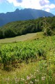
This walk in the Savoyard foothills runs alongside the vineyards of this region.
Vineyards are synonymous with well-exposed plots.
Mont de la Charvaz circular route from Ontex
 5.84 mi
+1,847 ft
-1,850 ft
4h 20
Moderate
Departure from Ontex (Savoie)
5.84 mi
+1,847 ft
-1,850 ft
4h 20
Moderate
Departure from Ontex (Savoie)
Mont de la Charvaz can be climbed from various sides. Here is a circular route offering a variety of routes from Ontex: ascent via La Cauche and the western slope, and a more direct descent via the mountain itself.
La Croix de Saint-Clair from Izieu
 3.44 mi
+764 ft
-774 ft
2h 15
Moderate
Departure from Izieu (Ain)
3.44 mi
+764 ft
-774 ft
2h 15
Moderate
Departure from Izieu (Ain)
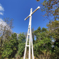
A hike from the picturesque village of Izieu, steeped in history, to a breathtaking viewpoint overlooking the Rhône and its valley.
Grand loop of the lakes of Saint-Jean-de-Chevelu
7.91 mi
+1,673 ft
-1,663 ft
5h 05
Moderate
Departure from Saint-Jean-de-Chevelu (Savoie)
A pleasant hike in the Savoyard foothills. Vineyards are still very much present. Yellow markings and a few directional signs help you follow the description.
 The ridges of Innimont
13.35 mi
+2,569 ft
-2,546 ft
3 hrs
Moderate
Departure from Saint-Germain-les-Paroisses (Ain)
A beautiful, long climb on a good path to the Col du Grand Pertuis, followed by the superb ridge trail. Then a challenging downhill section to Innimont and a gentler one back down to Appregnin.
The Dent du Chat circular route from the Hôtel de la Source
 7.29 mi
+3,159 ft
-3,150 ft
6h 05
Difficult
Departure from Saint-Jean-de-Chevelu (Savoie)
7.29 mi
+3,159 ft
-3,150 ft
6h 05
Difficult
Departure from Saint-Jean-de-Chevelu (Savoie)
A fairly challenging walk on the first section with an average gradient of around 20%. Some quite vertiginous sections, but well secured with cables and ladders.On the descent, part of the path is poorly marked or unmarked; it is best to have some basic orienteering skills. At the top, superb views of Mont Blanc, Belledone, the Chartreuse, the Bauges, etc.
From Furans to Lac du Bret
3.28 mi
+144 ft
-141 ft
1h 40
Easy
Departure from Chazey-Bons (Ain)
A pleasant, shaded family walk with very little elevation gain. It takes you along the banks of the Furans, through the Combe Carrée and past Lac du Bret.
Route of heather starting from Chazey-Bons
 3.66 mi
+322 ft
-315 ft
2h 00
Easy
Departure from Chazey-Bons (Ain)
3.66 mi
+322 ft
-315 ft
2h 00
Easy
Departure from Chazey-Bons (Ain)
Pleasant, shaded hike
Few markings at the start of the route, yellow markings in the undergrowth, cairns to cross the stone plateaus.
Circular at Hautecombe Abbey starting from the Ontex viewpoint
6.36 mi
+1,926 ft
-1,946 ft
4h 35
Moderate
Departure from Saint-Pierre-de-Curtille (Savoie)
This hike takes you to the remarkable site of Hautecombe Abbey, starting from the Belvédère d'Ontex, which offers a magnificent view of the site. The route is more difficult than it appears, with a somewhat uneven path above the lake and a fairly challenging final climb.
Mont Landard circuit
 3.97 mi
+719 ft
-725 ft
2h 25
Easy
Departure from Saint-Pierre-de-Curtille (Savoie)
3.97 mi
+719 ft
-725 ft
2h 25
Easy
Departure from Saint-Pierre-de-Curtille (Savoie)
An easy walk in the Savoyard foothills starting from the curious Church of Saint-Pierre-de-Curtille.
The walk provides access to a pretty viewpoint over the Rhône river developments.
Mont du Chat ridge: from the TV relay station to the Croix du Signal
 6.73 mi
+751 ft
-745 ft
2.5 hrs
Moderate
Departure from Meyrieux-Trouet (Savoie)
6.73 mi
+751 ft
-745 ft
2.5 hrs
Moderate
Departure from Meyrieux-Trouet (Savoie)
The Crête de la Montagne du Chat route follows paths and tracks with little change in elevation, offering exceptional views at both ends.
Water Trail in Brégnier-Cordon
 4.72 mi
+728 ft
-751 ft
2h 50
Moderate
Departure from Brégnier-Cordon (Ain)
4.72 mi
+728 ft
-751 ft
2h 50
Moderate
Departure from Brégnier-Cordon (Ain)
A signposted route taking you through several water-related areas (hillside, stream, marsh) around Glandieu and its waterfall.
The Dent du Chat from the Relais des Aigles
 2.61 mi
+837 ft
-807 ft
1h 55
Difficult
Departure from Saint-Paul (Savoie) (Savoie)
2.61 mi
+837 ft
-807 ft
1h 55
Difficult
Departure from Saint-Paul (Savoie) (Savoie)
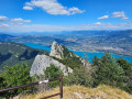
Ascent to the Dent du Chat from the Relais des Aigles. Splendid views, with 90 per cent of the walk taking place in the shade amongst the trees. Along the way, you’ll come across giant anthills shaped like large piles of fir needles, magnificent vegetation and plenty of butterflies and bumblebees. On arrival, there’s a superb view of Lake Bourget, with – in season – numerous paragliders flying overhead.
Circular Mont Tournier hike via the Chemin de la Boissière
 5.40 mi
+1,030 ft
-1,010 ft
3h 25
Difficult
Departure from Saint-Maurice-de-Rotherens (Savoie)
5.40 mi
+1,030 ft
-1,010 ft
3h 25
Difficult
Departure from Saint-Maurice-de-Rotherens (Savoie)
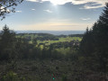
The Mont Tournier area offers numerous combinations of forest trails, which are often signposted and relatively well-used. This circular path deviates from these paths in part to reveal an ancient passage between two levels of the cliff overlooking the Rhône, leading to the Trou de la Mule and the Grotte de Jean Gonet, known only to a select few and a handful of hunters.
Please note: the route is in poor condition and difficult to follow in places: see Practical Information
In the woods and vineyards between Vongnes and Marignieu
5.21 mi
+679 ft
-673 ft
3h 00
Easy
Departure from Vongnes (Ain)
An easy walk through the woods, the Bugey vineyards and a few historic sites. Suitable for all seasons, but watch out for muddy paths or those that turn into streams after heavy rain. Discover the Chautagne plain and the Lavours Marshes, the Marignieu oak, planted in 1448, as well as the Caveau Bugiste and its small museum of wine-making trades. Wide paths with no difficulty or steep gradients, except where mud or streams have taken over certain sections of the path.
The Lac de Barterand circular from Vongnes
8.50 mi
+1,083 ft
-1,070 ft
4h 50
Moderate
Departure from Vongnes (Ain)
An easy route to discover the Bas Bugey. Pass by Lac de Barterand, a small, refreshing lake (fishing and swimming), Marignieu with its wines, honey and an almost 800-year-old chestnut tree, and the nearby Marais de Lavours with its discovery trail. Not forgetting Vongnes, its Bugiste wine cellar and the Ecomuseum on the trades of the vine and wine.
Mont de Cordon from La Bruyère
 4.60 mi
+837 ft
-833 ft
2h 50
Moderate
Departure from Brégnier-Cordon (Ain)
4.60 mi
+837 ft
-833 ft
2h 50
Moderate
Departure from Brégnier-Cordon (Ain)
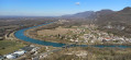
A lovely walk starting from the banks of the Rhône, leading to the Mont de Cordon viewpoint (altitude 400 m) and offering a beautiful panorama of the Rhône and the Izieu mountain. During the climb, you pass a beautiful private castle and on the way back, you can see three caves that were inhabited during prehistoric times: the Bonne Femme cave, an unnamed cave and the Liévrin cave.
Verthemex - Le Sentier de la Vierge.
2.77 mi
+961 ft
-965 ft
2h 05
Easy
Departure from Verthemex (Savoie)
A short hike in the Savoyard hinterland on ancient paths, once essential to economic life, now developed for the enjoyment of hikers.
Mont Landard
8.27 mi
+1,558 ft
-1,545 ft
5h 10
Moderate
Departure from Chanaz (Savoie)
A pleasant, easy hike through the Mont Landard forest and the Montagnin vineyards.
Circuit from Pierre Noire to Chanaz
 2.54 mi
+646 ft
-646 ft
1h 45
Moderate
Departure from Chanaz (Savoie)
2.54 mi
+646 ft
-646 ft
1h 45
Moderate
Departure from Chanaz (Savoie)
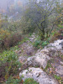
A short walk for a half-day outing from the tourist village of Chanaz. In the village, directional signs clearly indicate the Circuit de Pierre Noire.
Lovely viewpoint over the village and its canal, the Rhône river developments, Mont Colombier, etc.