Circular Mont Tournier hike via the Chemin de la Boissière

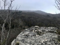
The Mont Tournier area offers numerous combinations of forest trails, which are often signposted and relatively well-used. This circular path deviates from these paths in part to reveal an ancient passage between two levels of the cliff overlooking the Rhône, leading to the Trou de la Mule and the Grotte de Jean Gonet, known only to a select few and a handful of hunters.
Please note: the route is in poor condition and difficult to follow in places: see Practical Information

Details

2615334
Creation:
Last update:
Last review:
  • Walking
    Activity: Walking
  • ↔
    Distance: 5.40 mi
  • ◔
    Average duration: 3h 25 
  • ▲
    Difficulty: Difficult

  • ⚐
    Back to start: Yes
  • ↗
    Ascent: + 1,030 ft
  • ↘
    Descent: - 1,010 ft

  • ▲
    Highest point: 2,874 ft
  • ▼
    Lowest point: 2,047 ft

Photos

Description of the walk

Head to Saint-Maurice-de-Rotherens (in the commune of Saint-Genix-les-Villages) from Novalaise, Yenne or Saint-Genix. Drive up near the hamlet of Les Rives and park (without obstructing the path) on the track leading to the Croix des Rives (reservoir).

(S/E) Head west and walk through the hamlet of Les Rives (Chemin de la Tour) as far as the last houses. Turn right onto a well-maintained path leading down towards the outlet of the Marais des Rives

(1) At the junction with the path leading up to Cupied, continue straight on towards Le Terailler and, after 300 metres, turn right, crossing the stream to reach Les Sangles. Cross two fields in succession along a faint track halfway up the slope until you reach the edge of the forest.

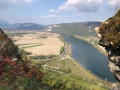
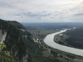
(2) Climb over the fence and enter the forest to find the remains of an old path starting at the same level. It crosses this side of the mountain, running between two cliffs, the lower one towering vertiginously over the Rhône Valley and the hamlet of Leschaux.

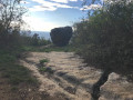
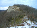
The first few hundred metres are in very poor condition and the path is barely discernible. It passes above the Trou de la Mule (be sure to go well round this gully at the top, the only slightly exposed section), directly beneath the Belvédère des Fils, then level with the Grotte de Jean Gonet (a few dozen metres to the right, at the foot of the upper cliffs). The path then often runs along the slope, skirting a rock that has broken away from the cliff at the bottom before descending quite steeply to a small wooded plateau.

(3) From this low point (around 620m), the path veers off to the right, climbing back up through the forest and following the clearing in the woodland – an old forest track – which winds its way up in a hairpin bend to the Vernay meadows. At the edge of the forest, follow the forest’s edge to the left to reach the end of the Route des Sérus coming from Le Borgey

(4) Head north-east along the signposted path that continues from the road, pass Les Sérus and, at a junction, turn right to join theGR® Chemin de Compostelle. Follow it to the right for 100 metres, then turn left twice to climb to the summit of Mont Tournier.

(5) Head back down the same path tothe GR® Way of St James (or cut across the south-facing slope as shown on the map) and descend to the left towards Pierre qui Vire.

(6) From here, retrace your steps for 50 metres to descend to the Croix de la Dronière and rejoin the Mont Tournier road (D42). Follow it down to the right for 500 metres.

(7) On leaving the forest, leave the road and head left up a good track which climbs into the Forêt de Nattage, crossing it along the edge of the plateau whilst heading south. At the end of the plateau, it descends to the left to join a wider track coming from the Route Forestière de la Lattaz.

(8) Turn right onto this track, which descends and becomes a tarmac road at La Balme.

(9) At Beauregard, 100 metres before reaching the Route de la Lattaz, turn right onto theGR® Chemin de Compostelle and follow it down to the Croix des Rives, where you will find the car park where you started opposite (S/E).

Waypoints

  1. S/E : mi 0 - alt. 2,287 ft - Along the Banks
  2. 1 : mi 0.54 - alt. 2,247 ft - Sous Cupied
  3. 2 : mi 1.09 - alt. 2,211 ft - Les Sangles
  4. 3 : mi 1.87 - alt. 2,051 ft - Low point of La Boissière
  5. 4 : mi 2.28 - alt. 2,444 ft - Chemin des Sérus
  6. 5 : mi 3.08 - alt. 2,871 ft - Mont Tournier
  7. 6 : mi 3.51 - alt. 2,631 ft - Pierre qui Vire
  8. 7 : mi 3.98 - alt. 2,467 ft - Start: Nattage footpath
  9. 8 : mi 4.73 - alt. 2,510 ft - Nattage junction at the foot of the rocky outcrop
  10. 9 : mi 5.01 - alt. 2,352 ft - La Balme/Beauregard
  11. S/E : mi 5.4 - alt. 2,287 ft - Along the Banks

Notes

Please note: between (2) and (4), the path is not always clearly marked; you are effectively off the beaten track, particularly as the box tree moth has destroyed the boxwood, making the passage difficult (branches and trunks lying across the path, overgrown brambles, etc.). Pruning shears are recommended, as are long trousers and long sleeves.

Between (2) and (3), the route runs between two cliffs; whilst it isn’t exposed as it’s wooded, the cliff face dropping down to the Rhône is clearly visible just a few metres away amongst the boxwood. This section should only be tackled in dry weather to avoid slipping on the sloping sections.

From (4), the route follows paths – or even tracks – which may or may not be signposted but are always clearly visible.

The original part of this route has been mapped out thanks to the research and explorations documented in the posts on the “Sentier-Nature” website, to which readers are referred for further details.

Worth a visit

In the wild section of the crossing beneath Les Fils, the route passes through the Trou de la Mule, a gully where domestic animals are said to have slipped towards the cliff, then near the Grotte de Jean Gonet, which is said to have sheltered a priest who refused to take an oath during the Revolution.

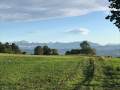
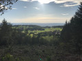
From Mont Tournier, there is an unobstructed view of the Rhône Valley.

Pierre qui Vire is a site steeped in legends and Celtic lore.

Always be cautious and plan ahead when you're outdoors. Visorando and the author of this route cannot be held responsible for any accidents occurring on this route.

The GR® and PR® markings are the intellectual property of the Fédération Française de Randonnée Pédestre.

Reviews and comments

4 / 5
Based on 4 reviews

Reliability of the description
4.3 / 5
Ease of following the route
4 / 5
Route interest
3.8 / 5
jfromager
jfromager

Overall rating : 4.3 / 5

Date of your route : Jun 16, 2024
Reliability of the description : ★★★★★ Very good
Ease of following the route : ★★★★☆ Good
Route interest : ★★★★☆ Good
Very busy route : No

Hello,
We went on this walk today and I can confirm that on the first section, the path is still full of brambles and branches on the ground.
It’s difficult to make headway, and on top of that, the view of the Rhône isn’t very clear.
The second part of the walk is more enjoyable.
A disappointing walk.

Machine-translated

JCParavy
JCParavy

Following the moderator’s comments and warning, I went back to walk the Boissière path on Sunday 11 September 2022.
The path has indeed deteriorated significantly. It was already a bit of a challenge (hence the ‘Difficult’ rating for a non-technical, low-altitude trail), but the box tree moth has been at work and the route is now cluttered with low-hanging branches and fallen trunks; and as nature abhors a vacuum, the box trees’ former dense foliage has been replaced by a significant growth of brambles in certain sections.
The start, as soon as you enter the forest, has become difficult to follow, but I managed to get through and make out a path, though not without picking up a few grazes as I’d set off in short sleeves! The rest is a little better marked and I was able to check that the GPS track was easy to follow all the way along.
I have therefore reinforced the warnings and expanded the text in the guidebook slightly; it suggests an original and wild route, but one intended only for experienced walkers capable of traversing forests ‘wild boar-style’. Avoid taking children there, and a pair of secateurs will be more useful than any other equipment.

Machine-translated

Ghaudik
Ghaudik

Overall rating : 3.3 / 5

Date of your route : May 22, 2022
Reliability of the description : ★★★☆☆ Average
Ease of following the route : ★★★★☆ Good
Route interest : ★★★☆☆ Average
Very busy route : No

Hello.
I set off on this hike today and made it as far as point 2.
I looked for the route through the forest, but I never found it. I went there using my GPS, but I couldn’t get started.
I had to turn back and take the signposted path via Cupied to reach point 4.
I think the walk and the route need to be updated, as it’s no longer feasible as it stands.
It’s a really lovely area and I really enjoyed the scenery at this time of year.
Thanks for sharing.
Kind regards,
Guillaume.

Machine-translated

JB6901
JB6901

Overall rating : 4 / 5

Date of your route : Jun 09, 2021
Reliability of the description : ★★★★☆ Good
Ease of following the route : ★★★★☆ Good
Route interest : ★★★★☆ Good
Very busy route : No

A lovely walk, with very little on the road, but as mentioned, it’s a real struggle between points 2 and 4, as the paths are hard to see, there are several different tracks, and you have to push aside lots of boxwood branches and other vegetation. No signposting.
The path is slippery in places and runs on a slope. Must be done in dry weather.
Beautiful views over the Rhône and its man-made structures.

Machine-translated

B.BELLIER
B.BELLIER
• Edited:

Overall rating : 4.3 / 5

Date of your route : Jan 05, 2020
Reliability of the description : ★★★★★ Very good
Ease of following the route : ★★★★☆ Good
Route interest : ★★★★☆ Good

A lovely walk, though the section at the start of the route that runs between the two cliffs is best left to experienced walkers. The path is difficult to follow, often obstructed and quite slippery in wet weather….
Otherwise, it’s a lovely walk through wild, unspoilt countryside, taking you off the beaten track away from the very busy paths around Mont Tournier.

Machine-translated

Other walks in the area

For more walks, use our search engine .

The GPS track and description are the property of this route's author. Please do not copy them without permission.