Mont du Chat ridge: from the TV relay station to the Croix du Signal

The Crête de la Montagne du Chat route follows paths and tracks with little change in elevation, offering exceptional views at both ends.

Details

1776637
Creation:
Last update:
Last review:
  • Mountain biking
    Activity: Mountain biking
  • ↔
    Distance: 6.73 mi
  • ◔
    Duration according to the author: 2.5 hrs 
  • ▲
    Difficulty: Moderate

  • ⚐
    Back to start: Yes
  • ↗
    Ascent: + 751 ft
  • ↘
    Descent: - 745 ft

  • ▲
    Highest point: 4,888 ft
  • ▼
    Lowest point: 4,534 ft
  • ⚐ Country: France
  • ⚐
  • ⚐ City: Meyrieux-Trouet (73170)
  • ⚑
    Start/End: N 45.658536° / E 5.815712°
  • ❏
    IGN map(s): Ref. 3332OT

  • ◶
    Type of surface: Not specified
  • ⇧
    Bike carrying: Not specified
  • ▲
    Difficulty: Not specified
  • Hour-by-hour weather

Photos

Description of the route

Start from the left-hand bend, at 1,385m, on the road to the Relais du Mont du Chat on the western slope, accessed from Yenne via Saint-Paul-sur-Yenne and Trouet, or from Novalaise via Verthemex and Vacheresse.

(S/E) At the bend, take the correct forest track which quickly heads south and climbs gradually up the Montagne de Futaie to the ridge.

(1) Once at the ridge, turn right onto the signposted path which starts off more or less level: it climbs a little further then descends slightly to a point where, on the right, a rocky outcrop offers a viewpoint.

(2) Continue along the ridge path heading south.

(3) Ignore a path branching off to the left down towards Le Bourget; pass over a high point before reaching the junction signposted ‘Croix du Signal’.

(4) Ignore the signposted ridge path heading down towards Château-Richard and turn left onto the path leading, after a few dozen metres, to the Croix du Signal.

(5) Return to the ridge path.

(4) Follow it due north until you reach the junction with the forest track you took on the way up.

(1) Leave the ascent track on your left and continue straight on along the signposted path, which follows the ridge as closely as possible. The route becomes more wooded and rugged until you reach the edge of the road (on the left). Head straight up towards the TV relay station. Go round its fence through the woods (keeping slightly to the right), then continue straight down to the roadside viewing platform (with an orientation table and plenty of tourists).

(6) From the orientation table, head down the road towards the south-west, and after a few bends, you’ll reach a left-hand bend which forms a viewpoint.

(7) From this bend, head down the final stretch of road which leads back to the starting car park (S/E).

Waypoints

  1. S/E : mi 0 - alt. 4,534 ft - Bend on the CD 42, facing west
  2. 1 : mi 0.65 - alt. 4,777 ft - Junction on the Crête
  3. 2 : mi 1.42 - alt. 4,783 ft - Viewpoint on the western side
  4. 3 : mi 2.16 - alt. 4,721 ft - Junction with the path heading east
  5. 4 : mi 2.89 - alt. 4,790 ft - Junction for the Croix du Signal
  6. 5 : mi 2.94 - alt. 4,767 ft - Croix du Signal
  7. 6 : mi 5.98 - alt. 4,875 ft - Relais du Mont du Chat viewing platform
  8. 7 : mi 6.46 - alt. 4,672 ft - Viewpoint over Yenne
  9. S/E : mi 6.73 - alt. 4,534 ft - Bend on the CD 42, facing west

Notes

An easy walk along paths or tracks that are generally in fairly good condition but can be rocky in places, as the bedrock is never far from the surface.

There are no water points, but a bar welcomes tourists on the esplanade at the Relais du Chat (6).

''Alternative route: you can avoid the road between (6) and (7) by heading down to the car park below the bar-inn and taking a path that leads straight down through the forest to the bend (7). Take care: it’s quite steep and there are pedestrians.

Worth a visit

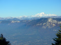
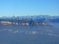
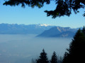
The route itself, which runs through woodland, offers few views (just a few spots a few metres off the main path, such as at (2)), but its endpoints provide sweeping views:
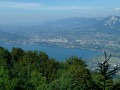
- from the Croix du Signal (5), you look down over Chambéry and its gorge, as well as Lake Bourget
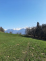
- from the Relais du Chat (6), the view over Lake Bourget and the Alps (Bauges, Mont Blanc, etc.) draws crowds
- at the bend in the descent (7), the view takes in the Avant-Pays Savoyard, including Yenne and the Bugey.

Reviews and comments

4.3 / 5
Based on 3 reviews

Reliability of the description
4 / 5
Ease of following the route
5 / 5
Route interest
4 / 5
nivolet
nivolet

Overall rating : 4.7 / 5

Date of your route : Oct 29, 2024
Reliability of the description : ★★★★★ Very good
Ease of following the route : ★★★★★ Very good
Route interest : ★★★★☆ Good
Very busy route : No

A lovely, easy walk. We walked as far as Château Richard.

Machine-translated

Lolotr@il
Lolotr@il

Overall rating : 4.7 / 5

Date of your route : Apr 20, 2024
Reliability of the description : ★★★★★ Very good
Ease of following the route : ★★★★★ Very good
Route interest : ★★★★☆ Good
Very busy route : No

All the instructions were very clear. Once there, you can quickly spot the starting point.
However, we decided to set off directly from the TV relay station and just do the out-and-back route; we avoided the short circular loop back to the start along the road.
However, it’s important to note – and perhaps worth clarifying if it hasn’t already been mentioned – that:
- the roads leading to the Belvédère du Chat are closed from November to April. In mid-April, the signs were still on the road but access was still possible.
- Mid-April 2024: recent snowfall: 10cm of snow across the entire route
Check the weather forecast before setting off and make sure you pack a change of clothes and warm clothing

Machine-translated

mimite73
mimite73

Overall rating : 2 / 5

Date of your route : Feb 28, 2021
Reliability of the description : ★★☆☆☆ Disappointing
Ease of following the route : Not used / Not applicable
Route interest : Not used / Not applicable
Very busy route : No

Hello, as has often been the case, the starting point isn’t specific enough, so we ended up driving a long way only to find we couldn’t go on the walk. Thank you

Machine-translated

For more walks, use our search engine .

The GPS track and description are the property of this route's author. Please do not copy them without permission.