Country:

 City:
City:


At the entrance to Les Malods, park next to the information board.
(S/E) Head north-west along the road and, when you reach the reservoir, turn right into the street leading downhill.
(1) Leave the street at the bend to the right and head up the path opposite. After a series of small bends uphill, the path reaches the 553-metre mark at the Puits Bacchus crossroads.
(2) Take the first path on the left and continue to the second junction.
(3) Head up to the far left (brambles), towards the Grotte de Sarradins (closed off by a gate).
(4) Retrace your steps back to the Puits Bacchus crossroads.
(2) Take the path that climbs to the left.
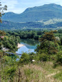
(5) Stop to take in the view from the Sentier des Balcons de Yenne (GR®9), then continue along the path on the ridge to reach, on the left, after 2.3 km, the Croix de Chevru and its panoramic view.
(6) After a return trip to the cross, rejoin the path on the left.
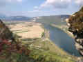
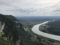
(7) At the next junction, ignore the path on the right and carry on straight ahead to the Belvédère du Rhône.
(8) After a return trip to the viewpoint, continue along the path to the left until you reach the Pierre Chatel Viewpoint.
(9) After a return trip to the viewpoint, rejoin the path on the left until you reach the junction at elevation 440.
(10) Leave the GR®9 and continue straight ahead to Chevru, passing the cross.
(11) Turn right onto a path between the houses and follow it for 500 m. It alternates between meadows and woodland.
(12) Take the short, steep path on the left; this leads onto another track, which you follow to the right towards a junction.
(13) Carry on straight ahead and follow the path which goes round a private property. Reach a junction of paths at elevation 369, then carry on straight ahead.
(14) First turn left then right, and follow a wide track which becomes a path at elevation 336. Carry on, keeping to the right, until you reach another track, then a road.
(15) Turn right onto the road and you’ll come to a cross and a commemorative plaque.
(16) Take the Charosse road on the left and return to the junction from the outward journey.
(1) Carry on straight ahead and, following the reverse route of the outward journey, return to the car park at the entrance to Les Malods (S/E).
 Visorando Member
 Difficult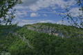
 Easy
Easy