


 Country:

 City:
City:



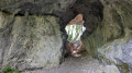


Park at Le Grangeon (opposite a large gate) at the end of the Chemin du Moulin, south of Thoys.
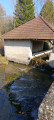
(S/E) Set off to the right and continue past the old mill until you reach a forest track.
(1) Follow it to the right and, as you come out of the bend, follow the path that runs alongside the Ruisseau d’Armaille. Ignore the path on the left that heads up towards Arbignieu and continue to the junction for the Source d’Armaille.
(2) Turn left twice, cross the stream via a footbridge and continue for 300 m southwards.
(3) Turn right and, further on, follow thesecond path which climbs to the right and, after crossing a small meadow, joins the PR®-marked path.
(4) Follow the sign for La Roche Percée, turning first right then left.
(5) Cross the Roche Percée and continue to a junction of paths.
(6) Ignore the two paths on the right and the one on the left, and continue through the forest along the path, which further on runs alongside a long meadow; keep going straight ahead due north until you reach the 369-metre mark.
(7) Turn right and, after passing to the right of a marshy area, you’ll reach the D41.
(8) Cross it carefully and head right towards the centre of the hamlet of Brognin.
(9) At the water point, head right towards the Red Cross Chemin, which descends to a pond (do not go any further as it is a dead end).
(10) Retrace your steps and take the path that climbs to the right. It is barely visible, crosses a small copse and then, via a steep climb through a meadow, reaches the ridge.
(11) Follow the path as it winds along the ridge to a cross. Carry on and, after a steep descent, you’ll reach the village of Essieux.
(It is possible to avoid the ridge by following the Route de Côte Bourdon, then the Route de Pierralat and the D41A between Brognin (9) and Essieux (11).)
(12) In Essieux, carry on straight ahead to the water point (Grange Neuve). Leave it on your left and head further on to the right along the path that runs alongside the Ruisseau de Marchand.
(13) Turn right and continue along the main path for 1 km.
(14) Leave the path and turn left towards the hamlet of Le Trappon, heading due south, until you reach a small road and arrive at the hamlet.
(15) At the water point, turn left and head for the D41.
(16) Follow it carefully to the right for a good hundred metres.
(17) After a right-left bend, take the “PR®” path to Lac d’Armaille.
(18) Continue straight on, staying on the main path, until you reach the Source d’Armaille (caution: slippery path).
(19) At the spring, turn right and return to the junction with the Ruisseau d’Armaille that you passed on the way out.
(2) Turn left and, following the route in the opposite direction to the outward journey, return to the car park at Le Grangeon (S/E).
 Visorando Member
 Easy
Easy 

 Difficult
