Country:

 City:
City:


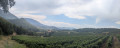
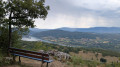
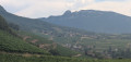

Park next to the cycle park near Jongieux Church.
(S/E) Opposite the town hall, turn left towards the D210 (Route des Vignobles). Head up the path opposite – this is the GR®9, marked in white and red – through the vineyards, cutting across the hairpin bends of the road as far as Jongieux-le-Haut.
(1) Follow the D210 to the right, then turn left onto the Chemin des Perrières. At the reservoir, turn left (north) and continue uphill, ignoring the side paths, until you reach the signpost for Les Vallières.
(2) Head slightly to the left, then continue along the track until you reach the sign for Le Plat.
(3) Take the path on the left, then, atthe first junction, turn right twice. Keep left at the next junction. Continue downhill and you’ll eventually reach the junction marked by the sign for ‘Les Golets’.
(4) Walk downhill opposite to the Route de Crémon D210 and take this road straight ahead to reach the village of Crémon.
(5) Head uphill along the first path on the right between the houses, ignoring the side paths, until you reach the sign pointing towards the Croix de l’Hiver.
(6) Continue to the path leading towards Curtille.
(7) Turn left onto the Chemin des Combettes, then follow the edge of the woodland. You’ll reach a crossroads with several directions.
(8) Turn left at a 90° angle, enter the woods and you’ll soon come to another crossroads.
(9) Take the track on the right heading due north and you’ll reach a Y-shaped junction.
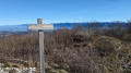
(10) Head uphill straight ahead; you’ll very quickly reach the wooden sign for the Pierre des Deux Évêques. Take the path on the left and, after a short round trip, reach the sign. On your return to the sign, continue uphill to the left. You’ll reach the sign for La Taille.
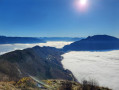
(11) Head left uphill towards the viewpoint.
(12) Return to the previous junction.
(11) Head down to the left until you reach a crossroads with four directions that are almost perpendicular to one another.
(13) Turn right onto the Chemin du Grand Bois track, heading due south, and at the bottom of the descent, join the road leading to Saint-Pierre-de-Curtille.
(14) Leave this road and head up the track to the right after stopping at the Fontaine aux Fées. You’ll come back to the Y-junction you passed earlier.
(10) Turn left and head back along the same route you took earlier until you reach the junction you also passed on the way there.
(9) Carry on straight ahead, heading due south downhill, until you reach a stone marker on the ground indicating the path to the Croix de l’Hiver on the left.
(15) Carry on straight ahead and, at the next junction, head up to the right. Reach the ridge and follow the slightly steep path back down towards the vineyard.
(16) Turn left, join the Chemin des Déviés and continue to the D210.
(17) Cross it carefully; after crossing the footbridge, follow the GR®9 and GR®65 to reach the Puthod district.
(18) Stay on the GR® trails, pass through Barcontian and then Aimavigne before reaching the car park near the church in Jongieux (S/E).
 Visorando Member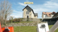
 Moderate
 Easy
Easy