Mont Tournier circular loop

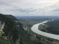
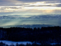
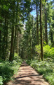
A hike through the heart of the Savoyard foothills in the Mont Tournier massif. Discover sites steeped in history and remarkable views from the many viewing points, with their steep cliffs overlooking the Rhône plain.

Details

n°109484186
Creation:
Last update:
Last review:
–
  • Walking
    Activity: Walking
  • ↔
    Distance: 10.93 mi
  • ◔
    Average duration: 6h 20 
  • ▲
    Difficulty: Moderate

  • ⚐
    Back to start: Yes
  • ↗
    Ascent: + 1,532 ft
  • ↘
    Descent: - 1,529 ft

  • ▲
    Highest point: 2,808 ft
  • ▼
    Lowest point: 2,093 ft

Description of the walk

Park at the end of the Chemin de l’Abully, accessible via the D921 from Yenne, then the D40.

(S/E) Head due north towards the Grange des Rochettes along a path at the edge of the forest. Then turn right onto the path which joins a track after 150 metres.

(1) Turn left towards the Chapelle Saint-Martin and head towards it.

(2) Continue along the path, which curves left further on and joins the GR®65, passing through an area dominated by cliffs.

(3) Turn left to follow the GR®, which runs on level ground to the ruins of the Maladrerie (on the left) and the path to the Recorba viewpoint (on the right).

(4) After a short round trip to the viewpoint, rejoin the GR® to the right and begin an ascent along a winding, stony path until you reach a three-way junction.

(5) Turn right, ignore another path on the right as you round a bend, and reach the Sérus junction.

(6) Continue straight ahead, then, at the next fork, turn right to reach the site and the Pierre Vire viewpoint.

(7) Retrace your steps slightly and rejoin the route to the right. At the crossroads with a cross near the D42, turn right, heading due west.

(8) Leave the GR® by taking a path on the right which descends between rocky outcrops and joins the Chemin des Sérus after crossing some meadows.

(9) Turn left and walk for about 200 m.

(10) Turn right to follow the path which winds through woodland and meadows and joins a small road; follow this to the right for a few tens of metres.

(12) Turn right to reach the Belvédère des Fils, which overlooks the Rhône valley.

(13) Turn back.

(12) Take the path on the right, passing the buildings at Cupied.

(13) Continue straight ahead on the footpath as the road curves and, after passing two paths on the right, reach an X-junction.

(14) Turn left, heading north-east, towards Les Rives. Walk through the hamlet, and at the cross, first turn right then left onto the D42 to join the path leading to the Croix des Rives.

(15) Continue straight on and join a small road after a right-hand bend and then a left-hand bend. At the small road, turn right for 90 metres.

(16) Turn left onto the path that winds through the forest, ignoring all side tracks and keeping east. You’ll come to a forest track.

(17) Cross this track, then turn left twice in succession and continue along the main path, ignoring all the junctions on either side. You’ll rejoin the D42.

(18) Turn left to reach the Col du Mont Tournier, walking carefully alongside the road: visibility is poor due to the bends. Then take the path on the right and follow it until you reach a hairpin bend.

(19) Head down to the far right and follow the main path as it winds through the forest to return to the car park (S/E).

Waypoints

  1. S/E : mi 0 - alt. 2,205 ft - Car park on Chemin de l’Abully
  2. 1 : mi 0.54 - alt. 2,116 ft - Junction at the Saint-Martin Chapel
  3. 2 : mi 0.95 - alt. 2,221 ft - Saint-Martin Chapel
  4. 3 : mi 1.47 - alt. 2,106 ft - Junction with the GR65
  5. 4 : mi 2.37 - alt. 2,313 ft - La Maladrerie
  6. 5 : mi 2.94 - alt. 2,769 ft - Turn right at the fork
  7. 6 : mi 3.2 - alt. 2,651 ft - Les Sérus, on the left
  8. 7 : mi 3.5 - alt. 2,631 ft - Pierre Vire
  9. 8 : mi 3.71 - alt. 2,530 ft - Leave the GR® route, turn right
  10. 9 : mi 3.98 - alt. 2,418 ft - Chemin des Sérus, on the left
  11. 10 : mi 4.12 - alt. 2,379 ft - Turn right at the fork
  12. 11 : mi 4.6 - alt. 2,352 ft - Turn-off to the Belvédère des Fils
  13. 12 : mi 4.87 - alt. 2,343 ft - The Harpe antenna - Belvédère des Fils
  14. 13 : mi 5.59 - alt. 2,290 ft - Cupied
  15. 14 : mi 5.93 - alt. 2,303 ft - X-shaped junction; turn left
  16. 15 : mi 6.27 - alt. 2,287 ft - Croix des Rives (straight ahead)
  17. 16 : mi 6.65 - alt. 2,343 ft - Beauregard junction, turn left
  18. 17 : mi 7.43 - alt. 2,559 ft - Junction with the forest track, straight on
  19. 18 : mi 8.59 - alt. 2,674 ft - D42, turn left
  20. 19 : mi 9.21 - alt. 2,743 ft - Hairpin bend to the right
  21. S/E : mi 10.93 - alt. 2,205 ft - Car park on Chemin de l’Abully

Notes

There are numerous sections over rocks and through scree.

Worth a visit

The Rhône Plain with its various viewing points.

The Saint Martin Chapel (2).

The ruins of La Maladrerie (4).

A little way from the viewpoint (5) is ‘La Pierre Chapeautée’.

Pierre Vire at the viewpoint (7).

The view from the Fils viewpoint and the remains of the Galletti Harpe antenna (12).

Taking a detour to the right after the viewpoint (13): the Tour de Conspectus and the Vieille Cure.

The Galletti Museum in Saint-Maurice-de-Rotherens.

The Croix des Rives (15).

Always be cautious and plan ahead when you're outdoors. Visorando and the author of this route cannot be held responsible for any accidents occurring on this route.

The GR® and PR® markings are the intellectual property of the Fédération Française de Randonnée Pédestre.

Other walks in the area

For more walks, use our search engine .

The GPS track and description are the property of this route's author. Please do not copy them without permission.