Country:

 City:
City:


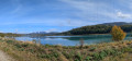
Coming from Virignin, take the small road on the left before the bridge, signposted ‘Via Rhôna’, and park on the right-hand side in Ivroux.
(S/E) Turn right and go under the bridge. Follow the small road rather than the cycle path, to avoid being held up by cyclists. Walk past the solar power station until you reach the Virignin bridge.
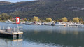
(1) Keep to the right, pass the harbour and the harbour master’s office, and after a short stretch on the cycle path, turn left. Take the steps to reach the sea wall.
(2) Turn right onto the sea wall path; further on, rejoin the cycle path.
(3) Follow it to the left, passing through a pleasant wooded area. Leave it to the left, go under the bridge, then head towards the rowing club and go round it on the right.
(4) Follow the path that runs below the D1504 and rejoin the path on the embankment to the left until you reach the next bridge.
(5) Go under the bridge and take the road on the right, then take the short, steep slope to reach the top of the bridge. Follow it carefully to the right to cross the canal.
(6) Head down to the right and go under the bridge again, then carry on along the embankment path on the left bank of the canal. Follow it and, after passing directly opposite a small pond on your right, continue to the bridge on the Route des Ecassaz.
(7) Carry on straight ahead, still on the embankment, until you reach a footbridge.
(8) Cross it, then pass the lock and return to the junction at the Virignin bridge.
(1) Follow the same route as on the way there, turning right and heading in the opposite direction to return to the Ivroux car park (S/E).
 Visorando Member
 Easy
Easy