Mont de la Charvaz circular route from Ontex

Mont de la Charvaz can be climbed from various sides. Here is a circular route offering a variety of routes from Ontex: ascent via La Cauche and the western slope, and a more direct descent via the mountain itself.

Details

55364791
Creation:
Last update:
Last review:
  • Walking
    Activity: Walking
  • ↔
    Distance: 5.84 mi
  • ◔
    Average duration: 4h 20 
  • ▲
    Difficulty: Moderate

  • ⚐
    Back to start: Yes
  • ↗
    Ascent: + 1,847 ft
  • ↘
    Descent: - 1,850 ft

  • ▲
    Highest point: 3,770 ft
  • ▼
    Lowest point: 2,326 ft

Photos

Description of the walk

Reach Ontex either from Yenne and Lucey, or from Chindrieux and Conjux. Park at the Côte car park below the main village, on the Lucey side.

(S/E) At the bottom of the car park, cross the road and head up the signposted path opposite, which soon leads to a grassy clearing. Do not take the first path on the left, but carry on a little way to the cross to join the path leading up from below, then turn left to enter the forest.
Head south along the path which leads to the summit of La Cauche, the highest point with a view being 100 m to the right.

(1) Return to the path and follow it down to the right until you reach a track coming from the main village at the crossroads.

(2) You can walk down this track a little to reach the Belvédère des Barmes.

(3) From the viewpoint, return to the crossroads.

(2) Continue to the left, more or less level, heading south-west. Cross a forest track at an altitude of 818 metres and go round the Turrioz to the east. Pass the first path on the right and head for a larger crossroads at Montmain.

(4) Turn right and head down a forest track; at the first junction, turn left (signposted ‘Billième’) to take a path that follows a long, ascending route through woodland on the western slope of the mountain, until you reach a path leading up from Jongieux and then a junction signposted ‘Sur le Sé’.

(5) Turn left onto a path running straight up the slope (blue markings), which climbs steeply to a wooded pass near the summit.

(6) First, head right to visit the natural viewing platform.

(7) Return to the wooded pass near the summit.

(6) Then head left up to the highest point.

(8) Return to the wooded pass near the summit.

(6) Head down to the left, due east, along the path which joins a cross-country track called ‘Sous la Charvaz’

(9) Turn left to descend northwards amongst the remains of charcoal kilns until you reach a junction at Mont de la Charvaz.

(10) Carry on straight ahead to the next junction. Turn right to descend to the Ordières junction, with an altitude of 773 on IGN maps.

(11) Turn slightly left to reach La Bouli on level ground.

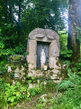
(12) Turn left to head back up to the Route du Mont, at the Oratoire de l’Arcelet.

(13) Take the road to the right as far as the Tables viewpoint.
(If you wish to avoid the road, you can turn left on this stretch onto a signposted path that climbs up to the Belvédère des Barmes, from where the descent to Ontex is clearly marked.)

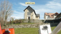
(14) Continue along the road to Ontex. Turn left onto the Chemin de la Mairie to pass by the foot of the church and head back down to the starting car park (S/E).
(It is possible to take a shortcut through Ontex via the Chemin du Four, between the Chemin du Mont and the town hall).

Waypoints

  1. S/E : mi 0 - alt. 2,356 ft - Ontex – La Cote
  2. 1 : mi 0.64 - alt. 2,986 ft - La Cauche – viewpoint
  3. 2 : mi 0.97 - alt. 2,677 ft - La Croisée
  4. 3 : mi 1.02 - alt. 2,661 ft - Viewpoint towards Les Barmes
  5. 4 : mi 1.74 - alt. 2,648 ft - Montmain
  6. 5 : mi 2.66 - alt. 2,897 ft - On the Sé – Start of the final ascent
  7. 6 : mi 3.1 - alt. 3,740 ft - Col de la Charvaz
  8. 7 : mi 3.18 - alt. 3,743 ft - The “natural viewing platform”
  9. 8 : mi 3.28 - alt. 3,770 ft - Summit of La Charvaz - La Charvaz
  10. 9 : mi 3.42 - alt. 3,642 ft - Below La Charvaz
  11. 10 : mi 3.91 - alt. 2,963 ft - Mont de la Charvaz junction
  12. 11 : mi 4.39 - alt. 2,539 ft - Les Ordières
  13. 12 : mi 4.75 - alt. 2,359 ft - La Bouli
  14. 13 : mi 4.82 - alt. 2,431 ft - L’Arcelet
  15. 14 : mi 5.03 - alt. 2,349 ft - Viewpoint at the ‘tables’
  16. S/E : mi 5.84 - alt. 2,356 ft - Ontex – La Cote

Notes

No difficulty; the route is signposted at the various junctions. Only the final climb between (5) and (6) is really steep.

Worth a visit

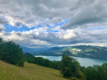
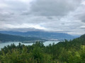
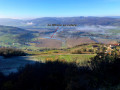
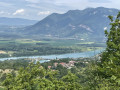
Views of the Gauche area and more expansive views of the peaks: the Savoyard Avant-Pays, Lake Bourget, Bugey, Bauges, Mont Blanc, etc.

Reviews and comments

4.1 / 5
Based on 3 reviews

Reliability of the description
4 / 5
Ease of following the route
4 / 5
Route interest
4.3 / 5
Léaa
Léaa

Overall rating : 5 / 5

Date of your route : May 07, 2026
Reliability of the description : ★★★★★ Very good
Ease of following the route : ★★★★★ Very good
Route interest : ★★★★★ Very good
Very busy route : No

A route done on a weekday in May, with no one else around! In the shade almost the whole time, except at the summit. The natural viewing platform at the top of La Charvaz is extraordinary. Perfect for a picnic. At the start of the hike, take the time to visit viewpoint 3, which offers one of the best views of the lake. The final climb before the summit is particularly steep. Trekking poles are recommended.

Machine-translated

Héritier
Héritier

Overall rating : 3.7 / 5

Date of your route : Mar 17, 2026
Reliability of the description : ★★★☆☆ Average
Ease of following the route : ★★★☆☆ Average
Route interest : ★★★★★ Very good
Very busy route : No

Done in lovely weather – the route starts with a steady climb for about 1 km (I skipped point 3, which I reached on the way back) - stunning views - signposting is fine up to point 5 (then a very steep climb for 800 m, approx. 40% gradient) signposting is poor from points 5–7 (the path isn’t always easy to find without a GPS if it’s covered by leaves or snow) except at crossroads, no signposting, except for one at a bend) picnic at the summit of La Charvaz, which offers a stunning view – the same applies to the section between points 9 and 10; apart from at the junctions, there is no signposting, requiring a GPS to navigate through fallen trees and branches. From point 13, I chose to avoid the road and climbed up the first path on the left (steep) to reach point 3, where there is a breathtaking viewpoint overlooking snow-capped mountains. Return not via point 2 but by continuing along the path branching off to the right

Machine-translated

POIROUX
POIROUX

Overall rating : 3.7 / 5

Date of your route : Aug 17, 2025
Reliability of the description : ★★★★☆ Good
Ease of following the route : ★★★★☆ Good
Route interest : ★★★☆☆ Average
Very busy route : No

The signposting was very clear, but the route description was somewhat misleading in terms of its difficulty. Most of the route is accessible, until you reach the southern foot of Mont Charvaz. There, a small sign indicating the summit at 800 metres sets the scene. 800 metres is fine, but there is a 310-metre climb with a steep gradient. It is very steep. This put off my partner, whose knee had been weakened during a previous walk and had probably contributed to a subsequent medical problem with the same knee. For the rest, the vegetation still obscures much of the view of the surroundings. The advantage of this disadvantage is that we were in the cool. This is probably a walk to do in autumn or when the foliage is not too thick. From the summit, the vegetation obscured much of the lake. The south-facing viewpoint was much more pleasant as it was more open. The return trip was much quieter, which was a relief (the advantage of this loop is that it doesn't take us back the same way). Many people did the circuit as a round trip or started the loop in reverse to make it less steep.

Machine-translated

claude.detraz0759%40orange.fr

This route is scheduled for Tuesday 11 March 2024. I’ll be able to give my opinion afterwards.
I usually plan my routes in advance so I can choose which outings to suggest to MDS MONTMELIAN 73, the club I belong to.
Have a good day.
Claude DETRAZ

Machine-translated

Other walks in the area

For more walks, use our search engine .

The GPS track and description are the property of this route's author. Please do not copy them without permission.