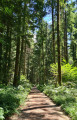
The main viewpoints in the Bois de Glaize

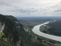
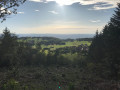
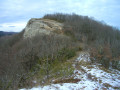
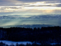
The Bois de Glaize offers a variety of route combinations suitable for all seasons: this circular route takes in the main viewpoints in the area, alternating between marked paths and off-trail sections – some of which are quite wild – where your sense of direction will be put to the test.
Moderator’s note A GPS device is recommended for this walk. Please read the reviews carefully.

Details

4384083
Creation:
Last update:
Last review:
  • Walking
    Activity: Walking
  • ↔
    Distance: 5.13 mi
  • ◔
    Average duration: 3h 00 
  • ▲
    Difficulty: Difficult

  • ⚐
    Back to start: Yes
  • ↗
    Ascent: + 732 ft
  • ↘
    Descent: - 751 ft

  • ▲
    Highest point: 2,726 ft
  • ▼
    Lowest point: 2,169 ft

Photos

Description of the walk

Access: from Saint-Maurice-de-Rotherens via the Col du Mont Tournier, or from Loisieux, heading up the CD 42: park in a disused quarry near an altitude of 738m.

(S/E) At the edge of the quarry, take the path that climbs in stages up through La Magne and joins the yellow-marked trail on the outskirts of La Léchère.
Take this path on the right and head down towards the bottom of La Léchère. A path branches off to the left towards the 763m altitude, Fond du Poljé. Follow it for a few metres, then immediately head up to the right (north) to reach the edge of the right bank and follow a well-marked track eastwards up to the high point, which offers a panoramic view over La Léchère.

(1) Continue along the track, which descends slightly and joins, to the north, a path ascending from La Combe. Follow it for 100 metres; then, when it turns south-west, climb up to the right beneath a limestone outcrop. Climb it via its weakest point, an easy gully: you will then be on the reverse side of the Pic de Glaise (838m), a few metres to the left.

(2) Descend a little to the north-east, skirting ridges and gullies, then turn left to cross the ledge of the small cliff and descend along an old path running along the western face of the Pic de Glaise. Follow this path down to a boundary marker just before it changes direction (descending to the right). From the boundary marker, a faint path branches off to the left, descending a south-west-facing valley. The route leads tothe GR® 65 near the ruins of Recorba.

(3) Walk to and from the Recorba viewpoint, then head south along paths between theGR® and the cliff to the Rocher du Corbeau, which overlooks the Rhône valley.

(4) Return to the previous junction.

(3) Follow theGR® 65 northwards. Before the path branches off to the right towards La Combe, two tracks lead off on either side of the path: they lead to the Grotte de Glaize a few metres above and to the Grotte de Recorba below the rocky outcrop.

Continue along theGR® and, at the start of a descent, veer right onto the route of a disused path which climbs slightly through a coniferous woodland before crossing level towards the north-east, joining the forest track coming from Saint-Martin.

Cross this path to continue on a gentle descent, gradually veering to the right to follow the course of a torrent flanked by limestone ridges. The area is littered with fallen timber, but the route of an old path becomes visible, climbing up a gully on the right bank and emerging near the pass crossed by the forest track.

(5) Make a circular route northwards to reach another rocky viewpoint.

(6) Return to the pass.

(5) Descend 100 metres towards the Chapelle Saint-Martin and take a path on the right heading due west to reach the edge of a rocky outcrop and climb up it. The track eventually turns left to climb the edge of the upper outcrop, following it up to a viewpoint at the summit of the Chenais area.

(7) The path descends slightly towards the south. Before it begins to head steeply down the slope towards La Combe, leave it and head up to the left along faint tracks, staying fairly close to the ridge. Shortly after a dip where a forest track from La Grange des Rochettes joins, continue to follow the ridge as closely as possible; this leads to Le Mollard Grandjean, overlooking La Combe.

(8) The descent to the south-east is off the beaten track. Follow either the edge of the cliff or the left-hand side of the ridge to descend via slopes that are not particularly difficult but are wild, until you reach a path coming from La Grange des Rochettes. Take this path to the right and, as soon as you reach the start of the Combe clearing, head uphill through the grass towards the Grange de la Combe (private property) to join the path leading to it.

(9) Take this level path heading south; it joins the yellow-marked trail coming from L’Abully. Continue south and turn right onto the marked path to climb for 100m. Then leave the marked trail, veer left and follow the path back to the CD 42 road, 100m below the starting point (S/E).

Waypoints

  1. S/E : mi 0 - alt. 2,434 ft - La Magne Quarry
  2. 1 : mi 0.63 - alt. 2,664 ft - Belvédère de La Léchère
  3. 2 : mi 0.95 - alt. 2,710 ft - Pic de Glaize
  4. 3 : mi 1.5 - alt. 2,310 ft - Recorba viewpoint (junction) overlooking the valley of the - Rhône (River)
  5. 4 : mi 1.74 - alt. 2,260 ft - The Raven
  6. 5 : mi 3.03 - alt. 2,270 ft - Unnamed pass leading to Saint-Martin
  7. 6 : mi 3.11 - alt. 2,267 ft - Belvédère de Saint-Martin
  8. 7 : mi 3.6 - alt. 2,510 ft - Belvédère du Chenais
  9. 8 : mi 3.98 - alt. 2,513 ft - Molard Grandjean
  10. 9 : mi 4.4 - alt. 2,382 ft - Grange de la Combe
  11. S/E : mi 5.13 - alt. 2,434 ft - La Magne Quarry

Notes

The circular route presents no technical difficulties, but several sections are on paths that are difficult to follow on the ground, or even clearly off-trail and requiring a bit of ‘wild boar’ style navigation. No special equipment is required, except – depending on the season and vegetation (brambles, holly, etc.) – a pair of secateurs!

The use of a GPS and the Visorando app is strongly recommended to avoid straying too far from the suggested route.

This route is directly inspired by the posts on the Sentier Nature website, an essential resource for a detailed exploration of the Bois de Glaize.

Worth a visit

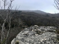
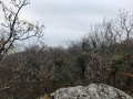
The description highlights the various viewpoints of interest – provided the weather is fine, of course.
The views stretch across the Rhône valley and the nearby Bugey region, the Chat and Épine mountains in the Avant-Pays Savoyard, and further afield to the Chartreuse and Tournette.

Always be cautious and plan ahead when you're outdoors. Visorando and the author of this route cannot be held responsible for any accidents occurring on this route.

The GR® and PR® markings are the intellectual property of the Fédération Française de Randonnée Pédestre.

Reviews and comments

3.2 / 5
Based on 5 reviews

Reliability of the description
3 / 5
Ease of following the route
3.2 / 5
Route interest
3.5 / 5
Héritier
Héritier

Overall rating : 5 / 5

Date of your route : Nov 12, 2025
Reliability of the description : ★★★★★ Very good
Ease of following the route : ★★★★★ Very good
Route interest : ★★★★★ Very good
Very busy route : No

A very beautiful hike. I didn't meet anyone, but I think that since it's on the Camino de Santiago, there must be people passing by. The climb up Mont Tournier is quite steep as it goes over cliffs, but it's not difficult.

Machine-translated

FREDERICNICOLAS
FREDERICNICOLAS

Overall rating : 4 / 5

Date of your route : Jun 30, 2024
Reliability of the description : ★★★★☆ Good
Ease of following the route : ★★★★☆ Good
Route interest : ★★★★☆ Good
Very busy route : Yes

Final navigation marks: below average

Machine-translated

cocogne.bernard
cocogne.bernard

I’d already noticed the same thing – the route was unclear. I was disappointed with this route.

Machine-translated

3072michel
3072michel

Overall rating : 2.3 / 5

Date of your route : Feb 27, 2022
Reliability of the description : ★★☆☆☆ Disappointing
Ease of following the route : ★★☆☆☆ Disappointing
Route interest : ★★★☆☆ Average
Very busy route : No

Under no circumstances should you attempt to follow the route without the mobile app. Even with a very accurate GPS, the off-trail sections are poorly mapped. As for accessibility, some sections are impassable or even dangerous; we were unable to reach the Pic de Glaize as we didn’t have a sharp machete. The section between point 2 and point 3 would even require a chainsaw – it’s a shame, as it must be an old historic route, given that you can see a huge metal cauldron there, just before the ruins of Recorba. We didn’t persevere any further and returned via the most direct path leading to the Grange de la Combe. We do not recommend this hike except for well-trained adventure seekers.

Machine-translated

Jé rôme
Jé rôme

Overall rating : 2 / 5

Date of your route : Apr 21, 2021
Reliability of the description : ★★☆☆☆ Disappointing
Ease of following the route : ★★☆☆☆ Disappointing
Route interest : Not used / Not applicable
Very busy route : No

The first part of the route is very poorly explained. We got lost right from the start. We wandered around for 30 minutes trying to work out where we’d gone wrong. We never found the paths indicated and ended up heading back home. The next day we tried another route suggested by Visorando in the same mountain range: ‘Bois de Glaize: Saint Martin’s Chapel, Recorba and Mont Tournier’: this was a truly enjoyable experience with a very well-explained route.

Machine-translated

cocogne.bernard
cocogne.bernard

Overall rating : 2.3 / 5

Date of your route : Feb 28, 2021
Reliability of the description : ★★☆☆☆ Disappointing
Ease of following the route : ★★★☆☆ Average
Route interest : ★★☆☆☆ Disappointing
Very busy route : No

There’s no mark between points 1 and 2, and no path between 2 and 3 – even though I had the map and the route on my phone. So the route is very rough. Be careful!!!

Machine-translated

Other walks in the area

For more walks, use our search engine .

The GPS track and description are the property of this route's author. Please do not copy them without permission.