Country:

 City:
City:


Start at Bons Church (other car parks available at the village hall or the school).
Red markings.
(S/E) From the church, head north-west along Rue de la Louvatière. At the end of the street, turn left, cross the bridge over the Furans, then walk across the school car park.
(1) At the far end of the car park, cross the small bridge and turn right immediately. The shaded path runs alongside the old mill leat to a round concrete picnic table. Just before this table, take the path that climbs to the left.
(2) At the very top of the path, turn right to head down into the woodland. The path runs close to the railway line. Go under a small bridge and carry on to the lock on the Furans. Follow the river until you emerge from the woodland. Enter a field, still following the railway line.
(3) After a few dozen metres, a bridge on the left takes you back under the railway line to climb up to the Combe Carrée. Then follow the bottom of the valley for a good kilometre to Lac du Bret, also known as Loup du Bret. This small body of water is covered in aquatic vegetation and has been drying up over the years.
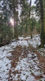
(4) When you reach the end of the lake, ignore the path leading uphill to the right towards Grevrin and turn left instead. Then head uphill through the woodland along the stony path, following the red markings until you emerge from the forest.
(5) Turn right onto the narrow path leading back to the village. At the first junction, turn left and, at the next three-way junction, head left again, skirting the rocks. The path climbs, then descends, and runs alongside a small meadow.
(6) Cross a road at a place called La Louvatière, continue straight on towards the village and arrive at the car park of the La Louvatière School Complex.
(1) Follow the route back in the opposite direction to the outward journey and head for the church (S/E).



 Visorando Member

 Moderate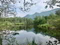
 Difficult