In the woods and vineyards between Vongnes and Marignieu

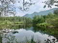
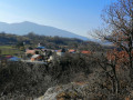
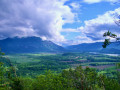
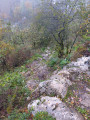
An easy walk through the woods, the Bugey vineyards and a few historic sites. Suitable for all seasons, but watch out for muddy paths or those that turn into streams after heavy rain. Discover the Chautagne plain and the Lavours Marshes, the Marignieu oak, planted in 1448, as well as the Caveau Bugiste and its small museum of wine-making trades. Wide paths with no difficulty or steep gradients, except where mud or streams have taken over certain sections of the path.

Details

69136035
Creation:
Last update:
Last review:
  • Walking
    Activity: Walking
  • ↔
    Distance: 5.21 mi
  • ◔
    Average duration: 3h 00 
  • ▲
    Difficulty: Easy

  • ⚐
    Back to start: Yes
  • ↗
    Ascent: + 679 ft
  • ↘
    Descent: - 673 ft

  • ▲
    Highest point: 1,398 ft
  • ▼
    Lowest point: 1,076 ft

Description of the walk

Park in one of the two small car parks in front of the Caveau Bugiste, avoiding the spaces reserved for customers. Alternatively, you can choose to start this circular route from Marignieu or from the Roman road, at the start of the path leading to the Chapelle de Poirin.

(S/E) Head up into the woods via theGR®59, following the red and white markings.

(1) Turn left to visit the orientation table and the viewpoint over the Lavours marsh.

(2) Turn back.

(1) Turn left again onto theGR®59, which continues to climb through the woods before beginning a descent to the first vineyards of Marignieu.

(3) Carry on to the right along theGR®59into the village, which you cross by following Rue du Four. When you reach the oven, turn right and head up to the Marignieu chestnut tree, a remarkable tree dating from 1448 with a circumference of 12 metres.

(4) Return to Rue du Four and rejoin the route to the right, either heading down into the village or crossing the vineyards (the winegrower has provided a path) to reach the track at the northern edge of the village.

(5) Opposite, follow this wide path marked in yellow, which climbs amongst meadows and copses before descending into the forest to join the Roman road; take this to the right until you reach the sign for the Notre-Dame de Poirin Chapel.

(6) Turn left to follow a well-maintained path leading to this chapel and memorial.

(7) Continue along the yellow-marked path which climbs towards Mont Follieux and then descends to the right to rejoin the Roman road. Follow this, turning left, and continue to the edge of the woods.

(8) Leave the Roman road and take the path on the right, staying within the woods. Begin the descent towards Ceyzérieu. When you come within sight of the hamlet of La Pierre, head up to the right through the woods to stay in the shade if possible. Carry straight on to join the road leading to Barbillieu.

(9) Turn right onto this road until you reach the Caveau Bugiste car park (S/E).

Waypoints

  1. S/E : mi 0 - alt. 1,086 ft - Caveau Bugiste
  2. 1 : mi 0.23 - alt. 1,257 ft - Access to the viewpoint
  3. 2 : mi 0.39 - alt. 1,296 ft - Viewpoint
  4. 3 : mi 1.12 - alt. 1,273 ft - Emerging from the woods, Marignieu vineyard
  5. 4 : mi 1.88 - alt. 1,253 ft - The Marignieu chestnut tree
  6. 5 : mi 2.11 - alt. 1,240 ft - Leaving the village
  7. 6 : mi 3.13 - alt. 1,191 ft - Sign for the Chapel of Notre-Dame de Poirin
  8. 7 : mi 3.29 - alt. 1,211 ft - Chapelle Notre-Dame de Poirin (Marignieu)
  9. 8 : mi 4.27 - alt. 1,224 ft - Head down towards Ceyzérieu on the right
  10. 9 : mi 4.83 - alt. 1,181 ft - Road junction
  11. S/E : mi 5.21 - alt. 1,079 ft - Caveau Bugiste & Museum

Worth a visit

(S/E) Vongnes: Caveau Bugiste, independent winegrower, Bugey wine tasting. An interesting little museum housing a very rich collection of tools related to viticulture and winemaking.

Marignieu: wine-growing village (Maison Angelot, Bugey wine tastings); a remarkable tree, and miniature replicas of traditional houses (in the lower part of the village).

Marais de Lavours: nature reserve with a discovery trail on stilts (car park at Aignoz).

Lake Barterand: a very pretty lake reserved for fishing, with a designated swimming area.

Always be cautious and plan ahead when you're outdoors. Visorando and the author of this route cannot be held responsible for any accidents occurring on this route.

The GR® and PR® markings are the intellectual property of the Fédération Française de Randonnée Pédestre.

Reviews and comments

4.7 / 5
Based on 2 reviews

Reliability of the description
4.5 / 5
Ease of following the route
4.5 / 5
Route interest
5 / 5
Misstaire
Misstaire

Overall rating : 4.3 / 5

Date of your route : Sep 20, 2026
Reliability of the description : ★★★★☆ Good
Ease of following the route : ★★★★☆ Good
Route interest : ★★★★★ Very good
Very busy route : No

Apart from a few doubts about which way to go, the walk was really lovely. We really enjoyed the points of interest that were marked out.

Machine-translated

User 910981

Overall rating : 5 / 5

Date of your route : Jun 14, 2026
Reliability of the description : ★★★★★ Very good
Ease of following the route : ★★★★★ Very good
Route interest : ★★★★★ Very good
Very busy route : No

A superb walk, very well signposted, with an orientation board; the pretty village of Marignieu – don’t miss the chestnut trees at 1,448; a stop at the sanctuary; arrival in Vongnes, a beautiful village

Machine-translated

Other walks in the area

For more walks, use our search engine .

The GPS track and description are the property of this route's author. Please do not copy them without permission.