


Refine your search for walks in Chassal
Chassal walks


 From the Grotte de l’Enragé to the Plateau de la Roche Lezan
 Visorando Member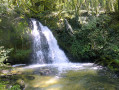
 4.22 mi
 +1,122 ft
 -1,122 ft
 2h 55
2h 55
 Moderate
 Departure from Chassal (Jura)
From Molinges, I suggest you take a relatively short route to reach the Plateau de la Roche Lezan and its beautiful meadows. Along the way, the path runs alongside the Grotte de l’Enragé and its waterfalls: depending on the season, the flow may sometimes be non-existent. Please note that there are a few steep slopes in certain sections.
From the Lizon Tram Viaduct to the Pas de L’Âne
 7.76 mi
+1,027 ft
-1,027 ft
4h 30
Moderate
Departure from Lavans-lès-Saint-Claude (Jura)
7.76 mi
+1,027 ft
-1,027 ft
4h 30
Moderate
Departure from Lavans-lès-Saint-Claude (Jura)
From the Lavans-lès-Saint-Claude fitness trail, you’ll reach the lower section of the Lizon Gorges by crossing the tram viaduct.
Walking alongside the Bienne, you’ll find yourself in the heart of a magnificent natural setting as you make your way to the Pas de l’Âne and the Roche Lezan.
This is also a lovely route for trail running enthusiasts.
The remote valleys of the Enragé
 5.26 mi
+1,322 ft
-1,309 ft
3h 35
5.26 mi
+1,322 ft
-1,309 ft
3h 35
 Difficult
Departure from Pratz (Jura)
Difficult
Departure from Pratz (Jura)
On this fairly challenging route, you’ll enjoy panoramic views and sounds of the Bienne valley.
A fairly challenging route, but the scenery is well worth the effort.
Circular route around Ponthoux starting from Lison
 10.23 mi
+2,507 ft
-2,493 ft
6h 55
Difficult
Departure from Lavans-lès-Saint-Claude (Jura)
10.23 mi
+2,507 ft
-2,493 ft
6h 55
Difficult
Departure from Lavans-lès-Saint-Claude (Jura)
This long route, starting from Le Lison and best undertaken in good weather, will take you all the way to Avignon-les-Saint-Claude, walking over the "Tête du Gaulois" which overlooks the Plan d'Acier industrial estate.On the way back, you can admire the Lison hillsides from the Ponthoux viewpoint and cool off in the Lison Gorges.
Saint-Romain-de-Roche via Vaux-Lès-Saint-Claude
 4.07 mi
+1,358 ft
-1,348 ft
3h 05
Difficult
Departure from Vaux-lès-Saint-Claude (Jura)
4.07 mi
+1,358 ft
-1,348 ft
3h 05
Difficult
Departure from Vaux-lès-Saint-Claude (Jura)
The route suggested, starting from Vaux-Lès-Saint-Claude, leads to Saint-Romain-de-Roche and its plateau.
It is a relatively short walk but involves a strenuous climb (somewhat challenging). As a result, it has been classified as difficult; the section on the plateau itself is fairly easy.
7 Tales on a Walk: The Tender-Hearted Witch
 1.66 mi
+69 ft
-69 ft
0h 50
1.66 mi
+69 ft
-69 ft
0h 50
 Easy
Departure from Vaux-lès-Saint-Claude (Jura)
Easy
Departure from Vaux-lès-Saint-Claude (Jura)
Welcome to the fantasy world of the Southern Jura.
On this “7 Tales on a Walk” trail, enjoy this short storytelling walk with your family and immerse yourselves in the story of the Tender-Hearted Witch.
The starting point is marked by an entrance gate (in the shape of a giant book), on which is written the type of object you’ll need to look for and follow throughout the walk.
Step through this gate to enter a world steeped in mystery.
The Nerbier Cave and the Griottier Waterfall
 8.58 mi
+1,719 ft
-1,699 ft
5h 25
Difficult
Departure from Vaux-lès-Saint-Claude (Jura)
8.58 mi
+1,719 ft
-1,699 ft
5h 25
Difficult
Departure from Vaux-lès-Saint-Claude (Jura)
This route takes you to the Nerbier Cave where, in 1899, five workers were trapped by a sudden flood. A statue of the Virgin Mary commemorates the successful outcome of their rescue. You then continue on to the Griottier waterfall, nestled at the back of a wooded area. The return route takes you via the Saint-Romain Chapel, followed by a difficult descent back to the starting point.
Grand Châtel – Saint-Romain de Roche circular loop
 8.28 mi
+2,224 ft
-2,198 ft
5h 45
Difficult
Departure from Villards-d'Héria (Jura)
8.28 mi
+2,224 ft
-2,198 ft
5h 45
Difficult
Departure from Villards-d'Héria (Jura)
The proposed route, starting from Grand Châtel, aims to reach Saint-Romain de Roche via very little-used, unmarked paths and to traverse the plateau overlooking the Bienne valley.
Part of the route involves a steep climb (somewhat challenging). As a result, it has been classified as difficult. Please ensure you are wearing suitable footwear and have hiking poles.
The section on the plateau is fairly easy and offers some lovely views.
Ferme du Crime - Lake Antre
 5.59 mi
+804 ft
-781 ft
3h 15
Easy
Departure from Pratz (Jura)
5.59 mi
+804 ft
-781 ft
3h 15
Easy
Departure from Pratz (Jura)
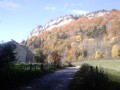
Walk in the forest with a view of Lake Antre and the Jura Mountains
The Scia viewpoint
 8.25 mi
+1,112 ft
-1,099 ft
4h 45
Moderate
Departure from Pratz (Jura)
8.25 mi
+1,112 ft
-1,099 ft
4h 45
Moderate
Departure from Pratz (Jura)
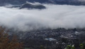
Set off to explore the Scia viewpoint.At an altitude of 800 metres, this remarkable natural site offers views across the entire Lizon Plateau near the Annuelle Forest (GR®® trail). It features an orientation table and picnic facilities.Then head to another natural site: Lac d’Antre.
Cuchet viewpoint
 Association / Club / Walk leader
 9.87 mi
+1,877 ft
-1,883 ft
6h 10
Moderate
Departure from Choux (Jura)
9.87 mi
+1,877 ft
-1,883 ft
6h 10
Moderate
Departure from Choux (Jura)
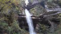
This moderately difficult walk will take you through unspoilt countryside and offer a unique view from the Cuchet viewpoint.In autumn, the colours are stunning...
From Jeurre to Saint-Romain de Roche (circular)
 9.40 mi
+1,811 ft
-1,821 ft
5h 55
Difficult
Departure from Jeurre (Jura)
9.40 mi
+1,811 ft
-1,821 ft
5h 55
Difficult
Departure from Jeurre (Jura)
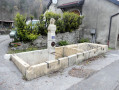
Starting from the village of Jeurre, I suggest a hike that partly follows a circular route to reach Saint-Romain-de-Roche.After a short detour to the Grotte de Nerbier, the route follows the course of the Bienne from a distance, then climbs slightly onto the plateau between Petit Châtel and Saint-Romain-de-Roche via a few winding paths.
Crêtes du Mont Chabot à partir de Saint-Claude
 2.49 mi
+1,480 ft
-1,480 ft
2h 25
Difficult
Departure from Saint-Claude (Jura)
2.49 mi
+1,480 ft
-1,480 ft
2h 25
Difficult
Departure from Saint-Claude (Jura)
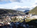
Le Mont Chabot est une des montagnes-phare dominant la ville de Saint-Claude.Il s'agira d'accéder à sa crête en empruntant un parcours en boucle partielle permettant de visualiser de superbes points de vues sur la ville et les alentours. La randonnée est assez courte, mais attention certains passages sont relativement raides et peuvent s’avérer glissants.Attention : le parcours présenté en 2016 vient d'être partiellement remanié (lire § Infos pratiques).
Circular route via the Belvédère de la Roche Blanche, Les Moussières and Le Crêt Joli
 9.50 mi
+2,894 ft
-2,917 ft
6h 55
Difficult
Departure from Villard-Saint-Sauveur (Jura)
9.50 mi
+2,894 ft
-2,917 ft
6h 55
Difficult
Departure from Villard-Saint-Sauveur (Jura)
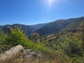
This circular route on the heights of Saint-Claude offers a magnificent view of the Gorges du Flumen and the ridges of the Haut-Jura from the Belvédère de la Roche Blanche, then takes in the village of Les Moussières before descending via the Crêt Joli and its typical Jura landscapes. The climb to La Roche Blanche is challenging and requires a high level of fitness. The use of walking poles is strongly recommended in wet weather, not only for the ascent but also, and especially, for the descent from the viewpoint (14).
Route of Mont Bayard starting from Saint-Claude
 4.18 mi
+1,680 ft
-1,667 ft
3h 25
Difficult
Departure from Saint-Claude (Jura)
4.18 mi
+1,680 ft
-1,667 ft
3h 25
Difficult
Departure from Saint-Claude (Jura)
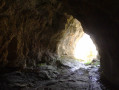
Starting from Saint-Claude, this is a short hike in terms of distance but quite challenging during the climb up Mont Bayard. Walking poles are recommended in wet conditions.
 Circular walk from the Chancia viewpoint via Vouglans, Nezan and Jeurre
 27.49 mi
+3,058 ft
-3,081 ft
4 hrs
Difficult
Departure from Villards-d'Héria (Jura)
27.49 mi
+3,058 ft
-3,081 ft
4 hrs
Difficult
Departure from Villards-d'Héria (Jura)
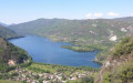
Set against a dreamlike backdrop, between Lakes Vouglans and Coiselet, lies the climb to the Chancia viewpoint.This challenging route, exceptional for its elevation gain and technical trails, will take you along Lake Vouglans and above Lake Coiselet.Feel free to catch your breath at the viewpoint, which offers a magnificent view over the Ain Valley, before tackling the climbs.
Circular route starting from Villards-d’Héria via Coyron, Meussia and Les Crozets
 30.37 mi
+1,929 ft
-1,932 ft
3 hrs
Moderate
Departure from Villards-d'Héria (Jura)
30.37 mi
+1,929 ft
-1,932 ft
3 hrs
Moderate
Departure from Villards-d'Héria (Jura)
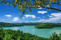
A fairly challenging circular route featuring tarmac (but on quiet roads), varied forest trails and a few slightly technical sections.
Tour of the Bienne Valley
 20.03 mi
+2,251 ft
-2,277 ft
2.5 hrs
Moderate
Departure from Villards-d'Héria (Jura)
20.03 mi
+2,251 ft
-2,277 ft
2.5 hrs
Moderate
Departure from Villards-d'Héria (Jura)
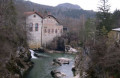
Starting from Villards d’Héria, this mountain bike route descends to Lizon via Saint-Romain, then follows the River Bienne for a good dozen kilometres, before finishing with the climb up the famous Côte de Jeurre.
Lake Antre viewpoint
 5.95 mi
+1,608 ft
-1,624 ft
4h 10
Moderate
Departure from Villards-d'Héria (Jura)
5.95 mi
+1,608 ft
-1,624 ft
4h 10
Moderate
Departure from Villards-d'Héria (Jura)
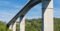
An easy hike around Villards-d'Héria with superb views of Lake Antre, the town of Moirans-en-Montagne and Lake Vouglans.Please note that access is currently prohibited: following a landslide, access to the Lac d'Antre viewpoint is prohibited until further notice. From point (2), go directly to point (4).
Please note: there has been a forest fire between points (4) and (7) since 17/08/2025 at 7 p.m. Do not attempt this route
Viewpoint at Chatillon
 7.55 mi
+1,339 ft
-1,322 ft
4h 40
Moderate
Departure from Villards-d'Héria (Jura)
7.55 mi
+1,339 ft
-1,322 ft
4h 40
Moderate
Departure from Villards-d'Héria (Jura)
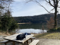
This woodland route will take you through the woods of Chatillon to discover a little-known viewpoint over the Bienne valley and, in fine weather, a view of the Mont Jura. A fairly undulating walk along lovely woodland paths, returning via Lac d’Antre. A lovely route for trail running or mountain biking.
Lac d'Antre, its disappearance and the resurgence of the Héria
 5.34 mi
+1,083 ft
-1,089 ft
3h 25
Moderate
Departure from Villards-d'Héria (Jura)
5.34 mi
+1,083 ft
-1,089 ft
3h 25
Moderate
Departure from Villards-d'Héria (Jura)
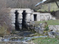
Around Lac d'Antre, its sinkhole and the resurgence of the Héria, one of the most important sanctuaries in Gaul was established between the 1st and 3rd centuries AD.
It is through the cult of water that I invite you to discover the ancient city of Antre, its Gallo-Roman remains, its resurgences and its cliff perched 962 m above the lake,
Please note: due to bad weather and tree-felling work around Lake Antre, access around the lake and to the Belvédère is prohibited. When facing Lake Antre, you must head for points (3) and (6) and avoid points (1), (2), (4) and (5).
The Couloirs circuit starting from Les Bouchoux
 4.75 mi
+1,486 ft
-1,506 ft
3h 30
Moderate
Departure from Les Bouchoux (Jura)
4.75 mi
+1,486 ft
-1,506 ft
3h 30
Moderate
Departure from Les Bouchoux (Jura)
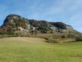
A short hike from the village of Les Bouchoux, which allows you to gain some height to see the surrounding area and take a short detour to a superb waterfall.
Queue de Cheval Waterfall
 3.14 mi
+482 ft
-482 ft
1h 50
Easy
Departure from Saint-Claude (Jura)
3.14 mi
+482 ft
-482 ft
1h 50
Easy
Departure from Saint-Claude (Jura)
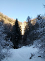
A pleasant little outing to discover this waterfall, which cascades down a sixty-metre drop in two stages. These drops, each around thirty metres high, are spectacular when it has rained. This is therefore an outing to do after a period of rain if you want to enjoy the scenery offered by one of the most beautiful waterfalls in the Haut-Jura.
Savoir-faire Trail
 1.70 mi
+141 ft
-154 ft
0h 55
Easy
Departure from Ravilloles (Jura)
1.70 mi
+141 ft
-154 ft
0h 55
Easy
Departure from Ravilloles (Jura)
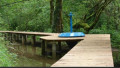
The Sentier des savoir-faire is a walk where you use your hands! Stroll along with your nose in the air and your mind alert on this unusual trail. You’ll uncover the mysteries of the Jura artisans’ skills and gain a deeper appreciation of the values associated with them.
From Saint-Claude to the heights of Septmoncel, a circular route
 10.35 mi
+3,356 ft
-3,353 ft
7h 40
Difficult
Departure from Saint-Claude (Jura)
10.35 mi
+3,356 ft
-3,353 ft
7h 40
Difficult
Departure from Saint-Claude (Jura)
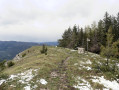
I suggest you try this lovely, slightly challenging route from Saint-Claude to the heights of Septmoncel. Along the way, you’ll come across some lovely views.
From Saint-Claude to Septmoncel via the Chemin des Cascades
 9.32 mi
+3,245 ft
-3,238 ft
7h 05
Difficult
Departure from Saint-Claude (Jura)
9.32 mi
+3,245 ft
-3,238 ft
7h 05
Difficult
Departure from Saint-Claude (Jura)
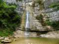
This hike takes you to the Queue d'Âne and Queue de Cheval waterfalls, then climbs a little to the Septmoncel area, via a good circular route that is a little physically demanding at times.Please note that some sections can be tricky due to wet ground, particularly the section between (9) and (10), which is quite steep.
Tour du Flumen via La Roche Blanche and Sur les Grès
 8.51 mi
+3,789 ft
-3,760 ft
7h 15
Difficult
Departure from Villard-Saint-Sauveur (Jura)
8.51 mi
+3,789 ft
-3,760 ft
7h 15
Difficult
Departure from Villard-Saint-Sauveur (Jura)
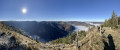
This loop will allow you to discover the bottom of the Flumen valley (and its waterfalls) as well as the ridges above it.
The round of viewpoints in Martigna
 8.61 mi
+1,063 ft
-1,037 ft
4h 55
Moderate
Departure from Martigna (Jura)
8.61 mi
+1,063 ft
-1,037 ft
4h 55
Moderate
Departure from Martigna (Jura)
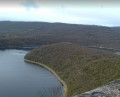
A circular route starting from Martigna and passing by four viewpoints overlooking the lakes of Chanon and Vouglans.From the top of their cliffs, the viewpoints invite us to contemplate the lush greenery and the reflections or sunsets on these lakes.
Villards-d’Héria – Rogna circular loop
 28.46 mi
+3,698 ft
-3,694 ft
4 hrs
28.46 mi
+3,698 ft
-3,694 ft
4 hrs
 Very difficult
Departure from Villards-d'Héria (Jura)
Very difficult
Departure from Villards-d'Héria (Jura)
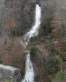
This challenging route, exceptional for its elevation gain, its long, gruelling climbs and its technical descents, will take you to two of the highest points in the Jura Mountains, separated by the Bienne Valley.
The three viewpoints: Le Replat, Sur la Roche, and Sur les Grés in Montbrillant
 8.95 mi
+2,382 ft
-2,405 ft
6h 10
Moderate
Departure from Villard-Saint-Sauveur (Jura)
8.95 mi
+2,382 ft
-2,405 ft
6h 10
Moderate
Departure from Villard-Saint-Sauveur (Jura)
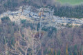
Starting from Montbrillant, a steady climb up to Septmoncel via the Chemin des Moines, the reward being three viewpoints: two with aerial views of the town of Saint-Claude, and the third overlooking La Roche Blanche.
The paths are very easy to walk on, with no technical difficulties.
Northern part of Lake Vouglans
 35.76 mi
+3,159 ft
-3,150 ft
4 hrs
Difficult
Departure from Villards-d'Héria (Jura)
35.76 mi
+3,159 ft
-3,150 ft
4 hrs
Difficult
Departure from Villards-d'Héria (Jura)
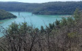
How beautiful France is if you take the time to look...On this route around the northern part of Lake Vouglans, with short, fairly steep climbs and descents as well as long, gentle climbs through the forest, you’ll have the chance to appreciate just how beautiful France is, thanks to the stunning Jura landscapes surrounding Lake Vouglans.This route is quite demanding physically but not overly technical. If you can, do this route on an e-MTB.
Tour of the Six Lakes starting from the Villards-d’Héria Viaduct
 40.56 mi
+3,566 ft
-3,596 ft
7 hrs
Very difficult
Departure from Villards-d'Héria (Jura)
40.56 mi
+3,566 ft
-3,596 ft
7 hrs
Very difficult
Departure from Villards-d'Héria (Jura)
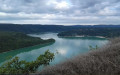
This route will take you from lake to lake: Lake Vouglans, Lake Clairvaux, Lake Étival, Lake Ravilloles, Lake Cuttura and, finally, Lake Antre.There are no fewer than six lakes to discover on this route, with some fairly steep short climbs and descents, as well as long descents and climbs through the forest, where you’ll have the chance to appreciate the beauty of the Jura Mountains.Make the most of the setting for a picnic and a swim!
Circular autumn loop starting from Villards d'Héria
 21.13 mi
+1,795 ft
-1,811 ft
3 hrs
Moderate
Departure from Villards-d'Héria (Jura)
21.13 mi
+1,795 ft
-1,811 ft
3 hrs
Moderate
Departure from Villards-d'Héria (Jura)
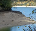
It’s a strange sight: this empty harbour, almost dry, with its stranded jetties and exposed tree roots. The low water level of Lake Vouglans means you can walk with dry feet or cycle along the banks through a somewhat lunar landscape, where the water usually lies.This mountain bike route, best enjoyed in October, will reveal a different side to Lake Vouglans, its harbour and its surroundings, adorned in their most beautiful autumn colours.
Circular route of the 4 viewpoints in Moirans-en-Montagne
 7.79 mi
+1,283 ft
-1,296 ft
4h 40
Moderate
Departure from Villards-d'Héria (Jura)
7.79 mi
+1,283 ft
-1,296 ft
4h 40
Moderate
Departure from Villards-d'Héria (Jura)
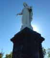
A route through the hills, with stunning views of the surroundings of Moirans-en-Montagne.Sections across the Jura mountains, with unobstructed views, interspersed with sections through the undergrowth and amongst boulders.A very varied, fairly challenging walk.
The Way of St James from Villards d’Héria to Santiago de Compostela
 1,231.39 mi
+106,063 ft
-107,326 ft
84 days
Very difficult
Departure from Villards-d'Héria (Jura)
1,231.39 mi
+106,063 ft
-107,326 ft
84 days
Very difficult
Departure from Villards-d'Héria (Jura)
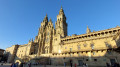
Do you want to connect with nature, admire its beauty at the slow pace of walking, walk to get to know yourself better, get back to basics, and push yourself to new limits? Set off on an adventure along the Camino de Santiago. That’s what I’m offering you with this route. I set off from my village in the Jura (the first six stages aren’t part of the signposted routes of the Camino de Santiago) to reach Santiago de Compostela in Spain, but there’s nothing to stop you setting off from your own home to join the route at one of the stages, or starting from Le Puy-en-Velay or any other town along the way..
Villards-d'Héria - Pic d'Oliferne
 14.58 mi
+2,438 ft
-1,972 ft
8 hrs
Very difficult
Departure from Villards-d'Héria (Jura)
14.58 mi
+2,438 ft
-1,972 ft
8 hrs
Very difficult
Departure from Villards-d'Héria (Jura)
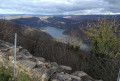
First stage of the Way of St James. This first stage, starting from Villards-d'Héria, takes you up to higher ground with a superb view of Lake Coiselet and, ultimately, a peak and a castle that are well worth the detour. Indeed, the Pic d’Oliferne towers over the Ain Valley by almost 500 metres and offers a beautiful view, particularly of the Haute-Chaîne du Jura.
Circular route between Lavancia and Sièges via the Belvédère des Roches
 7.21 mi
+1,890 ft
-1,919 ft
5h 00
Moderate
Departure from Lavancia-Epercy (Jura)
7.21 mi
+1,890 ft
-1,919 ft
5h 00
Moderate
Departure from Lavancia-Epercy (Jura)
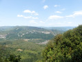
I suggest you try a simple but enjoyable walk starting from Lavancia, which mainly follows a path through the woodland: the route leads to a lovely viewpoint and then returns via the hamlet of Sièges, with limited difficulty (a slightly exposed section near a cliff, plus a few sections with steep or very steep slopes).
La Refrèche
 7.60 mi
+1,043 ft
-1,033 ft
4h 25
Difficult
Departure from Moirans-en-Montagne (Jura)
7.60 mi
+1,043 ft
-1,033 ft
4h 25
Difficult
Departure from Moirans-en-Montagne (Jura)
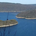
Hiking is often the best way to discover places – places that are all too often overlooked or simply underestimated. This new hike is proof of that, taking us to spots frequented by lovers of the great outdoors.You can admire Lake Vouglans from the viewing points, swim in its wild coves, explore a cave or simply discover the incredible biodiversity and birdlife of its vast forest.
La Vouivre and Pissevieille waterfalls, circular tour
9.34 mi
+2,264 ft
-2,260 ft
6h 15
Difficult
Departure from Saint-Claude (Jura)
A circular hike above Saint-Claude that takes you to the Cascade de la Vouivre waterfall, the Belvédère de Cinquétral viewpoint offering superb views of the Bienne valley and the Haut-Jura, and finally the Cascade de Pissevieille waterfall. It is best to do this hike when the snow has melted or after rain to get the most out of the waterfalls, but in this case, the use of walking poles is strongly recommended. Similarly, the climb to the Belvédère de Cinquétral is reserved for experienced walkers.
Opposite the La Sourde viewpoint, there is the Echo
 7.78 mi
+1,660 ft
-1,663 ft
5h 00
Moderate
Departure from Ravilloles (Jura)
7.78 mi
+1,660 ft
-1,663 ft
5h 00
Moderate
Departure from Ravilloles (Jura)
A route for the eyes but also for the ears.
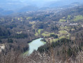
No fewer than three viewpoints with superb views of the villages of Ravilloles and Leschères, and to top it all off, one of the most beautiful acoustic sites in the Haut-Jura, where you can discover the pleasure of listening intently during this walk.
PLEASE NOTE:The GR®9is closed to all traffic, including pedestrians, from 15 July to 15 December 2020 due to forestry work between "sur la côte" (9) and "sur le château" (1).
Lac d’Embouteilleux and Crêt du Nerbier
 7.82 mi
+981 ft
-981 ft
4h 25
Moderate
Departure from La Pesse (Jura)
7.82 mi
+981 ft
-981 ft
4h 25
Moderate
Departure from La Pesse (Jura)
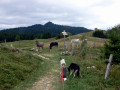
A varied route through pastures (don’t forget to close the gates!), woodland and an ascent to the Crêt du Nerbier.
The Gorges de l'Abîme, the Crêt Pourri and the hamlet of Vaucluse
 5.95 mi
+1,926 ft
-1,900 ft
4h 25
Difficult
Departure from Saint-Claude (Jura)
5.95 mi
+1,926 ft
-1,900 ft
4h 25
Difficult
Departure from Saint-Claude (Jura)
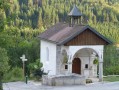
This circular walk will introduce you to some of the Jura’s attractions around the town of Saint-Claude. From the Gorges de l’Abîme, you’ll take a path towards the Crêt Pourri, then, after negotiating a few slopes, you’ll reach a plateau. On the way back, you’ll be able to admire the charming hamlet of Vaucluse.
The Gorges de l’Abîme route has been accessible again since 4 July 2026 (for the record, it was previously closed under a municipal by-law dated 4 December 2023).
Les Moussières - Lélex
 Tourist office
 12.33 mi
+1,467 ft
-2,303 ft
6h 55
Moderate
Departure from Les Moussières (Jura)
12.33 mi
+1,467 ft
-2,303 ft
6h 55
Moderate
Departure from Les Moussières (Jura)
Open from 1 April to 30 November, subject to snow conditions
The third and final stage of the 3-day, 2-night Crêts en combes hiking tour.
Starting from Lélex, this circular route combines the main GTJ route with the suggested alternative via Mijoux and the Col de la Faucille.
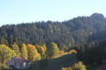
The crossing of the Hautes-Combes jurassiennes, the Valserine valley and the ridges of the Haute Chaine du Jura promise breathtaking landscapes. On one side, the view overlooks the ridges, on the other, it overlooks Lake Geneva and the Alps. In the heart of the Haut-Jura Regional Nature Park and partly in the Haute Chaîne Nature Reserve, the hike takes place in a preserved natural area.
The trail is marked with GR® (red and white) signs.
Moirans-en-Montagne – Oliferne Castle
 14.66 mi
+2,592 ft
-2,011 ft
9h 00
Difficult
Departure from Moirans-en-Montagne (Jura)
14.66 mi
+2,592 ft
-2,011 ft
9h 00
Difficult
Departure from Moirans-en-Montagne (Jura)
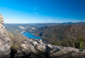
Thisfirst stage, starting from Moirans-en-Montagne, takes you up to higher ground with a superb view of Lake Coiselet and, ultimately, a peak and a castle that are well worth the detour. Indeed, the Pic d’Oliferne towers over the Ain Valley by almost 500 metres and offers a beautiful view, particularly of the Haute-Chaîne du Jura.
Overhangs of the Bienne Valley – Longchaumois Plateau
 15.80 mi
+3,671 ft
-3,678 ft
7 hrs
Very difficult
Departure from Saint-Claude (Jura)
15.80 mi
+3,671 ft
-3,678 ft
7 hrs
Very difficult
Departure from Saint-Claude (Jura)
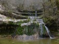
This hike (which is somewhat demanding) aims to take in a varied route at different altitudes in the Bienne Valley to the north of Saint-Claude, as well as on the plateau overlooking it around Longchaumois. The route is mostly circular, passing close to two waterfalls and a cave.
La Pesse Roches d'Orvaz
 8.41 mi
+656 ft
-640 ft
3 hrs
Moderate
Departure from La Pesse (Jura)
8.41 mi
+656 ft
-640 ft
3 hrs
Moderate
Departure from La Pesse (Jura)
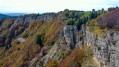
A pleasant route in the Haut-Jura, by mountain bike or on foot through pastures and forests with a panoramic view of the Roches d’Orvaz.
Between Les Moussières and Les Platières
 9.92 mi
+906 ft
-883 ft
4 hrs
Moderate
Departure from Les Moussières (Jura)
9.92 mi
+906 ft
-883 ft
4 hrs
Moderate
Departure from Les Moussières (Jura)
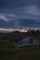
Mountain bike ride in the Haut Jura Nature Park with views of the Jura Mountains.
Moderator’s note Reviews indicate that the car park at the start is private. Plan to find a space elsewhere in the village
A family getaway to the Berbois mountain refuge, accompanied by a donkey
12.03 mi
+1,732 ft
-1,742 ft
2 days
Moderate
Departure from La Pesse (Jura)
In the heart of the Haut Jura Regional Nature Park, you’ll follow specially designed routes and pass through stunning landscapes.This donkey trekking route allows you to set off as a family with young children, to discover donkeysand experience a two-day walking tour. It’s a great way to go hiking with your young children without having to carry them, but be warned: once you set off with a donkey, you run the risk… of never being able to do without one!
The Belvédère de la Vierge in Moirans-en-Montagne
 1.81 mi
+358 ft
-358 ft
1h 10
Easy
Departure from Moirans-en-Montagne (Jura)
1.81 mi
+358 ft
-358 ft
1h 10
Easy
Departure from Moirans-en-Montagne (Jura)
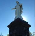
A short walk to help you explore the hills of Moirans-en-Montagne.
The Borne au Lion and the Crêt du Nerbier from the Anquerne
 6.86 mi
+971 ft
-942 ft
4h 00
Moderate
Departure from La Pesse (Jura)
6.86 mi
+971 ft
-942 ft
4h 00
Moderate
Departure from La Pesse (Jura)
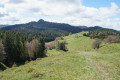
Head for the Borne au Lion via paths that are less frequented than those starting from La Pesse. The route takes you through forests and rolling pastures typical of this region. This hike can be done on foot or with snowshoes, and the landscapes are beautiful in both summer and winter. The route is easy, with regular signposting.
 The Grande Molune circular starting from Les Moussières
 4.77 mi
+397 ft
-404 ft
2.5 hrs
Easy
Departure from Les Moussières (Jura)
4.77 mi
+397 ft
-404 ft
2.5 hrs
Easy
Departure from Les Moussières (Jura)
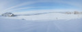
This is a snowshoe hike best undertaken after a fresh snowfall to enjoy the magical scenery of the woodland and snowfields stretching as far as the eye can see at La Grande Molune, a large, abandoned farmhouse. Yellow markers can help with navigation along part of the route.
Around Mont Robert
 3.63 mi
+794 ft
-771 ft
2h 20
Easy
Departure from Moirans-en-Montagne (Jura)
3.63 mi
+794 ft
-771 ft
2h 20
Easy
Departure from Moirans-en-Montagne (Jura)
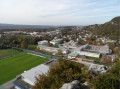
A pleasant route on the slopes of Mont Robert, interspersed with sections through the undergrowth, offering unobstructed views of Moirans-en-Montagne.
Crêt de Chalam from La Pesse
 6.74 mi
+1,490 ft
-1,490 ft
5 hrs
Difficult
Departure from La Pesse (Jura)
6.74 mi
+1,490 ft
-1,490 ft
5 hrs
Difficult
Departure from La Pesse (Jura)
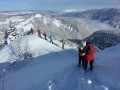
A beautiful winter snowshoe hike.Once you reach the summit, which looks a bit like a sugar loaf (1,545 m), you will discover a 360° panorama (the Haut Jura mountain range and, of course, Mont Blanc in good weather).Please note that depending on snow conditions, there may be a risk of avalanches at the Crêt de Chalam.
Beginners should refrain from climbing to the summit; the view is already very beautiful and safe from the plateau just before the summit.
Over hill and dale around Mont Saint-Christophe
 6.15 mi
+1,125 ft
-1,109 ft
3h 50
Moderate
Departure from Moirans-en-Montagne (Jura)
6.15 mi
+1,125 ft
-1,109 ft
3h 50
Moderate
Departure from Moirans-en-Montagne (Jura)
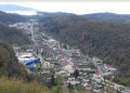
This route takes you over hills to the tops of cliffs, with viewpoints that invite you to contemplate the lush green countryside, and through valleys and deep, steep-sided gorges, offering cool respite and the chance to discover a natural world rich in diverse flora and fauna.
A 10 km route with some good climbs on all types of terrain awaits you from start to finish, offering a sense of tranquillity and a few panoramic views well worth capturing on camera.
Crêt de Chalam and La Borne au Lion via the Combe d'Évuaz
 11.15 mi
+2,362 ft
-2,333 ft
7h 10
Difficult
Departure from La Pesse (Jura)
11.15 mi
+2,362 ft
-2,333 ft
7h 10
Difficult
Departure from La Pesse (Jura)
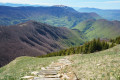
An original route to reach Crêt de Chalam and La Borne au Lion. Passing through the Combe d’Évuaz, which is not without charm, a little way from La Pesse. A forest route offering, of course, the truly remarkable panorama from Crêt de Chalam. Descend then via Col de l’Encoche (difficult and very difficult if you’re not very agile, but a possible alternative) to reach Borne au Lion.
Please note: between (3) and (4) there is no path and brambles are present. A map or GPS is essential. Route and description amended following feedback from hikers.
From the Regardoir viewpoint to the Roche aux Corneilles viewpoint
 7.22 mi
+909 ft
-922 ft
4h 05
Moderate
Departure from Moirans-en-Montagne (Jura)
7.22 mi
+909 ft
-922 ft
4h 05
Moderate
Departure from Moirans-en-Montagne (Jura)
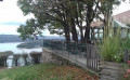
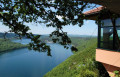
The view from the viewpoint is always impressive. Along this route, you’ll look out over the beautiful landscapes of Lake Vouglans, observe its ever-changing colours and admire its wooded shores, which have been remarkably preserved from any unsightly urban development.This route is also ideal for trail runners.
The Grand Tour of Lake Vouglans
 52.47 mi
+4,859 ft
-4,839 ft
7 hrs
Very difficult
Departure from Moirans-en-Montagne (Jura)
52.47 mi
+4,859 ft
-4,839 ft
7 hrs
Very difficult
Departure from Moirans-en-Montagne (Jura)
Lake Vouglans offers an ideal playground for outdoor sports enthusiasts.
This 86km route is designed for experienced mountain bikers. It is quite hilly and features numerous technical trails, with a well-balanced mix of surface types (woodland, scree, roots…) and trail types (singletrack, footpaths, dirt tracks…).
This route is signposted as a major mountain bike route (red ‘VTT’ symbol on a white background, with the letters ‘TLV’).
The short loop around Lake Vouglans
 34.16 mi
+3,222 ft
-3,202 ft
5 hrs
Difficult
Departure from Moirans-en-Montagne (Jura)
34.16 mi
+3,222 ft
-3,202 ft
5 hrs
Difficult
Departure from Moirans-en-Montagne (Jura)
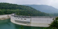
As it’s difficult to reach by road, cycling remains the best way to go round the lake and discover its hidden treasures. Unspoilt viewpoints, the Vouglans dam and even the submerged Chartreuse.
This route is intended for experienced mountain bikers.
It is quite hilly and features numerous technical trails, with a good mix of surface types (woodland, scree, roots) and trail types (singletrack, footpaths, dirt tracks).
Crêt au Merle from Bellecombe, return via the ridges
 5.33 mi
+981 ft
-984 ft
4 hrs
Moderate
Departure from Bellecombe (Jura)
5.33 mi
+981 ft
-984 ft
4 hrs
Moderate
Departure from Bellecombe (Jura)
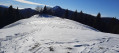
An easy snowshoe route with remarkable views. However, conditions are more tiring if you have to break trail through a substantial layer of fresh snow.
Around the Fyète
 4.61 mi
+886 ft
-866 ft
2h 55
Moderate
Departure from Crenans (Jura)
4.61 mi
+886 ft
-866 ft
2h 55
Moderate
Departure from Crenans (Jura)
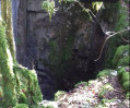
In the Jura, the forest covers most of the region.This walk through the forest is a great opportunity to really soak up its atmosphere.Along the route, there are several lovely views, such as the path leading to the Fyète well – a geological feature typical of karst landscapes – as well as fountains, wash houses and a bread oven.
Borne au Lion - Crêt de Chalam
 3.28 mi
+846 ft
-846 ft
2h 15
Moderate
Departure from La Pesse (Jura)
3.28 mi
+846 ft
-846 ft
2h 15
Moderate
Departure from La Pesse (Jura)
A breathtaking view.
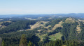
This hike is a round trip to Crêt de Chalam where, on a clear day, you will have a 360° panorama of the Jura and the Alps. At the summit, there are two orientation tables.
The Crêt de Chalam
 2.78 mi
+942 ft
-948 ft
2h 05
Moderate
Departure from La Pesse (Jura)
2.78 mi
+942 ft
-948 ft
2h 05
Moderate
Departure from La Pesse (Jura)
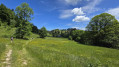
Short hike with magnificent views of Reculet, Crêt de la Neige and Mont Blanc (in clear weather).
Moderator's addition on 07/08/2021: Since this hike was created, the trail for the return seems to have deteriorated and some hikers have preferred to do the round trip. See reviews
Grande Traversée du Jura: from La Borne au Lion to Culoz
62.98 mi
+11,985 ft
-15,436 ft
6 days
Very difficult
Departure from La Pesse (Jura)
The GTJ runs through the Jura Mountains from Mandeure (Doubs) to Culoz (Ain), crossing the Haut-Jura Regional Nature Park and offering a detour into Switzerland. The route suggested here covers the second half of the itinerary.
Opened in 2004, the GTJ follows the GR®5, GR®9 and GR® de Pays trails for 400 km. Winding along ridges, skirting lakes and emerging from forests, this is a route accessible to most people, with no particular difficulty. It can be tackled as a 2–3-day trip for families, or as the full 15–20-day route.
The route winds through the heart of the Haut-Jura Regional Nature Park and the Haute Chaîne du Jura National Nature Reserve: a protected area to be explored with respect.
La Borne au Lion - Refuge de la Loge
6.86 mi
+2,060 ft
-1,617 ft
4h 55
Moderate
Departure from La Pesse (Jura)
Open from 1 April to 30 November (subject to there being no snow)
First stage of the Grande Traversée du Jura walking route: from La Borne au Lion to Culoz, in 6 days.
The GTJ links Mandeure (Doubs) to Culoz (Ain) in 15 to 20 days, crossing the Jura Mountains and the Haut-Jura Regional Nature Park. The route proposed here corresponds to the second half of the itinerary.
The route winds through the heart of the Haut-Jura Regional Nature Park and the Haute Chaîne du Jura National Nature Reserve: a protected area to be explored with respect.
Part of the route passes through the Haute Chaîne du Jura National Nature Reserve.
Dogs and tent camping are prohibited.
Please respect these rules to help preserve this exceptional environment.
Pissevieille Waterfall, Grotte des Sazarins and Belvédère de la Corbière
 9.08 mi
+1,686 ft
-1,677 ft
5h 40
Difficult
Departure from Saint-Claude (Jura)
9.08 mi
+1,686 ft
-1,677 ft
5h 40
Difficult
Departure from Saint-Claude (Jura)
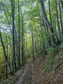
A few kilometres from Saint-Claude, beautiful beech forests, a 70-metre-high waterfall, an unusual cave and the magnificent Belvédère de la Corbière viewpoint.