Country:

 City:
City:


Head to the area near the restaurant Le Regardoir, in the village of Moirans-en-Montagne. Park near the Via Ferrata chalet.
(S/E) Walk past the chalet and take the small tarmac path for about 200 metres.
After the short climb, take the path to the right (marked TLV).
From there, follow the mountain bike signposts or the blue markings labelled ‘TLV’. These markings will guide you along the entire route.
You’ll arrive at the Route forestière de la Réfrèche.
(1) Turn left and immediately take the small path on the right. Cross the stream and continue along the forest track until you reach the tarmac forest road. Turn right and follow the road for about 150 metres.
(2) At the farm, take the path leading uphill on the left. Carry on, keeping an eye on the signposts. Follow the path for about 8 km until you reach a forest road running alongside the lake.
Please note: there are many paths crossing here. Make sure you follow the signposts.
Carry on along the Les Plans forest track until you reach the S-bend.
(3) Leave the forest road before you reach the first bend, taking the small path that runs alongside the road. You’ll arrive in the village of Vouglans. Turn right onto the D299 and take the first left. Keep following the signposts until you reach the River Ain. Walk alongside the river until you reach the bridge.
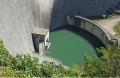
(4) At the bridge, turn left (from the bridge you may be able to see the base of the Vouglans dam). At the entrance to the village of Menouille, take the first right. Follow the road towards the dam for 1 km, then turn left to join the D60. Continue to the right, passing in front of the dam. Carry on for a further 1.5 km past the dam.
(5) At the bend, leave the RD60 by taking the path at the end of the car park. Please note: there are still numerous paths and forest tracks criss-crossing the area. Do not lose sight of the signposts. Continue for around 10 km.
You’ll reach the forest road near the hamlet of Chavia.
(6) At the hamlet of Chavia, turn right. Please note that there are many paths criss-crossing the area; be sure to follow the GRP® signposts.
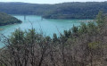
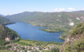
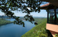
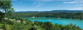
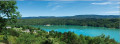
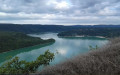
(7) At the viewpoint, continue downhill to Lake Vouglans. When you reach the lake, turn left.
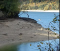
Carry on to Bellecin Beach.
(8) Cross the beach to rejoin the path. Walk past the sewage treatment plant and enter the Bellecin water sports centre.
(9) Head for thefirst building at the top left of the centre (with the lake behind you) to rejoin the path, which starts again behind the building (it is signposted). Continue along this path for several kilometres until you reach the Pont de la Pyle.
(10) At the bridge, turn right and cross it. Continue along the D301 for about 500 metres. Leave the D301 and take the path on the left. Join the small forest road towards Maisod. Continue to the junction and turn right, towards Maisod and Belvédère de la Braise. Continue for 3 km until you rejoin the D301.
(11) Stay on the D301 for about ten metres, then turn left onto the path heading uphill towards Maisod. Back on the D301, turn left, then stay on the road branching off to the right towards Maisod Castle.
(12) After walking alongside the wall surrounding the château, turn right. You’ll come out onto the first section of the “La Sirène Enragée” walk. Please be aware that you’re very likely to encounter families and groups of children. Continue until you reach the steep descent and, at the bottom, turn left towards Port de la Mercantine.
Walk alongside the VVF and carry on to the lake. Walk past the harbour, and after the harbour master’s office, turn right towards the lowest car park.
(13) Go to the far end of the lower car park, pass the restaurant and take the path on the right. Follow the lake for a few hundred metres and, before Mercantine Beach, take the path on the left. Climb up to the D301 and, at the ‘Neige et Plein Air’ holiday centre, turn right onto the D301. Continue for 1 km and take the path on the left. (Always follow the mountain bike signposts.) Join the Route du Lac and continue to the right for 300 metres, then take the small path branching off to the right. Carry on until you reach the Auberge Jurassienne farm inn.
(14) Ride past this farmhouse inn and take the path at the end of the car park until you reach the tarmac road.
On this tarmac road, turn right until you reach the D470 car park. Walk alongside the car park for 100 metres
(15) Just as you’re leaving the car park, take the small path on the right which will take you back to the starting point (S/E).


 Visorando Member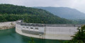
 Very difficult
 Moderate